|
|
||||
| Date | Starting Place | Ending Place | Author | Last Update |
|
|
||||
| 07-25-09 |
Challis, Idaho, United States |
Mackey, Idaho, United States |
ray | 12-16-10 21:13:27 |
|
|
||||
|
I wanted to get out early to avoid as much of the headwinds as I could. In the past two days, they have become fierce later in the day. Also, some rain was predicted and I wanted to try and get to Mackey before it started. I knew a nearby cafe opened at 6am so I was up, showered, and at the breakfast place a bit after it opened. I ate a big meal and ordered two vegiburgers to go. I was on the road by 7:30am after a few brief conversations with other early morning breakfast eaters. It was cool, clear and sunny. 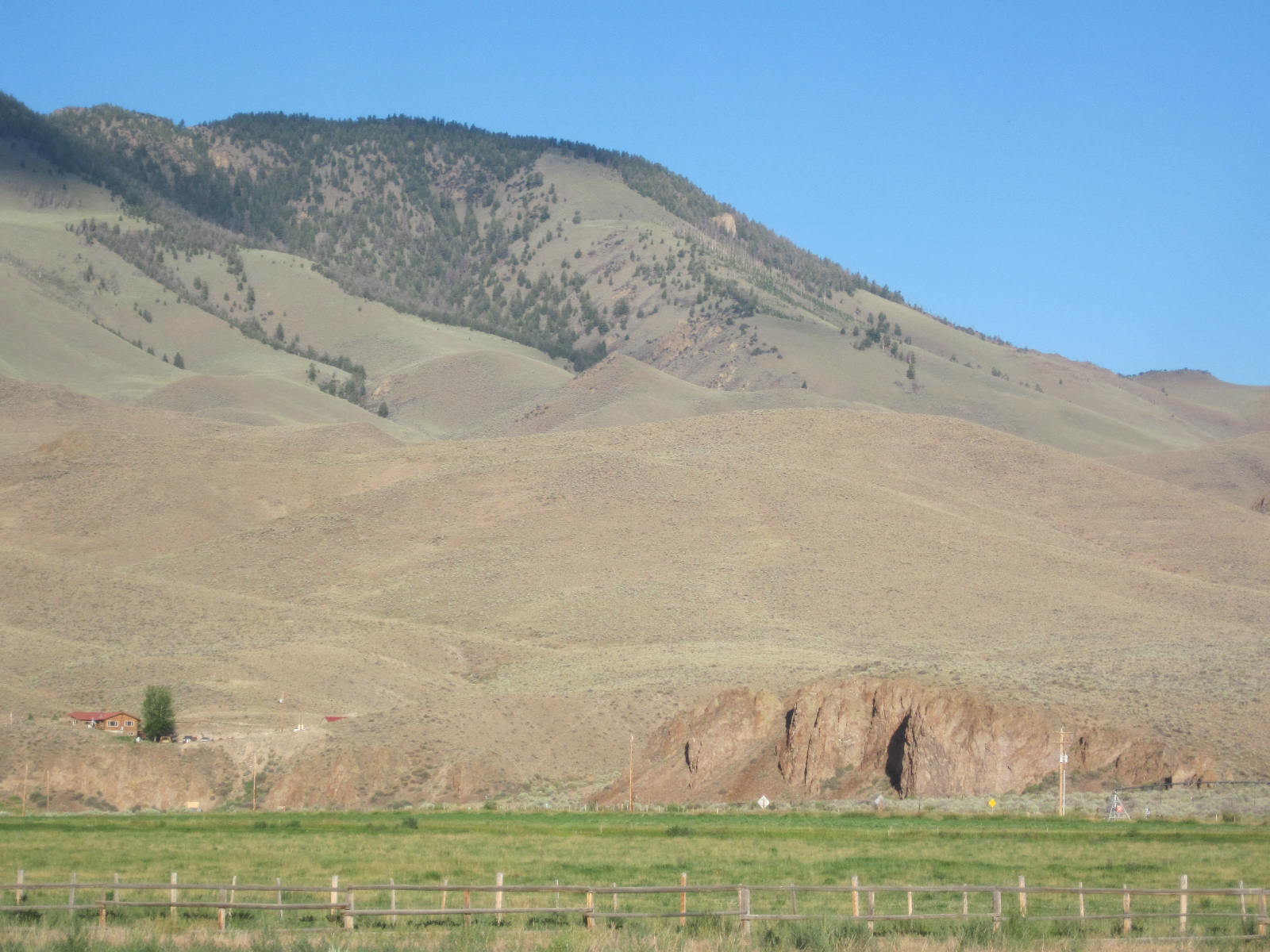 I rode down the hill and past the turn-off to Stanley. I passed the Salmon River for the last time as it went north and I was going south. 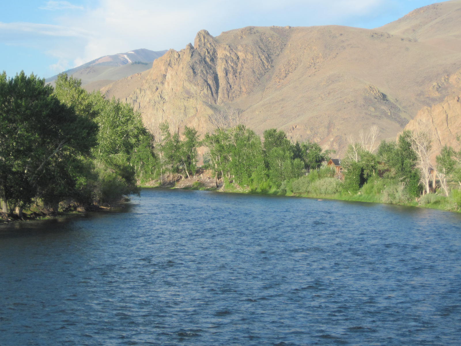 Even this early in the morning, there was a headwind. It wasn't howling, like it would later, but the bike felt heavy and it was a struggle to get it up to my usual cruising speed of 10 MPH. The route today would be through pastures. It was 24 miles up to Willow Creek Pass and then 30 miles down to Mackey. Here is a preview of the day's view. 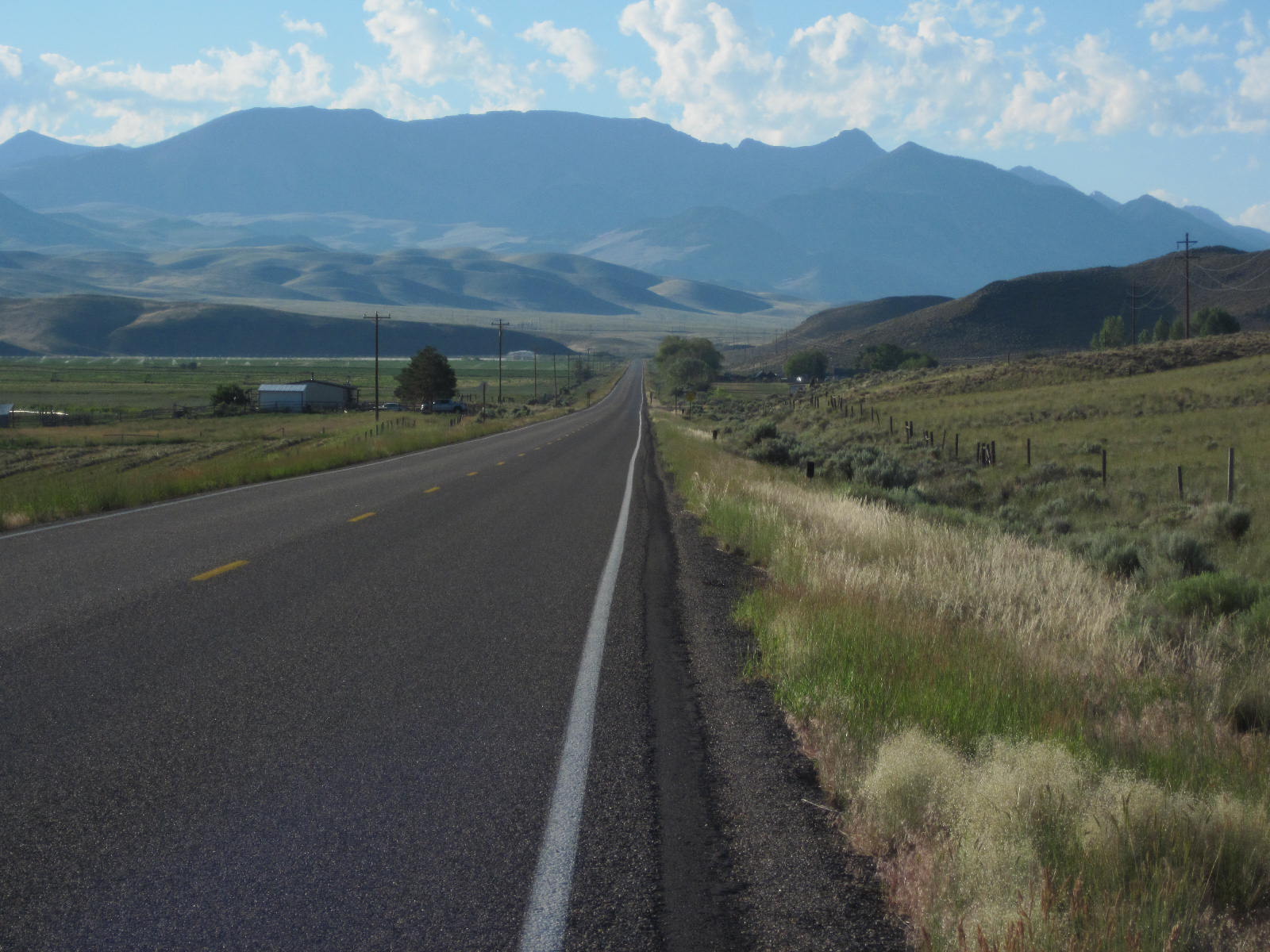 In addition to the tall mountains in front, there were ones to the sides, as well. 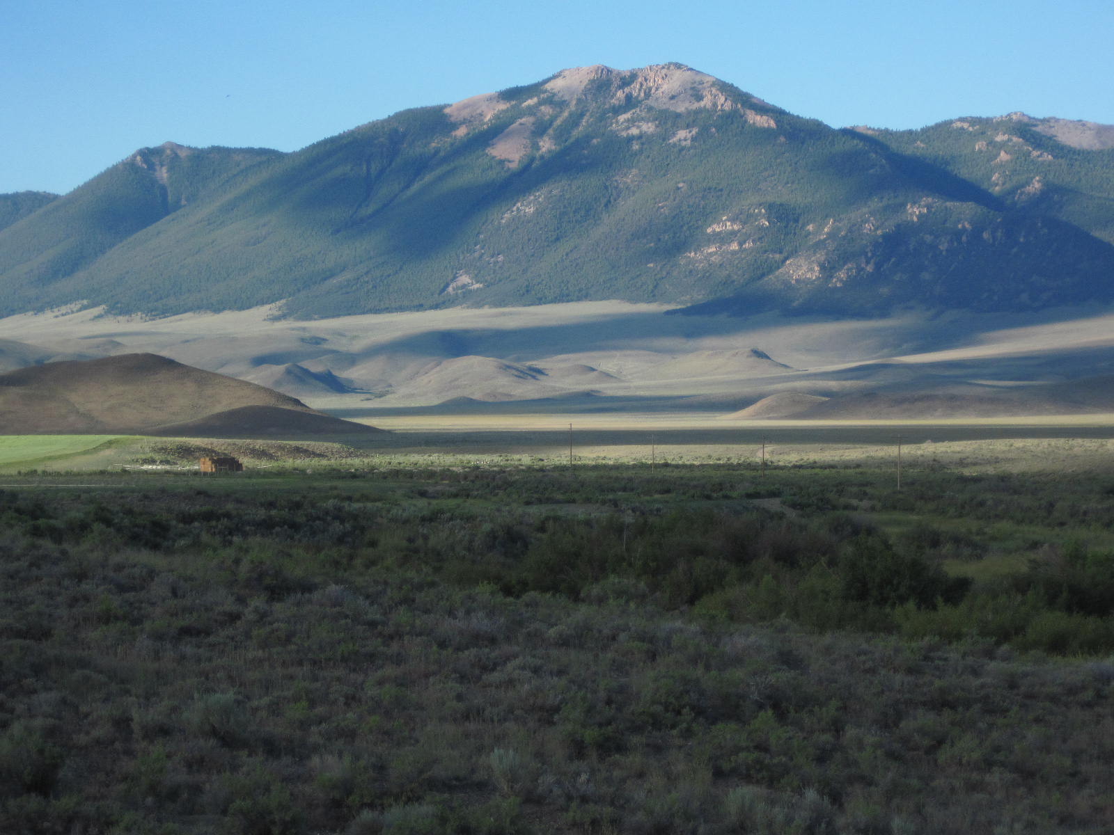 About 10 miles from Challis is Grand View Canyon, a set of hills with a narrow slot that runs through them. 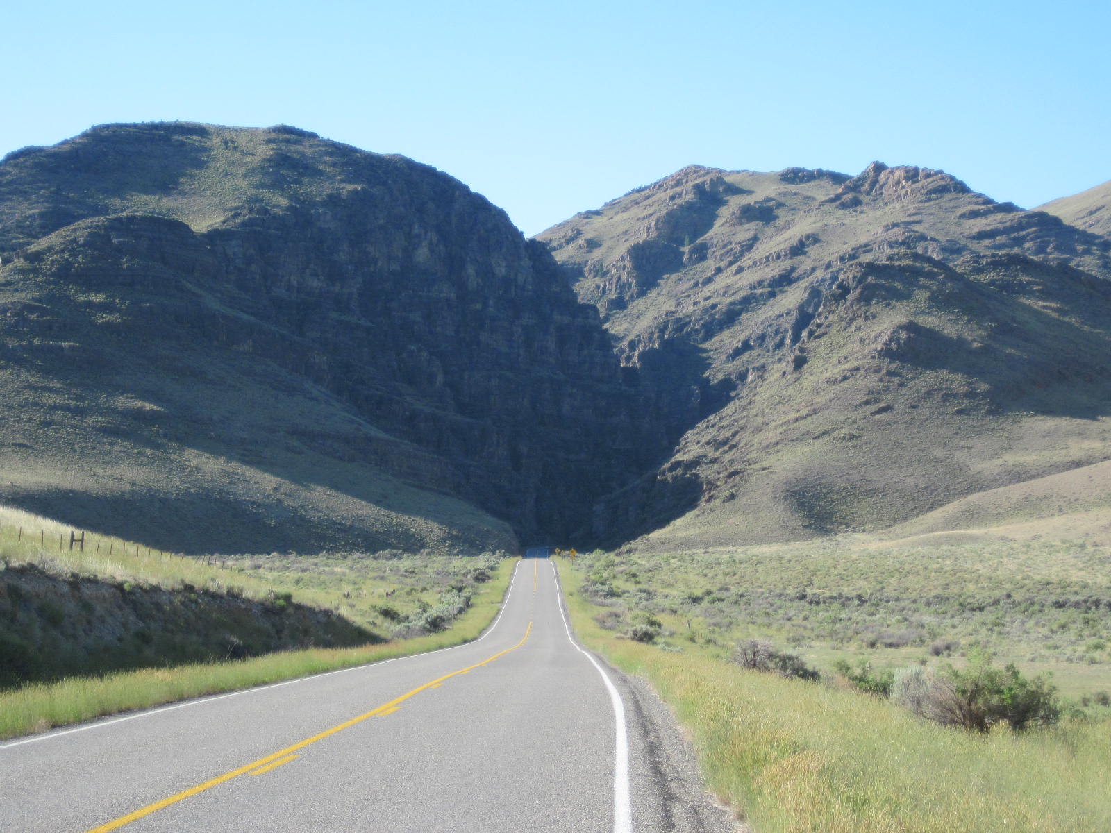 The canyon is about a mile long and consists of steep "corrugated" hills. 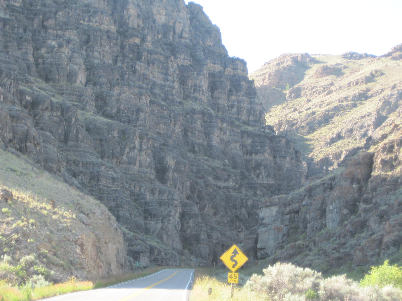 The play of sun and shadows made an interesting scene more so. 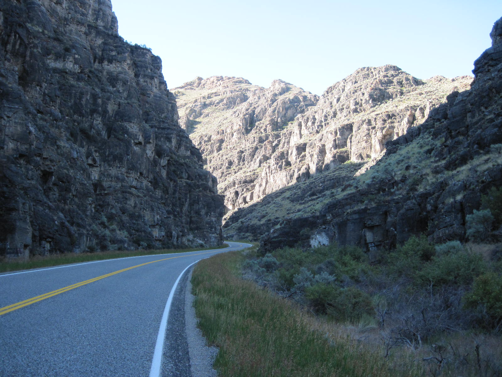 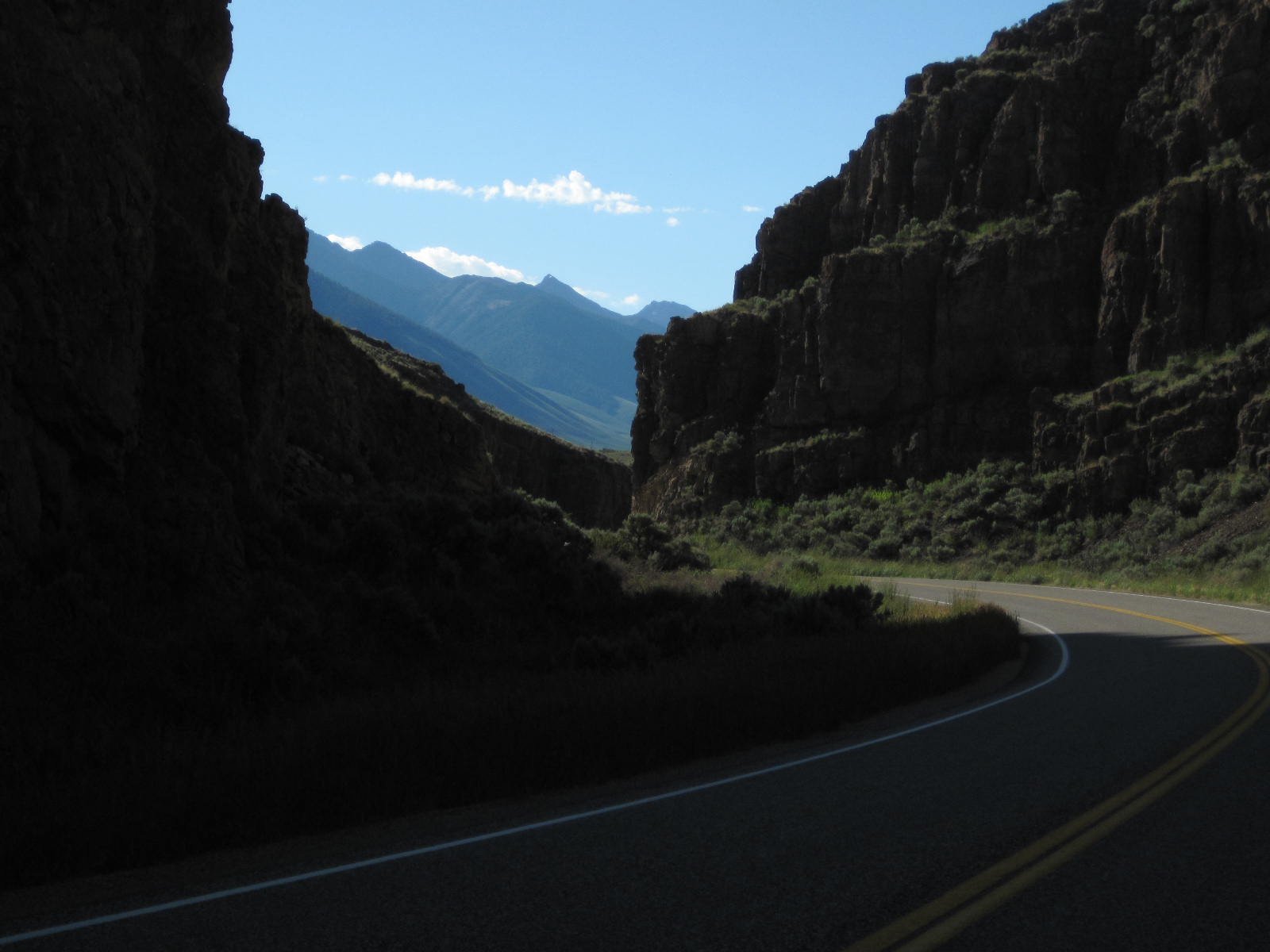 Once through the canyon, it was back to open pastureland. Some of the fields had ponds and the reflection on this one made me stop for a photo. 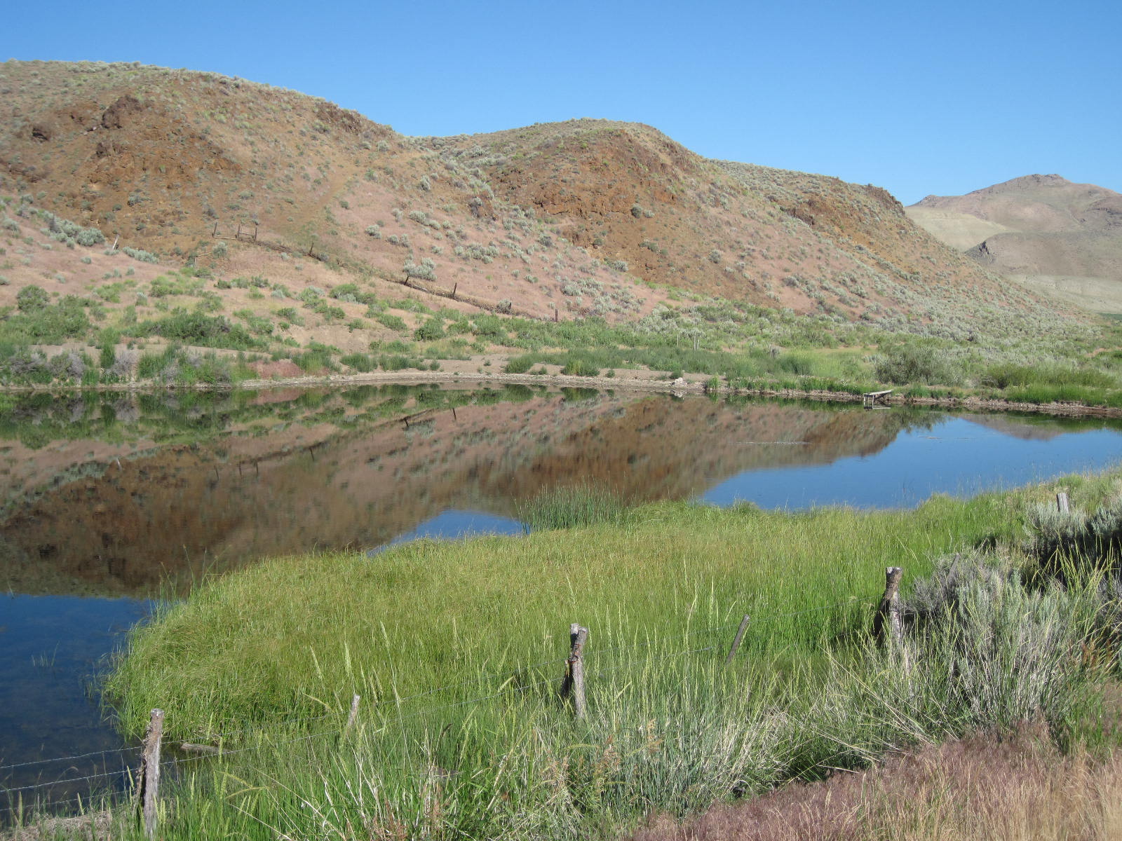 For the most part, it was wide open spaces. 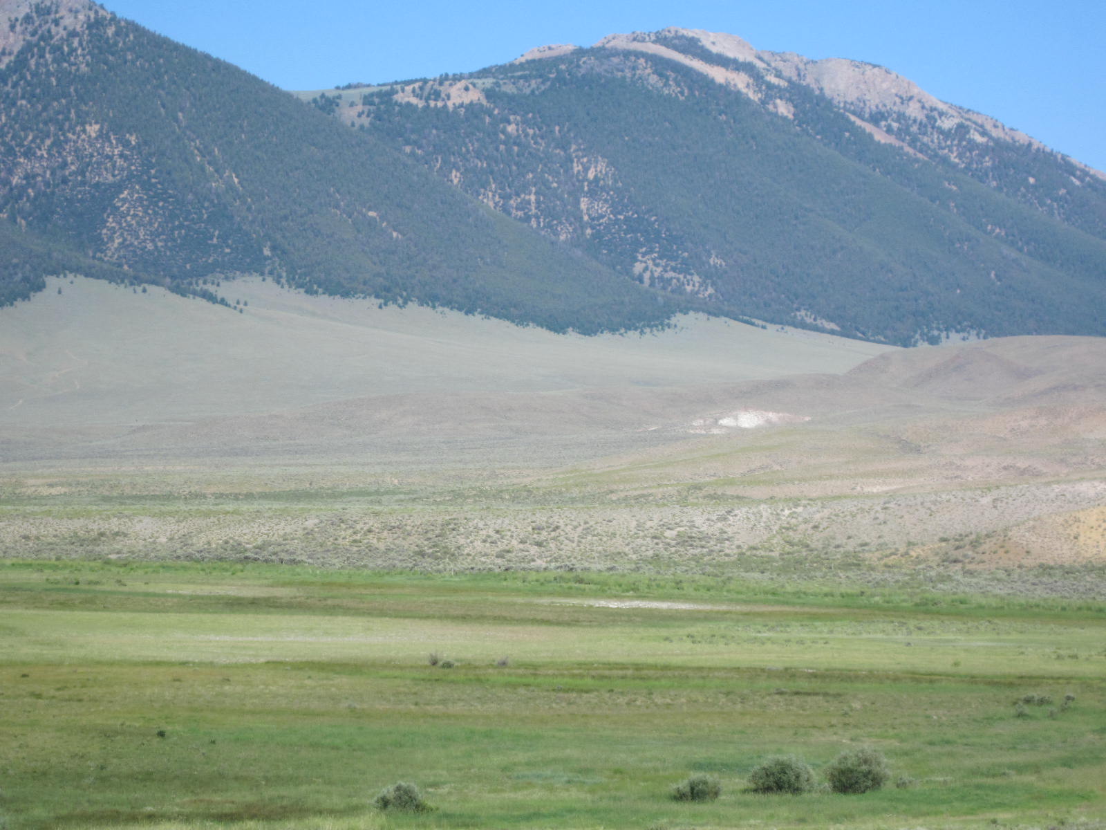 The road was heading up and the wind was getting stronger. Then, in the distance, I started to see this huge snow-streaked mountain. 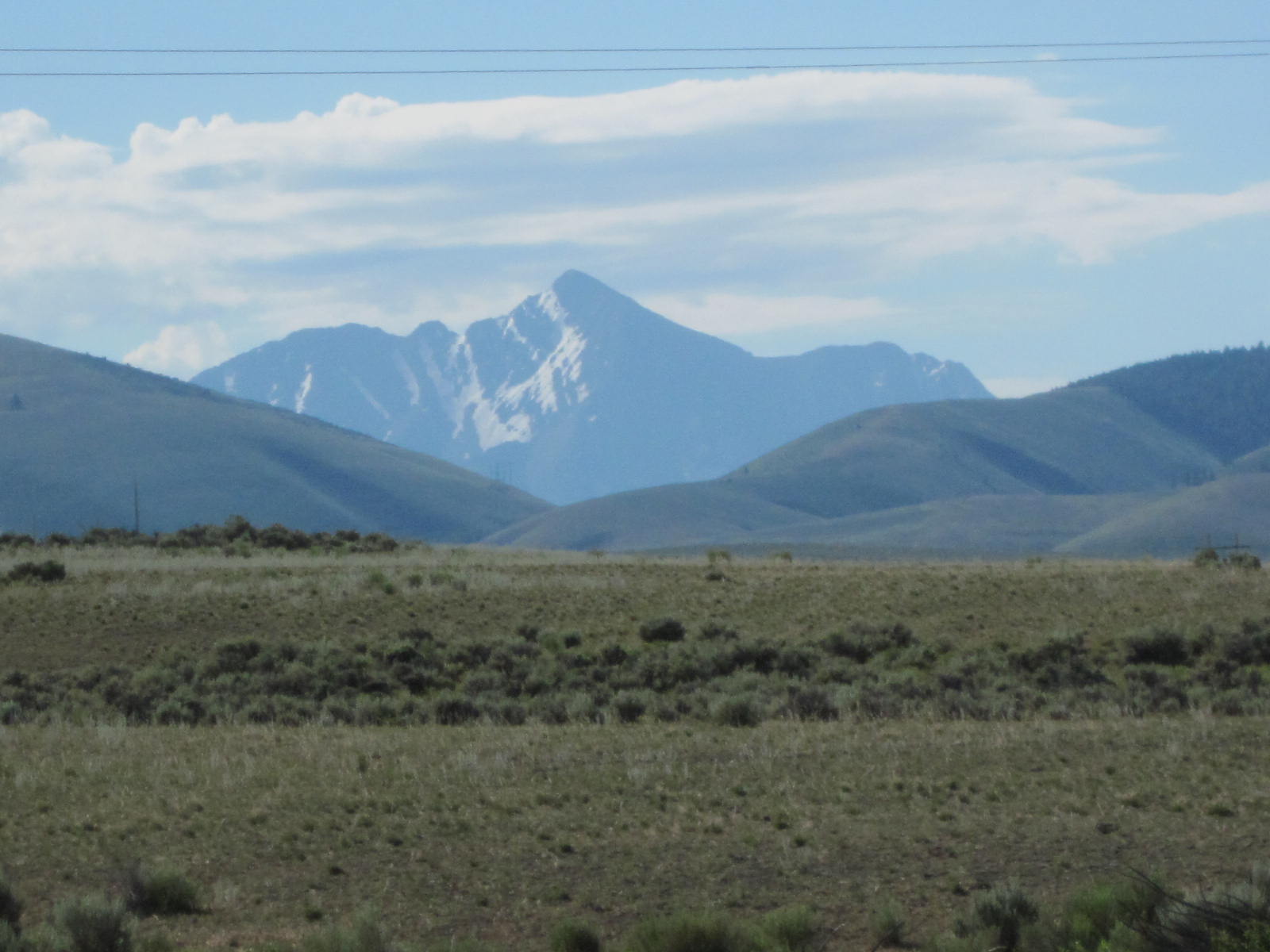 As seems to always be the case, the road kinked up as I approached Willow Creek Pass. 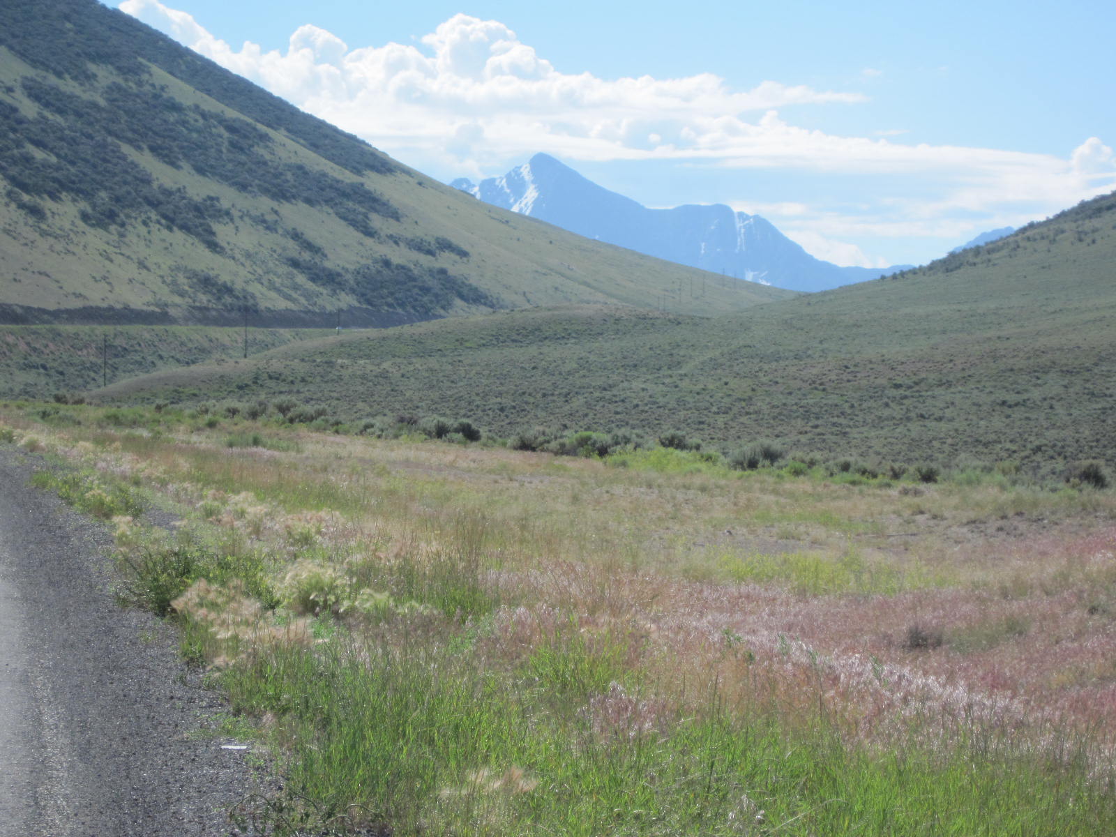 This meadow was in the pass. 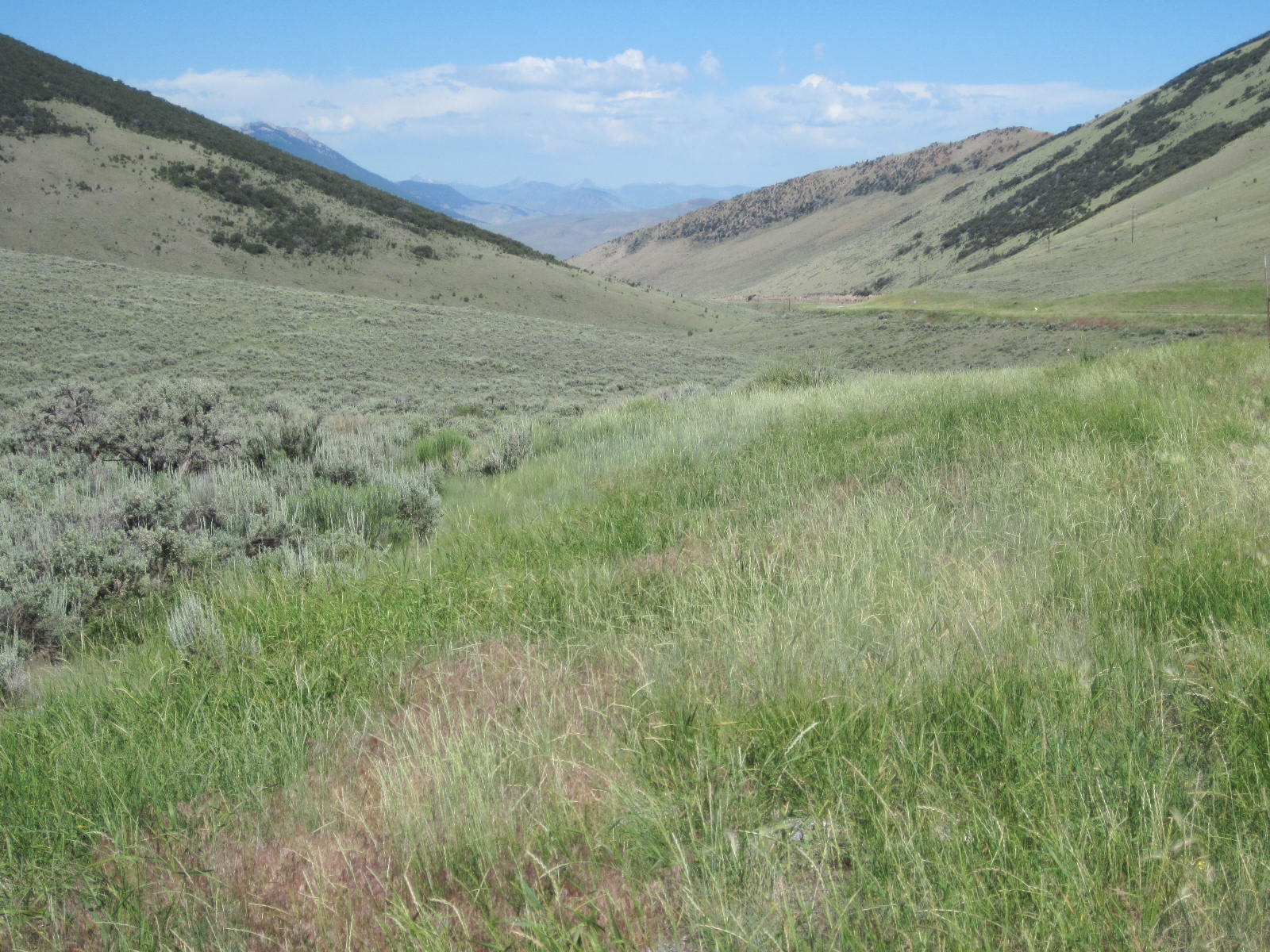 It was cold and windy at the summit. 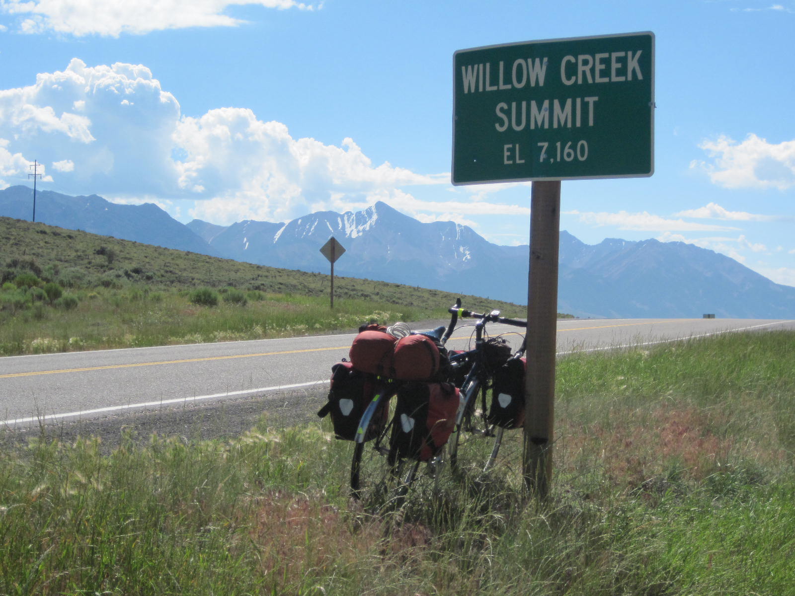 It seemed like it should be all downhill from there. 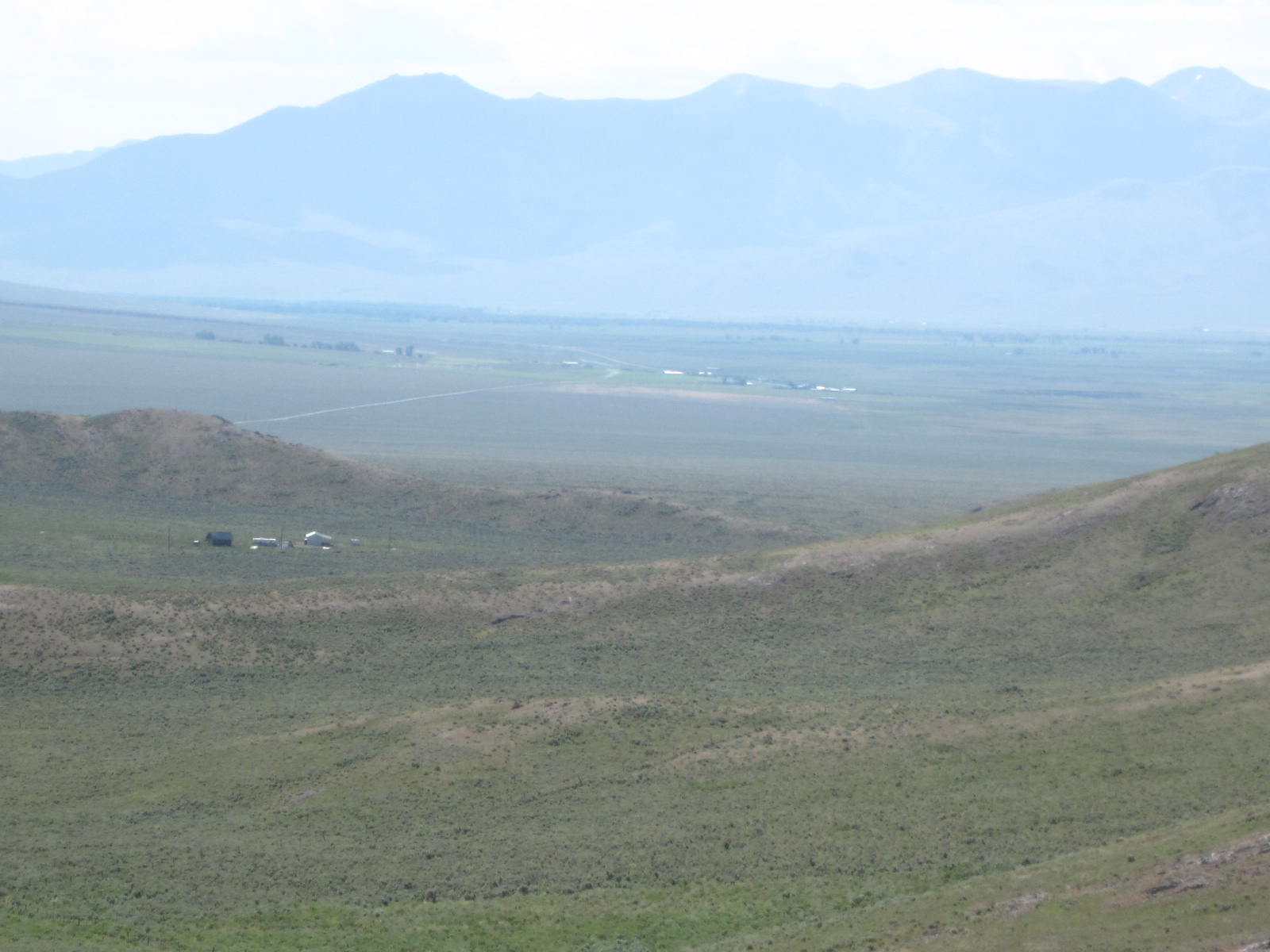 The entire valley was dominated by Mt. Borah. 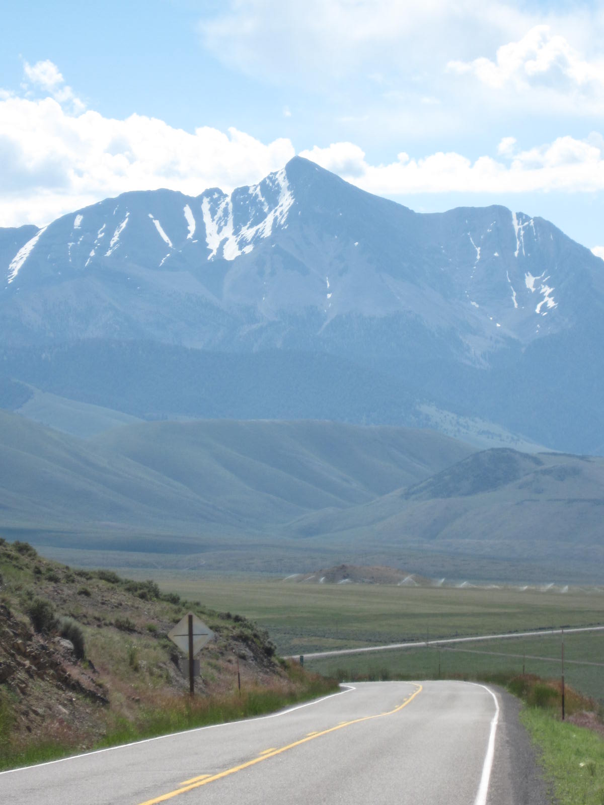 I'd seen lots of "Watch for Animals" signs but never really saw any animals of note. It was easy to spot this badger, though, as it was dead in the middle of the road. 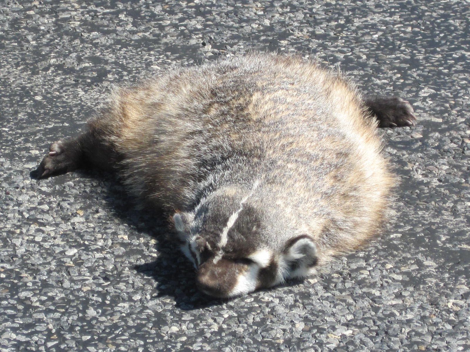 Now that I was below Mt. Borah, I could see that it was part of a larger range of mountains. 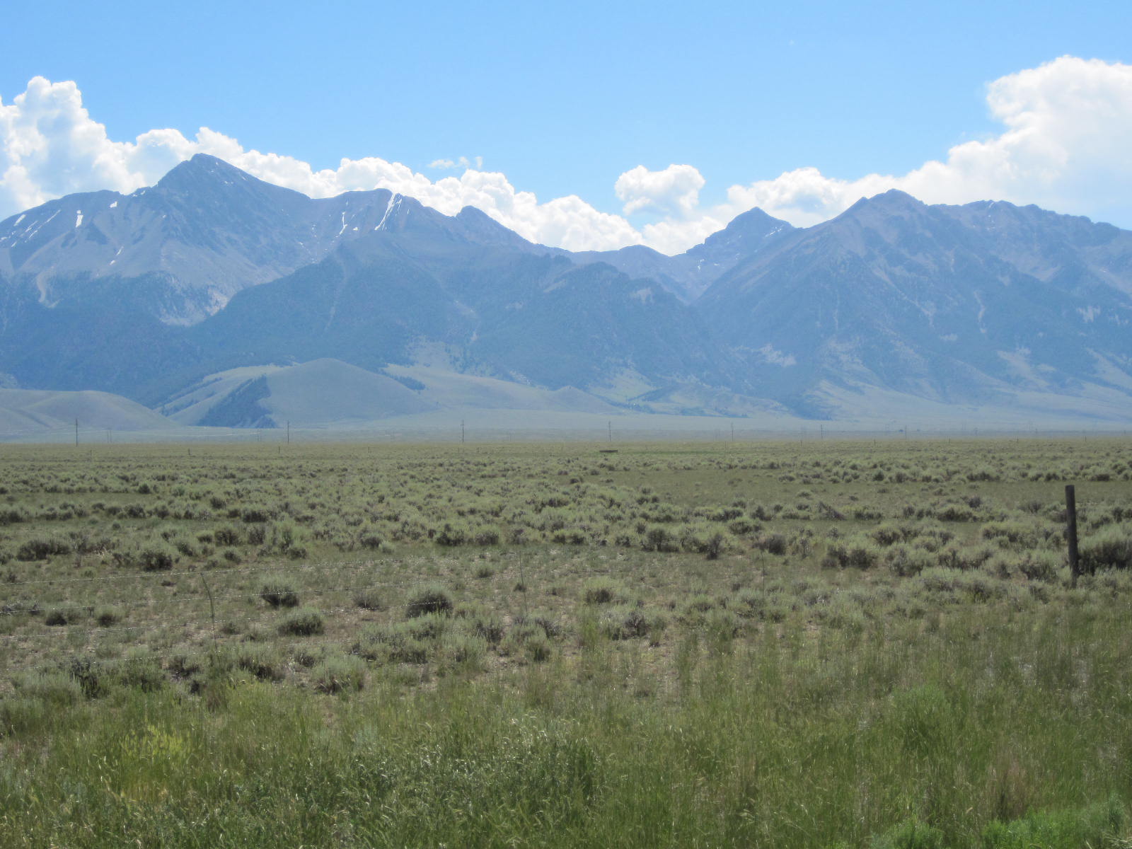 Here is Mt. Borah's information sign. 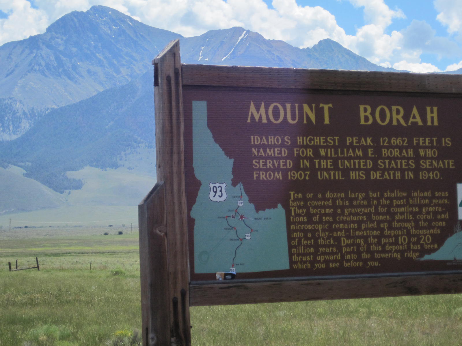 There were signs every so often and I found this one infomrational as I didn't know there was a big earthquake in Idaho in 1983. 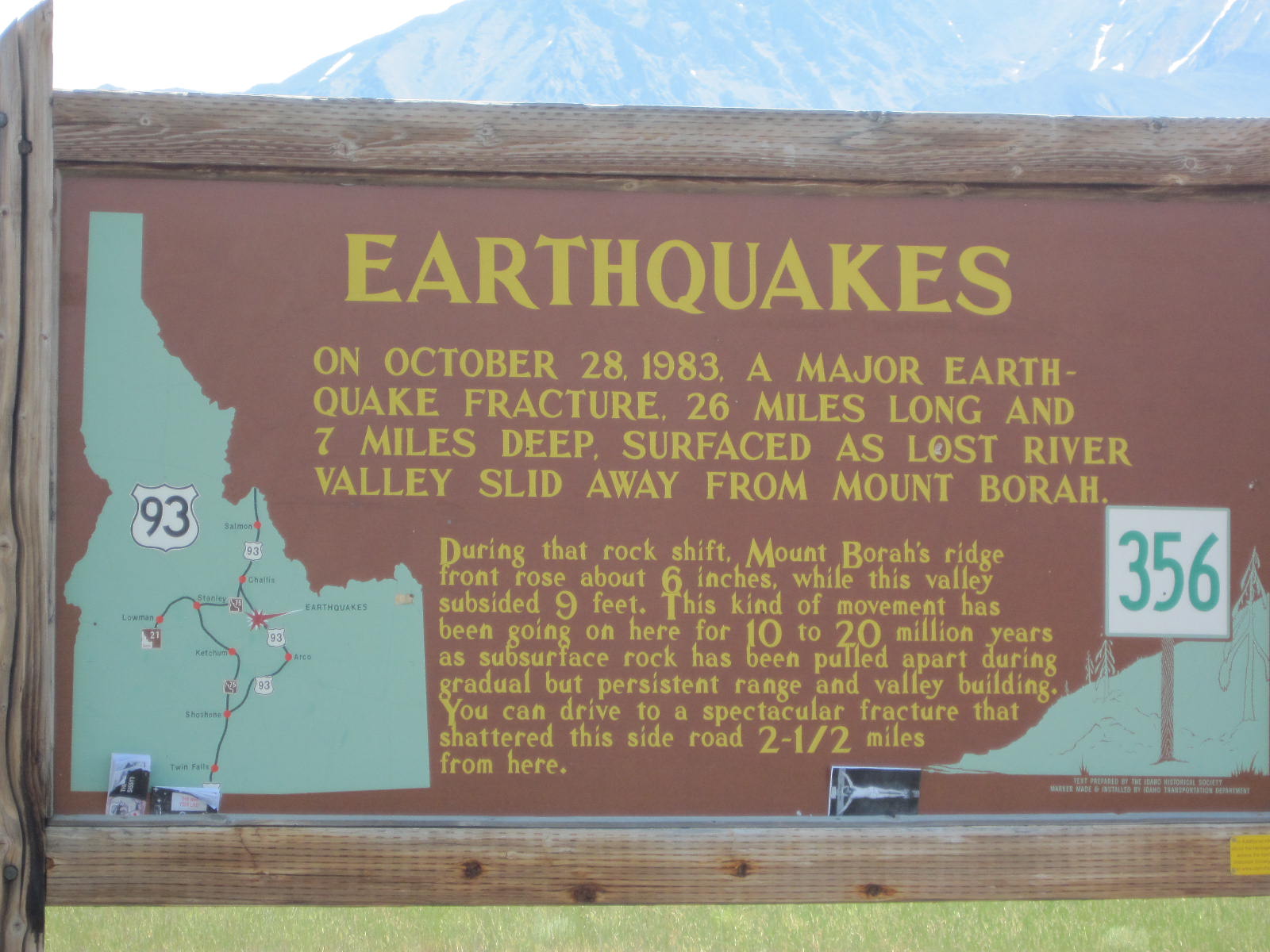 I saw these two Sandhill Cranes beaking around in the fields. 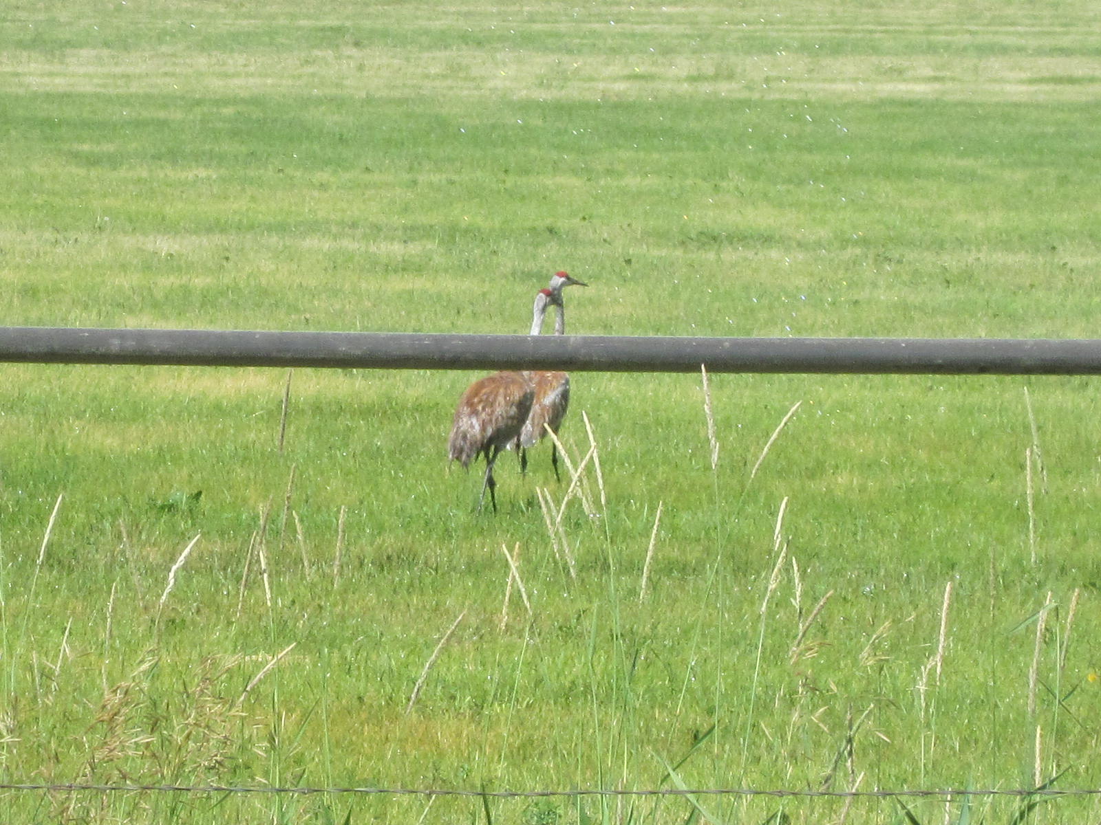 The mountains were not far off the road and then were very steep. 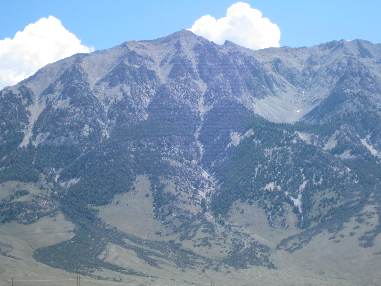 Much of the day was spent riding up and down small hills like this one. I always find it disheartening to see this kind of road ahead. Especially when riding into a stiff headwind. 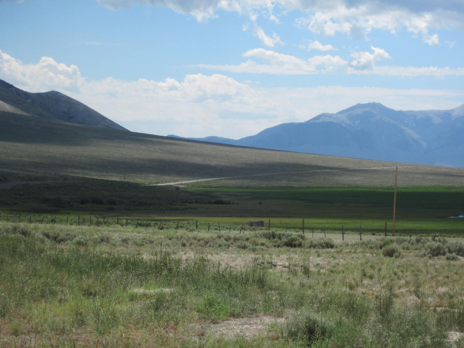 This is the view looking north toward the mountains from the top of one of the hills. Note the turbulent cloud formations. 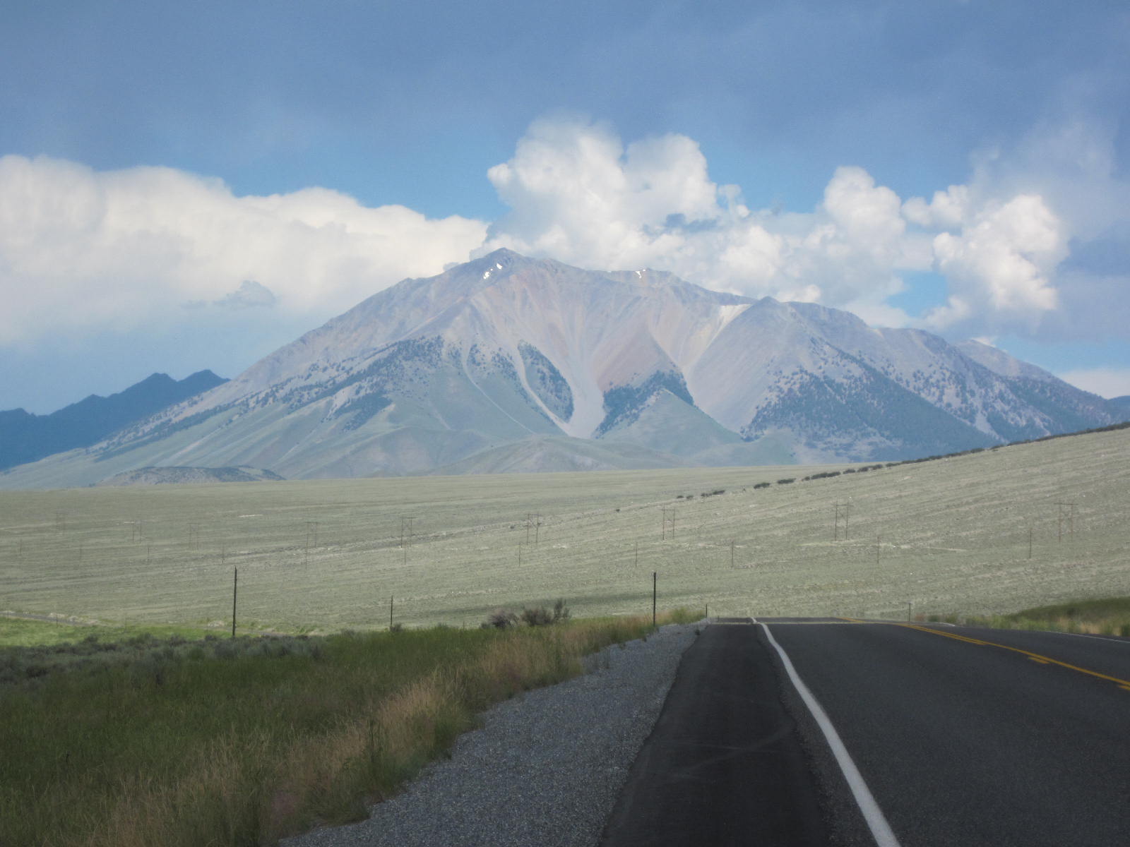 There is a natural area north of Mackey known as the Lost River Valley. Due to the seismic activity, there is a sink here that swallows up a river that runs in the valley (thus, the name). 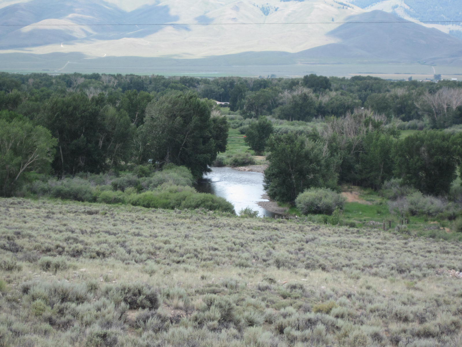 These were the only trees I saw in this valley! I also passed Leatherman Peak. 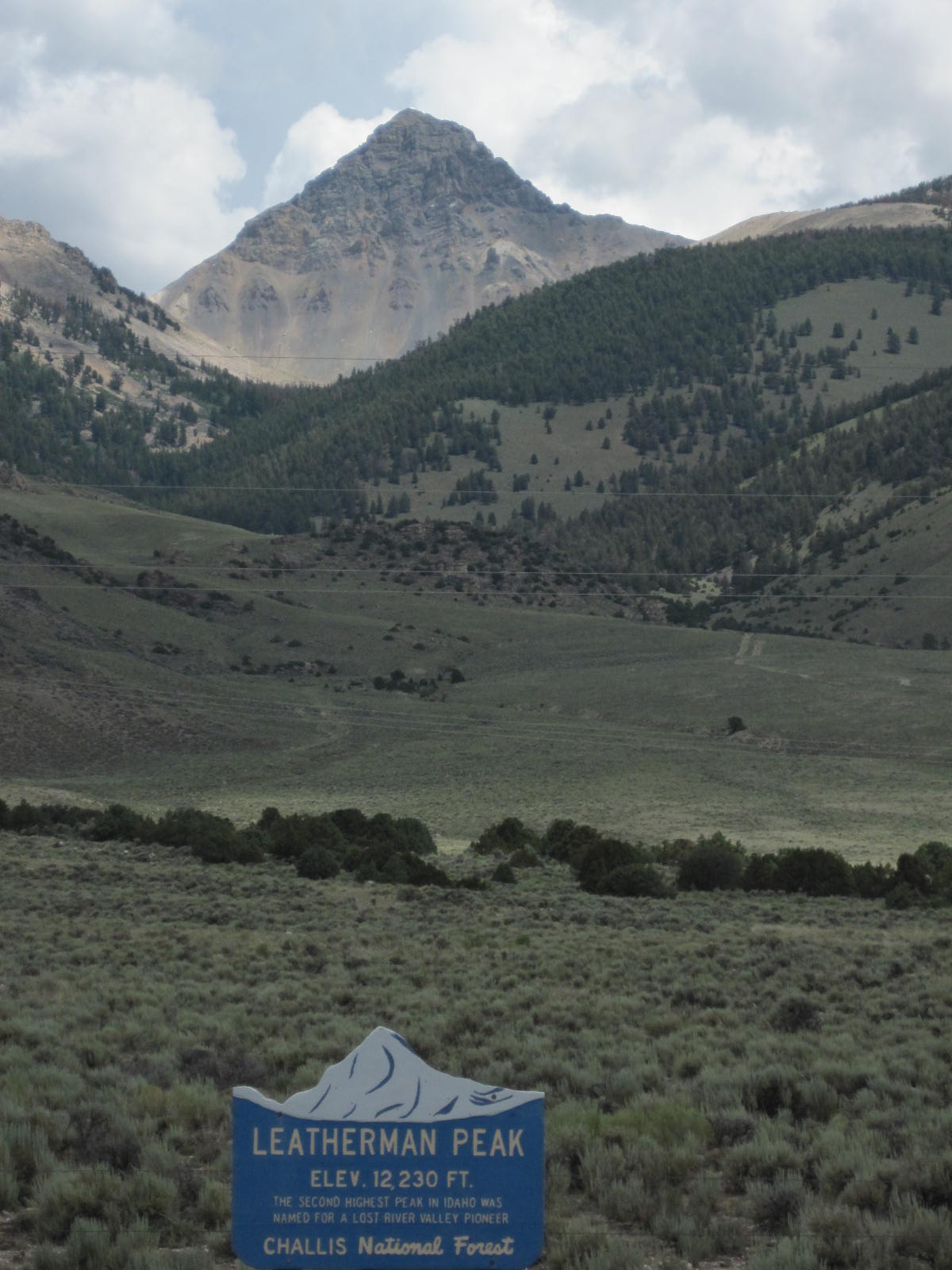 As I went further south, the clouds on top of the mountains got darker and darker. The wind intensified and I saw lightening and heard thunder. While I saw lots of wet pavement, I didn't ride through any rain. But, I was well aware that there might be a deluge any moment and there wasn't anything to get under if it did! 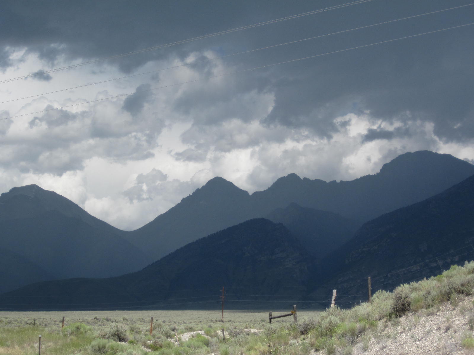 Just north of Mackey is a large reservoir that has an attached campground. I could have stayed there but given the ugly clouds and unattractive camping area, I pressed on to Mackey. 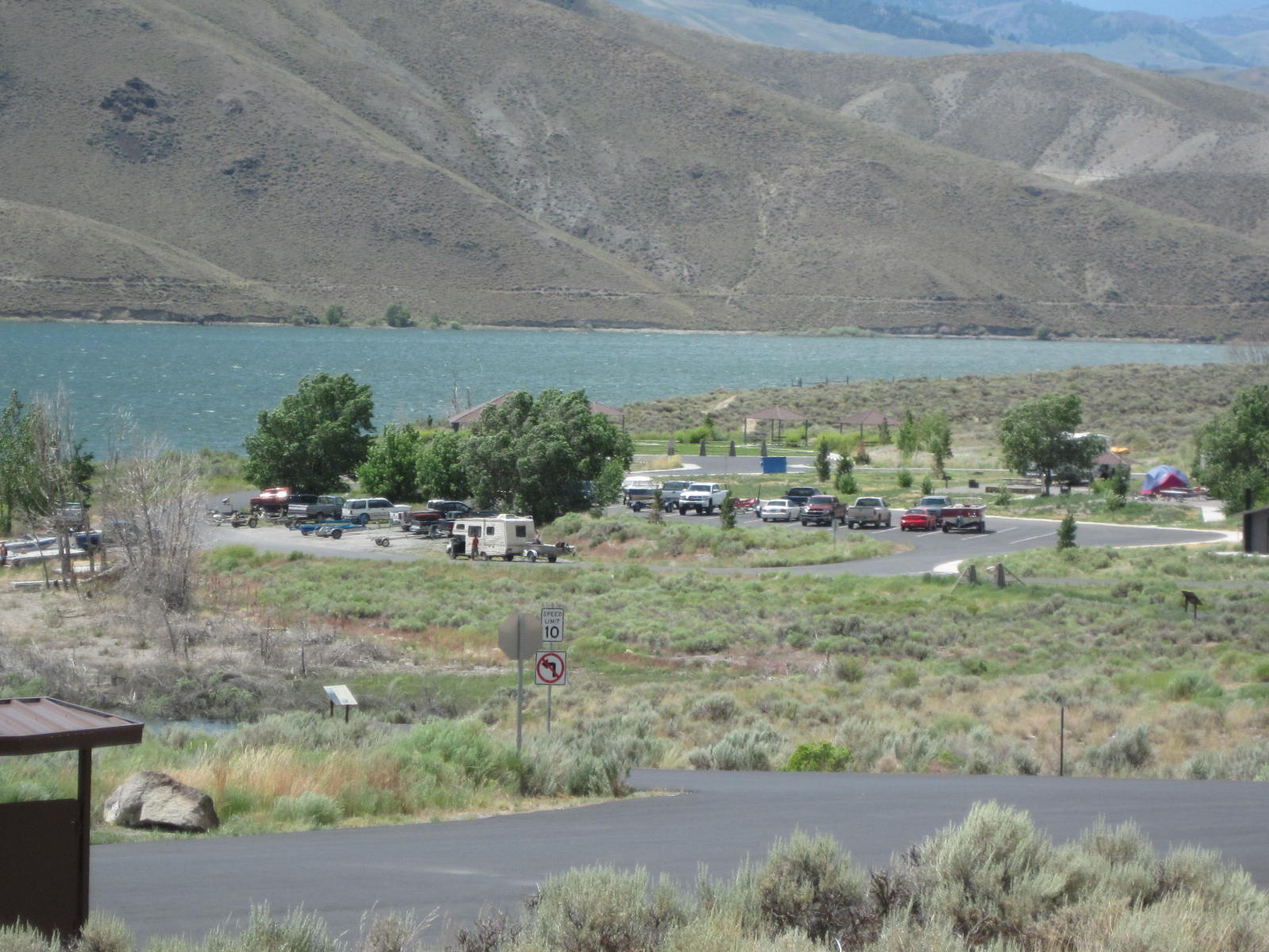 It's about 5 miles of uninteresting riding from the campground to Mackey. As I was getting into town, I began seeing no vacancy signs on all the motels. I eventually rode through this very small town to see if there was a park where I might camp. I was eventually sent to the municipal campground on the edge of town. The campground was full of people apparently having a big party which seemed to involve golf at the local course. Even one had RVs and various gas-driven scooters. I looked for a place to check-in but couldn't find one so I found a bit of open ground next to a picnic table, set up camp, and ate the last vegiburger I had bought in Challis. It was still early in the afternoon so I called my wife and brother and talked with them for a while. About 4, it started to rain and I crawled into my tent to wait it out. It rained for about an hour during which time I noticed that the floor of the tent was getting wet. It was here that I discovered that the rain fly of my tent needs to be staked out in four places to prevent the run-off from pooling under the tent. It continued to rain off and on for the rest of the day and I was in my tent from 4 o'clock on. As it got dark, the partying got more intense. I went to sleep among lots of hooting and hollering. |
||||
|
|
||||