|
|
||||
| Date | Starting Place | Ending Place | Author | Last Update |
|
|
||||
| 05-20-10 |
Jacksonville, North Carolina, United States |
Sealevel, North Carolina, United States |
ray | 07-20-10 17:46:46 |
|
|
||||
|
Today, the idea was to ride as far as I could. My ultimate goal was to get all the way to end of Cedar Island and the terminal for the Ocracoke ferry. That would be over 100 miles, something I've never done on a bike, loaded or not. I wanted to get up and out early, so I hit the motel's breakfast bar at 6:30am. I took down as much cereal, yogurt, and toast as I could and then went back, showered, packed up and left. I was on the road by 7:45. I knew from my ride through Jacksonville the previous day that the roads where not bike friendly. But, I had seen a bike path the evening before and started my ride on it.  The bike path went over a stream that was still and picturesque in the morning light.  The people driving on the street just behind the camera probably didn't even know this pretty view existed! It took a short while to navigate the city neighborhoods of Jacksonville and to get to the suburban and rural outskirts. The route meandered through sparsely but consistently populated farm and wood land. The view remained the same. 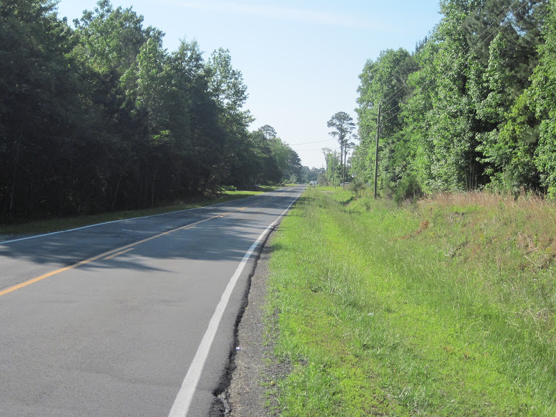 As the above photo shows, much of my riding was on shoulderless, low traffic two-lane roads. Since I'd left Charleston, I had passed by many churches. Most of them had some pithy religious message on an outdoor display. Some made me smile, others got a head shake. This one hit so close to home that I took a photo of it and emailed to a couple friends! 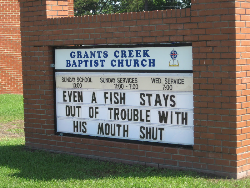 Just as the ACA map says, there are no services along this road. After about 10 miles, I came to the T-junction that splits the route. 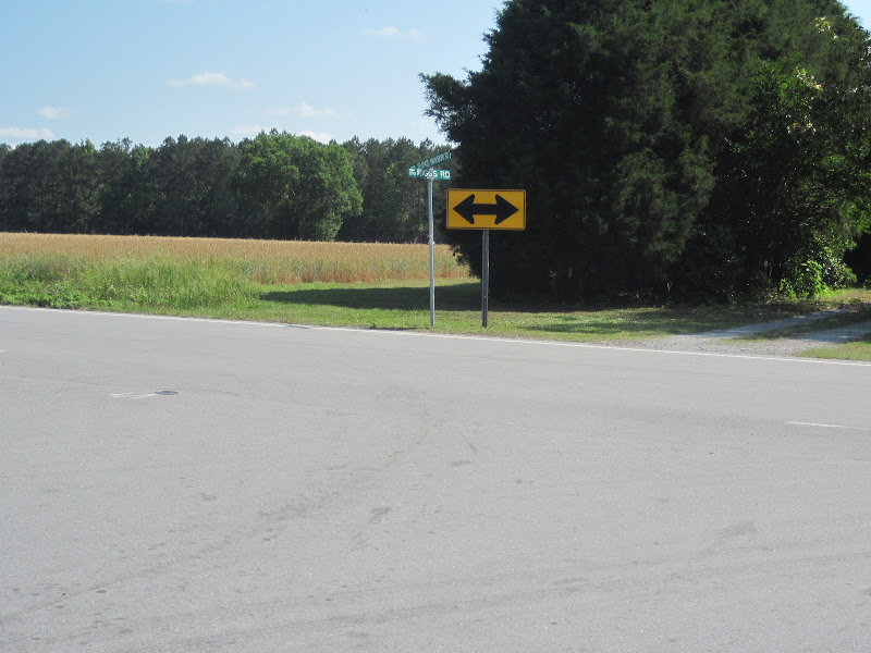 To the left is the shorter, inland route. To the right is the Outer Banks. I turned right. The 15 miles to Swansboro were more of the same woodlands punctuated by homesteads that I'd been seeing for the last week. Several miles north of Swansboro, I turned onto Highway 24, a main road through this area with an intermittent shoulder. Swansboro is yet another old town surrounded by all the new consumer outlets so familiar these days. I stopped at a fast food place (McDonalds?), ate a Subway, and drank down a chocolate malt. It was great to get out of the humidity and into some cool air and chocolate malt always lifts my spirits. Unfortunately, the alarm lock I was carrying broke (the alarm no longer sounded) while I was locking my bike and I would have to make do with a plastic lock until I fixed this one or bought a new one. Swansboro is on the north side of the White Oak River. From the bridge over the river, I could see the attractive older part of Swansboro.  As usual, I couldn't resist taking a photo of the wetlands around the river. This view is from , what I'd call, a causeway just past the Swansboro bridge.  The road continued though coastal outskirts of homes, boat-related businesses and marinas. At an empty lot at the intersection of two large highways, I saw these flowers. I took the photo because wildflowers were rare on this trip.  Two minutes later, I rode by these flowers in a field that was in front of a gated housing community.  I was still on Highway 24, which had now expanded into a straight, uninteresting, 4 lane road.  I knew there had to be some kind of military air base (or some big dragons) nearby as I could hear the wailing of jet engines. For the most part, I couldn't see the water from the Highway but as I neared my turn-off, I passed an inlet that gave me a pretty view into Bogue Sound. 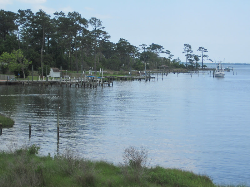 At 9 Mile Road I turned into the Croatan National Forest. In a moment, the development was gone and it was just a narrow road through the forest.  Not surprisingly, it was 9 miles from there to the town of Newport, a tiny collection of local businesses and tidy homes. I stopped in at one of the eat in/take out Chinese places that dotted many of the strip malls in the small towns I rode through. 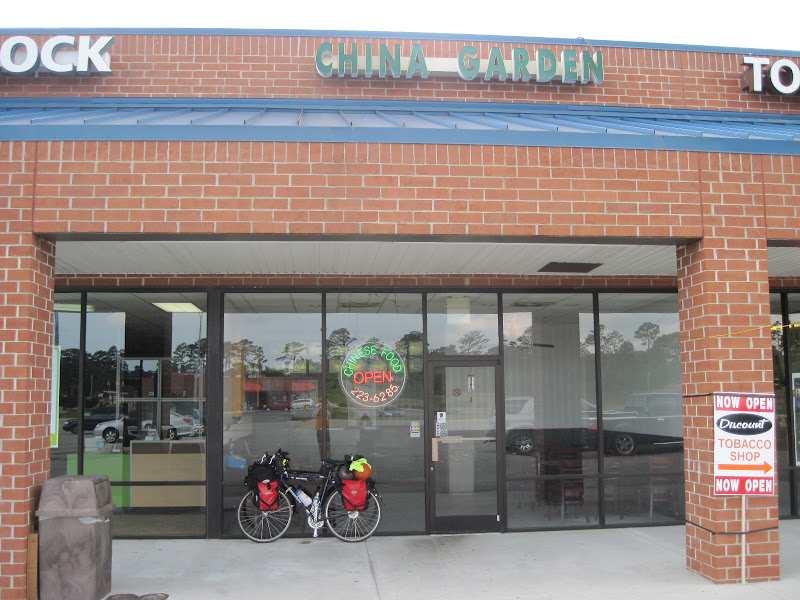 I had a nice meal of fried tofu and broccoli, charged my iPhone, and rested.  I felt good about my progress as I'd gone about 50 miles and it was only 3:30pm. I didn't think I would make it all the way to the ferry terminal, but my legs still had lots more miles in them. Once past Newport, the woodlands continued. While I was riding, I happen to notice some water through the trees next to the road. 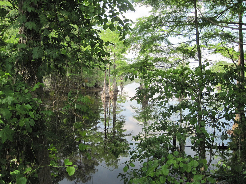 I stopped, pushed my way through some branches, and had this fabulous view. 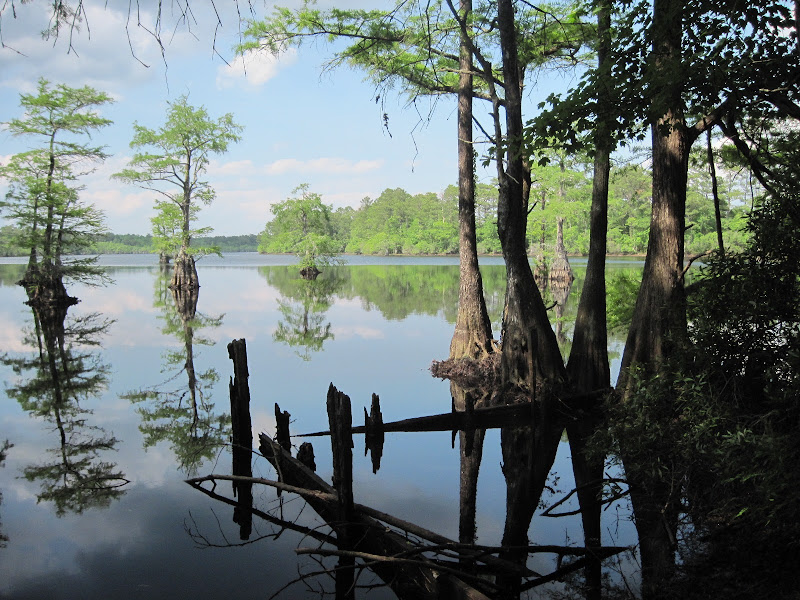 I spent some time just soaking in this scene, taking several pictures, and realized that one of the main reasons I tour on a bike is to spot such places. In a car, I'd have driven right by and not ever known I'd missed anything. The eastern edge of the Croatan National Forest is marked by Harlowe Creek. I stopped on the bridge over the creek as this egret posed for a photo. 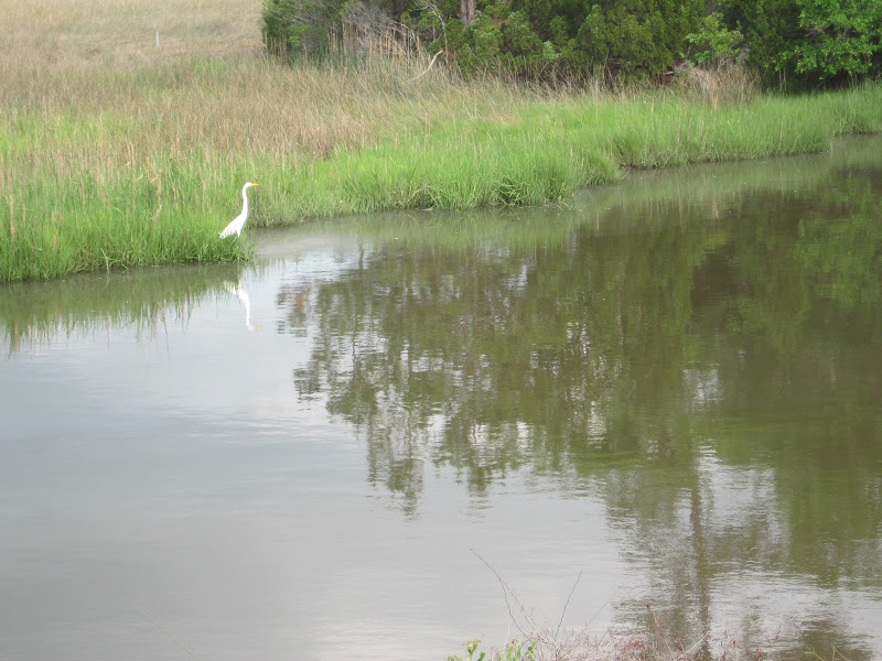 Now, intermixed with the trees were farm fields and horse ranches. It was getting onto rush hour and the traffic on the shoulderless, two-lane road was getting worse. I was constantly looking in my mirror as SUVs passed by me with little more than a foot to spare. I went over the Intercoastal Waterway on this bridge that I thought might be the highest point of my entire tour!  There was something about the golden Lions guarding this non-descript house (among a whole neighborhood of non-descript houses) that caught my attention.  The traffic got worse as the road headed out toward Cedar Island. I was now riding through some very pretty areas connected by narrow, scary bridges. 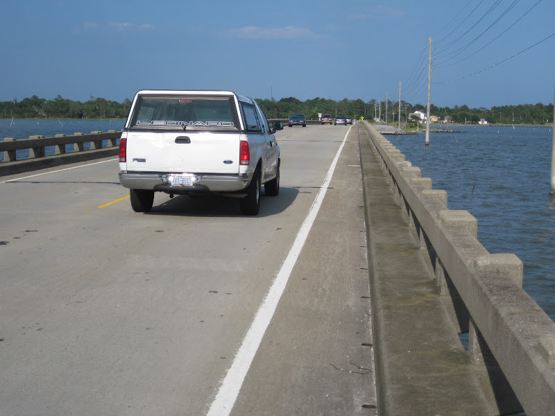 Views like this one were very common, especially when I was crossing one of the many bridges. 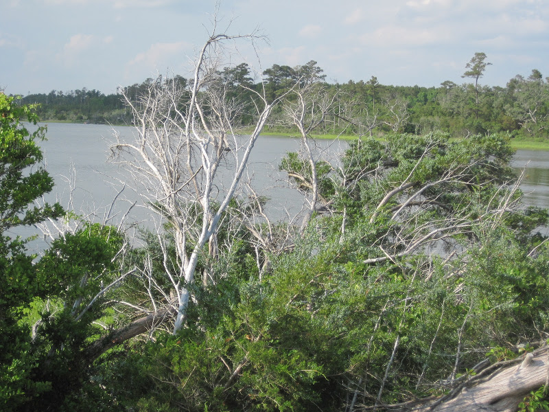 When I saw white birds (ibis?, storks?) wading through a grassy wetland, I stopped and watched. Birds don't seem to mind things moving along the road. But, when something stops, they move along. I tried to get a close up but they kept walking out of the frame. Here was the best photo I got. 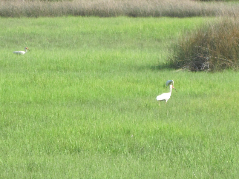 In between bridges, there were wetlands, farm fields, tiny towns, and more trees. The vistas kept changing in a very appealing way. This meandering creek seemed to go all the way to one of the many bays that make up this part of the coast of North Carolina.  This is the view along the eastern shore of Jarrett Bay. 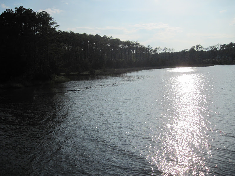 By 6:30pm, the traffic had passed and the straight, flat road took me through brown wetlands. 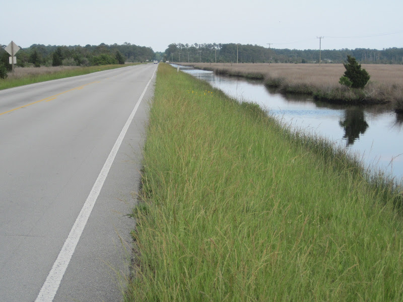 The sun bursting through this cloud was stunning. Unfortunately, the photo doesn't do it justice. 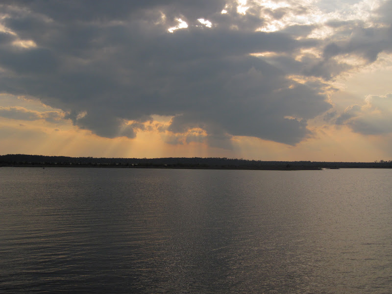 I was now riding through flat, reed-covered swamp with the occasional reflective pool 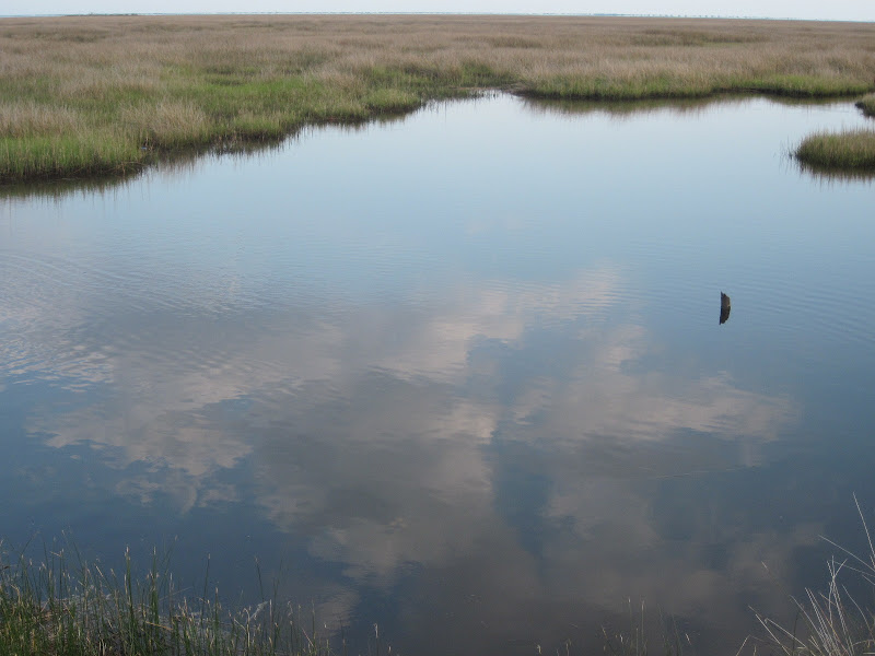 and meandering creek.  It was now past 7pm and my legs were very tired. The ACA map showed the Cedar Creek Campground just a few miles ahead. I had called earlier to insure that I would have a place for the night. Just before the signed turn-off to the campground, I got this view of Nelson Bay. 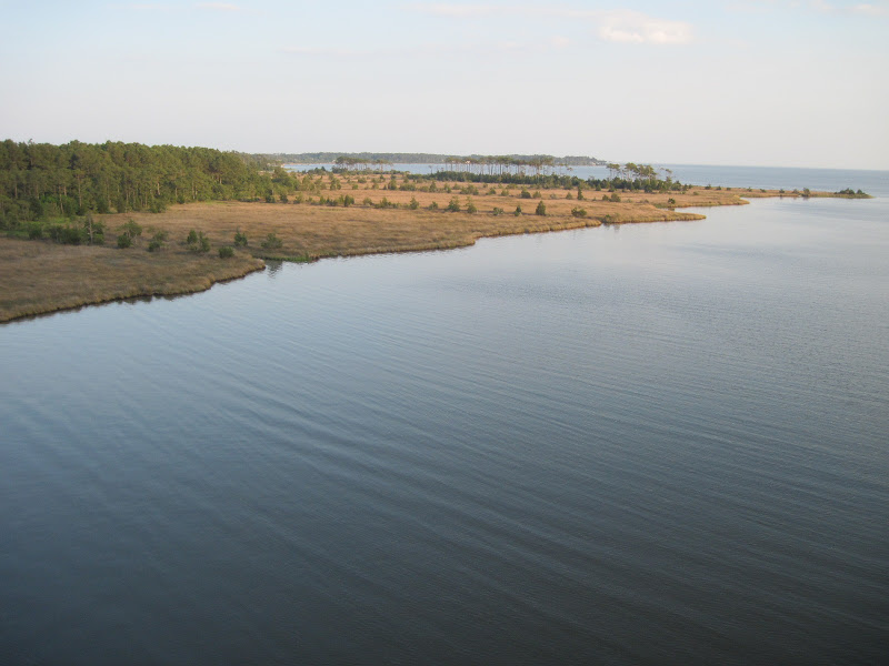 I rode through the nothing town of Sealevel to the campground. I was the only tent in the place filled with RVs, trailers, and camper vans. The campground was in a pretty location and my spot was away from everyone else.  I was dead tired. I ate the rest of a Subway sandwich, put up my tent, crawled in, and went to sleep. |
||||
|
|
||||