|
|
||||
| Date | Starting Place | Ending Place | Author | Last Update |
|
|
||||
| 10-03-10 |
Concord, Massachusetts, United States |
Boston, Massachusetts, United States |
ray | 12-06-10 16:01:31 |
|
|
||||
|
I wasn't in any hurry today. I had about 35 miles to ride and my wife, who I was meeting at the airport, wouldn't arrive until 5pm. The motel provided breakfast and at 7am I went up to see what it was like. It turned out to be very good. The meal was a buffet line of fruit, breads, cereals, eggs, and other breakfast items. I ate as much food as I could pack in and read the paper while I was there. I took my time getting packed up and didn't leave until close to 10am, hoping it would warm up a bit. It was a cold, overcast day with a bit of breeze. Instead of taking the ACA route to Boston, I had mapped a route using the Minuteman Bike Path that wasn't open when my map was published (2004). But, before heading away from Concord, I decided to check out Walden Pond and rode the 3 miles there on deserted local roads. All in all, Walden Pond is about average in size and not much different than the others I'd seen. 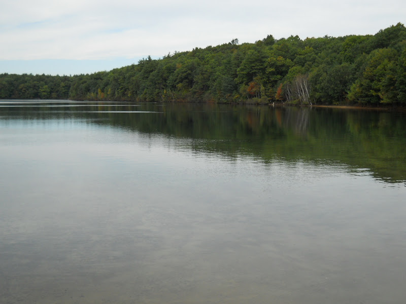 One improvement was a footpath that went around it. 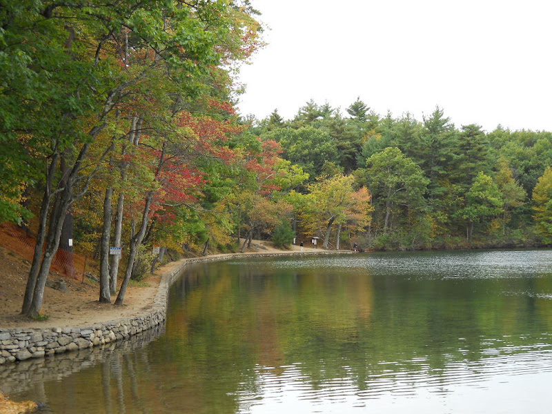 It was important to get my red tree photo in early on so I wouldn't worry about getting one later. 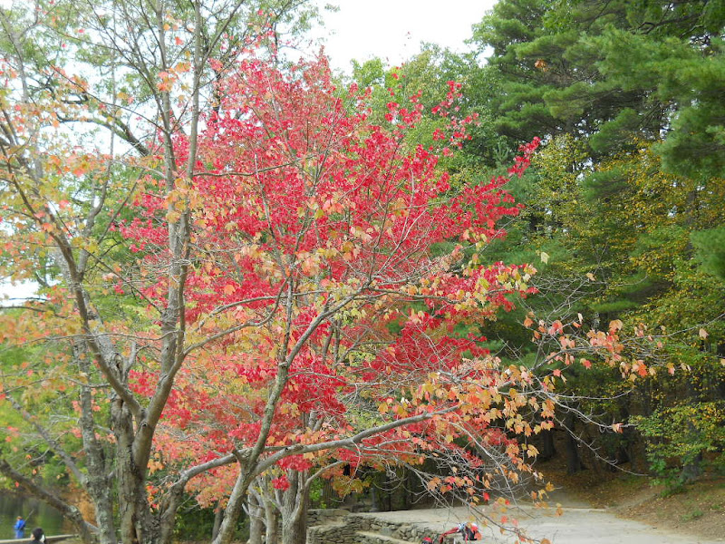 The pond is below the road. The walk down is through tall pine trees on a carpet of needles. 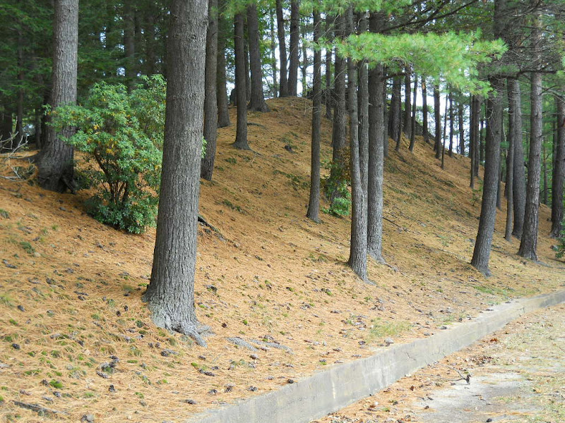 To get to the bike path, I had to ride to the town of Bedford, about 4 miles east of Concord through residential housing on the usual two-lane, unshouldered road. A little ways outside of Concord, I met Richard, a bike rider who had just finished his Sunday route. We talked about 10 minutes by the side of the road about biking and bike touring. I encouraged him to consider a tour in New England, as it is a great place to ride. These impromptu meetings are always welcome and one of the daily highlights of any bike tour. The bike path is actually a converted railroad line paved for anyone using wheels or feet. 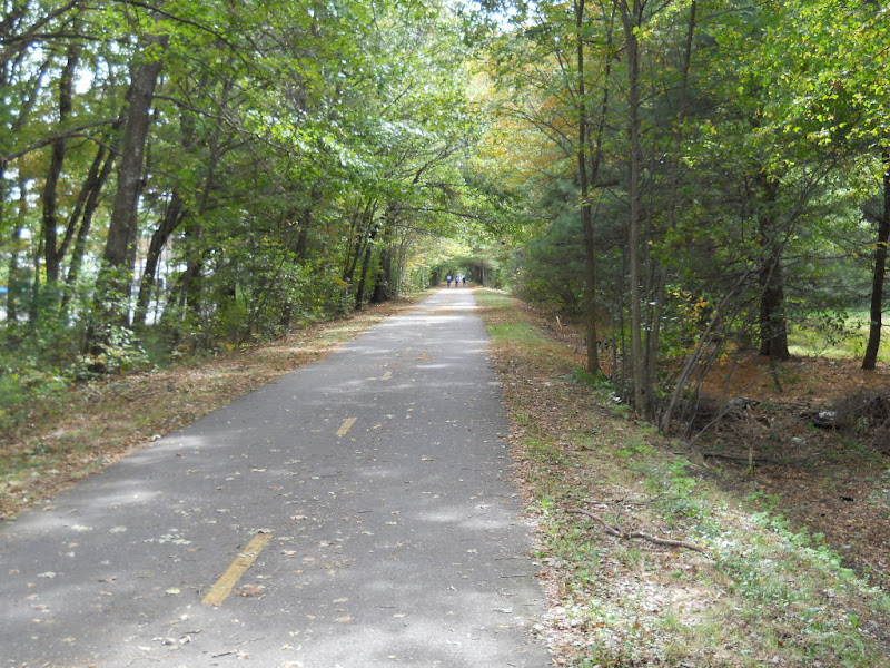 I saw lots of walkers, as well as, rollerbladers, skateboarders, and people on all kinds of bikes. It was very nice to ride along without worrying about automobiles, though I still had to watch were I went, given all the people using the path. The trail went through houses and lined by trees. For the most part, the views weren't interesting and I took only one picture while riding on it. Also, tree roots had grown through the asphalt at many places making for a bumpy and, at time, uncomfortable ride. The path went right through Lexington, where I passed the historic Munroe Tavern. 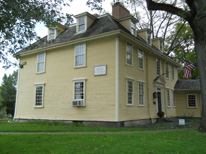 According to the sign, militiamen met here the morning they confronted the British. I rode into and around the small town of Lexington and checked out the "battle green," which was essentially a small park on the edge of the commercial district. I ate a tasty Chinese meal that was spiced just right and then some good, chocolatety ice cream. While enjoying my dessert, I read the Park Service's brochure on Lexington, saw that the visitor center was close by and decided to ride over there and check it out. On the way, I passed this attractive roadside pond. 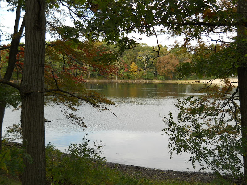 It was a couple miles away and when I got close, I decided it was getting late and that I didn't really have enough time to see it properly. I turned around to return to the bike path but got lost and ended up with a 5 mile detour just to get back to where I started in Lexington. Once back on the bike path, the residential scenery continued, though I did pass this open field and felt I needed to take at least one photo from the path. 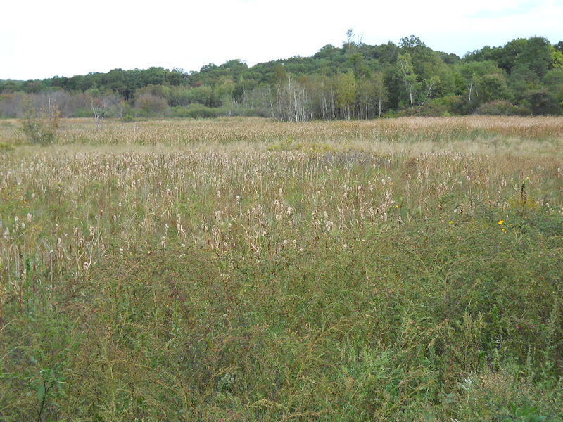 I found myself riding about the same speed as a young couple out on a bike date. I followed them, getting their help in navigating the on-road directions through Arlington. They also told me what to do at the end of the path to find the main road to the Charles River. I had written directions to get through Cambridge, over the Charles and into downtown Boston that I followed without problems. There is a bike path on both sides of the Charles. Here is the view from the south (Boston) side of the river. 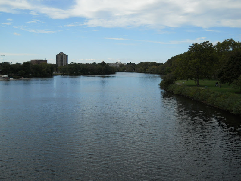 The bike path ranges from nice lane next to the river 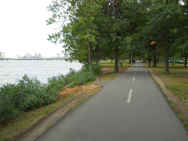 to narrow sidewalk next to the road. It was easy to follow and safe to ride on, though often full of foot and bike traffic. It took much longer than I thought to ride to downtown and I had to ask several times to discover exactly where to leave the bike path and head onto city streets. Once off the path, I had to navigate busy Boston streets that were a bit unnerving but not too scary. Eventually, I found the Hertz rental office and waited in line to get my reserved car. I was given an option of two cars, one a Toyota Prius, which I'd never driven but was not necessarily big enough to handle my bike and all our bags. After considering it for a bit, I figured I could make it work and spent about 30 minutes taking the bike apart and fitting it into the back in the car. Once everything was packed, I hoped in the car wearing my bike gear and drove off to the airport, where I waited in the cellphone lot for my wife's plane to arrive. The transition from bike tour to family vacation was somewhat abrupt, though, I did have about 30 minutes in the car at the cellphone lot to begin it. While the pressure of packing and driving through the unfamiliar streets of a major city wasn't the best way to end a long bike tour, in my experience, the ending of a bike tour is rarely anything more exciting than getting off the bike one last time and being glad to have made it one piece. My time on the East Coast didn't end there. My wife spent a week in Burlington, MA leaf peeping, sightseeing, hiking, driving to Montreal, and spending time with friends. It was a great way to decompress from a long bike tour. |
||||
|
|
||||