|
|
||||
| Date | Starting Place | Ending Place | Author | Last Update |
|
|
||||
| 04-19-11 |
Newport, Monmouthshire, Wales |
Abergavenny, Monmouthshire, Wales |
ray | 01-19-12 13:01:53 |
|
|
||||
|
My original plan was to continue my tour from wherever the supported ride ended up. But, when I discovered that the UK had two 4-day weekends in a row, the first for Good Friday/Easter Monday and the second for the Royal Wedding Friday/May Day Monday, I wanted to get up to Scotland as soon as I could to avoid all the problems associated with so many holidays in a short time. As a result, I decided to skip the couple of days necessary to ride from Bude to Wales and, instead, take a train from Reading to Newport, Wales and start north from there. I already had a ticket and a bike reservation for the 9:41 train. The transportation system is one of the best things about bike touring in the UK. If the time is short, weather bad, or terrain boring, it can be easily handled by taking a train. I did this several times. I was up early and on my way to the station by 8:30. The 3 mile ride through Reading's early morning traffic was as easy as riding through the park  and then pedaling past the swans on the bike path along the river. 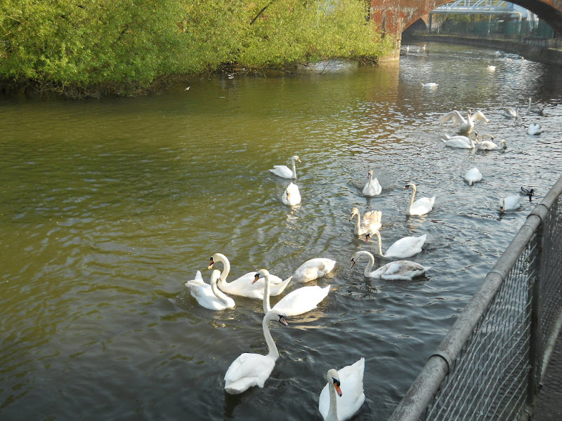 I got to the station in plenty of time and sat waiting for my train to arrive. I wouldn't have much time to get my bike, gear and me on the train before it left, so I was psyched up to move quickly. When it did arrive, right on time, I found the bike compartment, a small room in the car just behind the engine, got my bike in there, got it strapped in, and then quickly got on the train. I was the last one to board! I was carrying an iPad on this trip and I spent the entire train trip playing Civilization Revolution, something I'd do alot of on this ride. The train trip was uneventful except at the very end. The train didn't stop at Newport for more than a few minutes. I was quickly off the train and put my panniers on the platform while I went into the bike compartment to retrieve my bike. The door slammed shut behind me. I quickly got the bike and was ready to exit the train when I realized that there was no way to open the door from the inside. I had a moment of panic as I had visions of the train continuing on with me stuck inside the bike compartment. I banged on the door but no one heard me. Then, I noticed the window was down so I reached through it and opened the door from the outside. The conductor was waving the train on as I left the compartment relieved but with a big smile on my face. I rode the short way into Newport's pedestrianized downtown and looked around a bit. I saw this interesting sculpture group, though saw no sign as to what it was.  I found a Subway shop, got some sandwiches for the day, bought some water, and other provisions, and rode out of the town. While I knew there was a bike path out of Newport, I had no idea how to find it. I knew I wanted to ride along the river but didn't have a map of exactly where. At home, it seemed so clear. But, once there, it wasn't so obvious! In the UK, there is an extensive National Cycling Network (NCN) where every route is numbered but not identified any other way. Without knowing a route number, it is a bit of a crapshoot. I headed toward the river, which we'd crossed on the train, and discovered a ruined castle.  Newport had a number of separate paths for people and cyclists to cross the busy highways in town. One was this subway with an interesting mosaic. Note that this is right next to the castle, which can be seen in the upper part of the photo.  Near the river is a maze of roads and pedestrian overpasses that were confusing to traverse. I eventually located a sign for NCN 49 which appeared to be going upstream and took it. This route was a paved path right next to a no longer used canal.  As you can see, the canal is little more than a stagnant pool and is lined with houses. According to information signs I read, this canal, known as the Monmouthshire Canal, was a major economic force in the development of Wales and Newport. I ride along it and then the Brecon canal to get up to Abergavenny (pronounced Aber-ga-venny), my destination for the day. The path went through residential areas for quite awhile, though the path itself was lined with the canal, grass and trees. The riding surface went from smooth to rough and was made a bit challenging by very short but very steep bits near the locks.  In fact, the part I rode was known as the 14 locks and it seemed like I struggled up each one of them! Also, the path was well used by locals for walking and riding, which was nice to see. The route ended at Cwmbran. The only sign I saw directed me up a steep embankment and then nothing. I looked around, chose a direction, rode for awhile, turned around, and then went the other way. Eventually, I asked a local and was directed to the path, which was a bit further up the street. While this route supposedly followed a canal, as well, it mostly went through trees and had few users.  The first route seemed flat with all the up coming in short, steep spurts. This path had a noticeable upgrade the entire way. I had to navigate through Pontypool on pedestrian over and underpasses where I again saw a series of attractive mosaics showing historic scenes.   After Pontypool, the route moved away from civilization into the trees and the grade kinked up significantly. 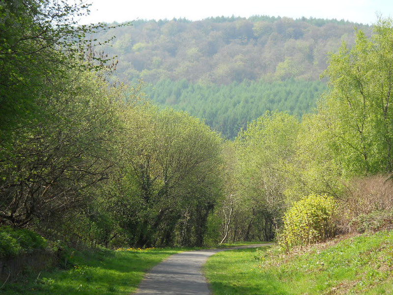 For the next several miles, I had panoramic views of green and brown hills.  There weren't always expansive views. Sometimes, I was riding through a narrow rock canyon  with trees growing on its sides.  The wide open views reminded me that I'd been climbing all day and was no longer anywhere near the coast.  I met a cyclist as I approached Blaenaven who told me that the bike path was closed ahead and how to navigate through the work site. Instead of continuing on the route, I rode into town, ate some food, rested a bit, and tried to figure out what road to take. I asked a man who was working inside the building I was leaning against and, after consulting my map, he pointed to one of the roads and said it was steep but he thought it was the right one. I wasn't done resting and, after a few minutes, the man came out and ushered me back into his office to see something on Google Maps that was the intersection where I'd have to turn off to get to Abergavenny. It was nice of him to take the time and I thanked him for his help. The road I had to take was a busy one full of traffic and going uphill. After about half a mile, it kinked up seriously and I had to grind a bit in my lowest gear, though by this time the traffic had lessened but sped up. The higher I climbed, the more desolate it became.  Eventually, I found the intersection where I needed to turn. There seemed to be no sign of humans anywhere.  But, there were lots of sheep.  Once I got to turn, the climbing moderated and, while it was windy, it wasn't too difficult. At the crest of the hill, there was a parking area, a hiking trail to the very top, and an information sign. I rode over and checked out the sign.  As far as I could make out, this was the final resting place of Foxhunter, a horse who had won a gold medal in jumping at the 1952 Olympics. His rider (who is the one who actually got the gold medal) got to choose where he was buried and this is where he chose. It was a moving tribute, for sure. While it was very windy, the views from there were stunning.  The descent was a bit treacherous as it was on a steep road full of debris and potholes.  I carefully threaded my way down shaking like I was holding onto a pneumatic hammer. My forearms, teeth, and eyes were jarred all at once. It was an odd sensation. By the time I was at the bottom, I was on the outskirts of Abergavenny, which which is bounded by the River Gavenny on one side. 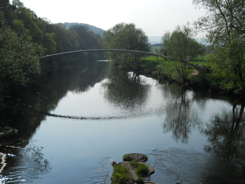 It was a warm afternoon and there were lots of people resting on the river bank and splashing in the water. I followed the path around a large field to a road that went into town. Where the path met the road I saw the ruins of Abergavenny Castle.  When I got to Abergavenny's main street, I was hungry so I decided to eat something. I checked out two Chinese take-away places looking for broccoli but neither offered any. Instead, I decided on a tofu and veggie dish that I ate sitting on a couch in the waiting area. I called Ruth, my host in Abergavenny and got directions to her place, less than a mile from downtown. I met Ruth and her husband Harry and we spend about an hour sitting in the sun in their backyard talking.  Harry was an inveterate optimist and a committed environmentalist. It was very enjoyable. Jo, their daughter, had made a stir-fry which we and Jo's friend, Anne, shared. Anne was very funny and we spent much of the meal laughing. It was very homey and pleasant. After dinner was a rhubarb pudding and more conversation. We moved to living room where Harry and Ruth helped me plan the next day's route over the Brecon Beacons. After talking with my wife on their computer, we all went to bed. |
||||
|
|
||||