|
|
||||
| Date | Starting Place | Ending Place | Author | Last Update |
|
|
||||
| 04-28-11 |
Balmaclellan, Kirkcudbrightshire, Scotland |
Troon, Ayrshire, Scotland |
ray | 07-20-11 21:24:52 |
|
|
||||
I was up and out of bed about 8am but there was nary a sound from the rest of the house. To pass the time, I wrote up the previous day's diary entry and took a photo of the living room. An alarm went off about 9 but still no movement. I decided to pack up so that I'd be ready to go when they were put of bed. My rush was that it looked like I had a long ride ahead of me today, over 70 miles if I wanted to get to Ayr and I wanted to get a move on. When they emerged, about 9:30, I quickly said my good byes and left. Before, leaving, I got this photo. Sal is on the left.  I'd only eaten a banana that I brought with me, so I stopped at the Balmaclellan store, just down the hill from Sal's place, and got 2 fresh baked scones (which were very good!), an apple, and 2 snickers bars. Here is downtown Balmaclellan. The store is visible at the end of the road.  Southwestern Scotland is no heavily populated. Balmaclellan is on the eastern edge of a Galloway Forest Park, a large area with no towns, at all. The closest village to Balmaclellan is New Galloway, about 2 miles away. I headed there to get some breakfast. Here is the view just outside of Balmaclellan.  Note that it is a beautiful sunny day and the riding was extraordinary, given I was in Scotland. To get to New Galloway, I had to cross the placid but picturesque River Ken.  New Galloway wasn't what I'd hoped. There weren't any cafes and the two hotels still open didn't appear to have restaurants. The only thing open was a tea room.  I went in, ordered coffee and asked what I could get to eat. The cook said she could make me a cheese sandwich and did. I drank the coffee out of china cups with saucers! The sandwich had tomatoes and onions in it and can with a watercress salad and was both good and filling. I felt that I should keep my pinkie finger in the air while I was drinking my coffee!  I asked all the people there about the road through the Galloway Forest Park and they said it was a narrow, busy road and that I'd do better to take the one north from New Galloway. Ayr was 33 miles along that road. That sealed it for me as it meant I could might get all the way to Ardrossen, if I took a more direct, and safer, route to Ayr. After eating a relaxed meal, I rode through town and wound my way along a deserted, tree-lined raod. At first, I rode past a forest of young trees.  Then, it was back to the usual rolling countryside.  I liked these trees' gnarly roots.  I again crossed the River Ken. It is hard for me not to take such a pretty photo!  Where I rejoined teh A713, I passed the Earlstoun Dam, the first one I've ever seen in the UK.  Here is one of the streams feeding the reservoir and an attractive stone bridge.  I rode along the western edge of the water under the watchful eye of the local sheep. 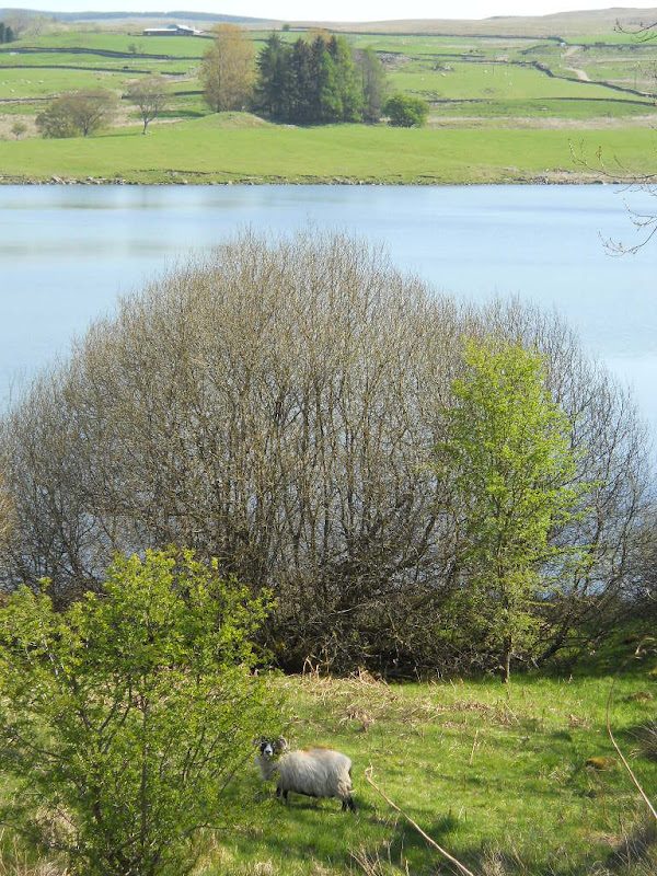 The road was a bit busier than the previous day's ride but I still spent most of the time riding without cars. I rolled up and down and was thoroughly enjoying life and the experience of gliding through space, no doubt helped by the tea room's 2+ cups of coffee! The views of green fields and rolling hills remained similar mile after mile. When a river was added, I usually took a photo.   I never expected to see snakes in Scotland, so I stopped when I past one on the side of the road.  I didn't notice any injuries, but it didn't move as I stood next to it and took a photo. Frankly, I thought it was dead but I don't like jabbing animals just to see them move, so I left it alone and went on my way. By now, I had gotten accustomed to seeing tracts of trees surrounded by barren land.  Now, I began seeing the evidence of the clear-cutting that created this landscape.  Incidentally, the trees are part of the Galloway Forest Park and the warning about logging trucks now becomes clear. I would later find out, after a lot of asking, that this how the UK manages it forests. I also began to understand why all the hilltops are barren; they've been logged out. This body of water is Loch Doon, I believe.  A little south of Dalmellington, the road swerved down into the Doon Valley.  The road meandered along a stream and through a narrow valley.  It was another one of those pretty places that only bike tourists experience fully.  Things changed when I hit the town of Dalmellington, about 20 miles from Balmaclellan. Suddenly, there were trucks on the road and the traffic got heavier. It wasn't so bad that I was scared, but it made the riding much less pleasant. While the traffic got worse, the terrain remained the same.  In addition, a headwind started. I remember thinking that this was the first time weather has impeded me much. North of Dalmellington, the road followed the River Doon.  Scotland's road aren't in the best repair. I got so tired of dodging potholes, that I decided to take a photo of the road surface.  There was no obvious alternate route so I kept pedaling on the busy "A" road, keeping on eye on my rear view mirror and the other scanning the road for holes. The traffic wasn't so bad that I couldn't handle it and taking a smaller road and adding another 10 miles to the route seemed too high a price for a bit more safety. I'd go through this mental dance every time I hit another turn off opportunity. A few miles south of Ayr, I rode up a rise and saw this pretty view below the road. 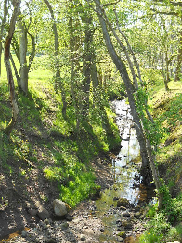 I particularly liked that the car and truck drivers couldn't see it! I'd been told that just before Ayr I'd be able to see the Arran Island, the one I'd ride the ferry to, off the coast. It was hazy and this photo maybe shows the island in the far distance.  In the end, I followed the A713 all the way into Ayr's town center. I wanted to find the Tourist Information center to check on accommodations but there were no signs for it, which I found unusual. The first person I stopped to ask had a strong Scots accent and stuttered. I got maybe 5% of what he said, most of it from hand gestures. I rode toward where he pointed and ended up at the seashore, which is the usual English seaside ugliness of amusement rides and casinos, though people seemed to be enjoying the sun. 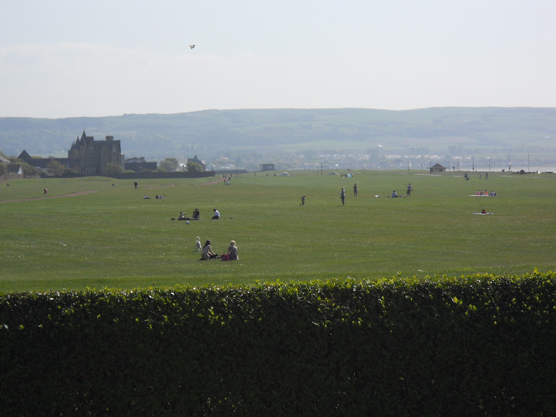 I, again, asked for TI directions and was told to go to "Sangie." When I asked for a spelling, it turned out the woman was saying Sandgate. I started wondering if speaking English was going to be a problem in Scotland. I followed her directions and saw a sign for Tourist Information. I spent another 10 minutes standing across the street from it without finding it. I had to ask yet another person where it was and she pointed me across the street. Why bother having a Tourist Information office if no one can find it? The woman at the TI was helpful, giving me a brochure of bike routes and storing my bike while I grabbed a Chinese lunch across the street. She wasn't surprised at my difficulty with finding the office. It wasn't unusual, apparently. Lunch was, by far, the worst Chinese food I've ever had. When I asked for broccoli, I was told "the English don't like broccoli.". When I got my meal, it tasted like red bell peppers in catsup. Not something I want to eat a second time. The food was so bad that I promised myself not to eat Chinese meals unless broccoli was actually listed on the menu. The woman at the TI suggested that Troon, about 6 miles north, was the best place without a reservation. Ayr is right on the water and the bike route out of town went ride next to it. 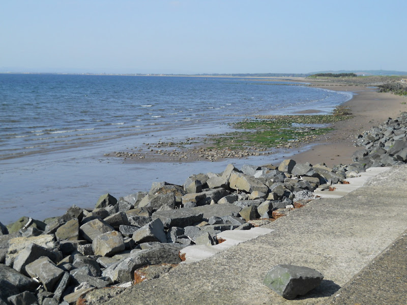 While the bike route was well signed, it was hard following them because they are placed on poles next to the road at a height that a bicycle rider doesn't normally scan when riding. As result, I got lost a couple times. By this time I was done with Ayr and simply wanted to get out of the city. The path meandered through residential streets and by the airport and then finally got on a separate bit of Tarmac.  I got to Troon after riding along side "golf" courses that were more like sheep fields than what I would call a golf course. They were all flat (they are right next to the coast, after all) and looked completely uninteresting to play. Consider this treeless par 3. To me, it looks more like a farm field than a fairway!  At Troon, I found a B&B for 25 pounds. While telling me how to get to his place, the proprietor told me to go to the train station. I'd passed several on my way to Troon and asked him "The Troon Station?" and he responded, "Yes, the train station." We both had a laugh when I asked him "The Troon Train station?" to which he replied "Aye, the Troon station in Troon." It was a very nice room with fluffy towels and well-appointed shower about 3 blocks from Troon's main street. I walked over to get supplies for tomorrow as I plan to get up and out early to ride to Ardrossen (20 miles north) and get the 12:30 ferry to Arran. I walked back to the B&B, cooked dinner on an outside table, talked with my wife via Skype, and went to bed. |
||||
|
|
||||