|
|
||||
| Date | Starting Place | Ending Place | Author | Last Update |
|
|
||||
| 05-11-11 |
Great Ayton, North Yorkshire, England |
Scarborough, North Yorkshire, England |
ray | 09-11-11 11:57:13 |
|
|
||||
|
John and I both spent some time on the internet and phone getting our train tickets for the next day in order before leaving about 9:30. He is going home to Cambridge, I am going on to York and the Peak District. Our plan is to ride to Scarborough today so are trains are going from there. Today, it was overcast but with openings for some sun. Great Ayton is right on the western edge of the Yorkshire Moors. It was green all around and I got my first water photo right off the bat. 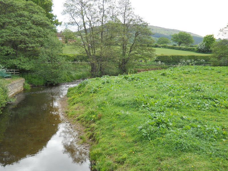 The route started off flat and then there was a little up and down. However, I could see steep hills all around and knew that there soon would be climbing. 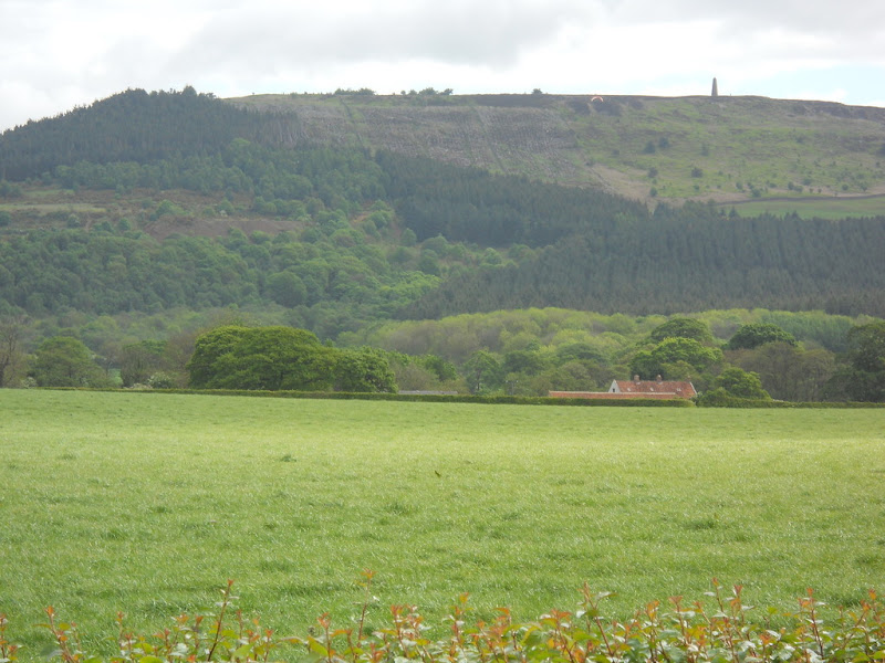 The serious uphill started after a few miles, just past Kildale, where I really liked the tree behind the town's sign.  The undulations became more pronounced and then I saw these signs, which could sum up the whole day, really.  Luckily, I didn't have to ride this road. Instead, my attention was taken by the road I was on,  which had its own 20% grade to deal with.  The rain started just as I clicked down into my granny gear. While this climb was tough, the hardest thing was trying to get my raincoat out of the pannier while on a steep slope, put it on, and then close the bag all while trying to hold up the bike on a 20% grade! After that climb, we meandered along on a paved road for a while and then the cycle route we were following took us up and done on dirt.  I heard some water flowing and discovered this brook coming out of the side of the hill.  At the end of the dirt, we, again, got an expansive view of the countryside.  John got, yet another, flat tire, though this time it only required one tube to fix. While I waited, I walked along the road and got this stream photo. 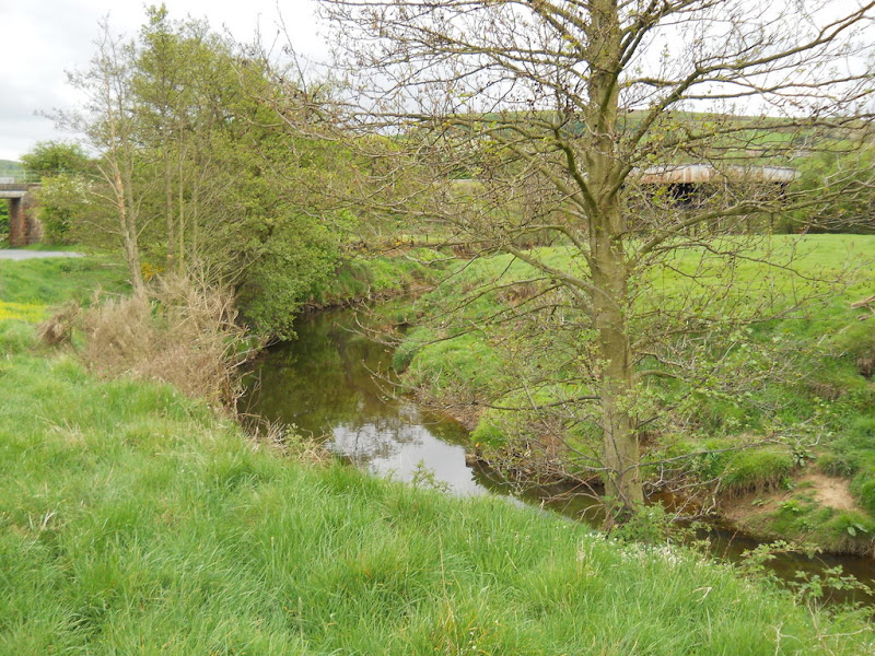 The bike route followed the rail line, more or less. There was something about this bridge and the hills beyond that seemed right for a photo. 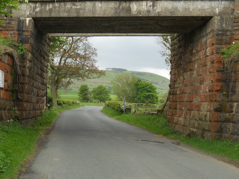 The route was hard up and down with very little flat in between. It was one of those days where I spend most of the time in my lowest gears, either grinding up a slope or coasting down the other side. When the route passed a town or village, which always seemed to be in a valley, it would head hard down, a quick run through the town, and then hard up on the other side. The biggest town we passed in the mid-Moors was Castleton. John was ahead of me and I didn't see him at the turn identified by the route sign. I followed the sign and waited for him at the top of a short steep hill I didn't want to descend. After 10 minutes, I contacted John via phone calls and texts but still got no answer. After about 15 minutes or longer, I decided to send him a text message and to start riding. I got an answer as I got underway that John had missed a turn, was ahead of me, though he though he was behind me, and to stop in the next town. As it turned out, he couldn't make an international call from his cell phone and had stopped to get it right with the phone company when I rode up We continued on past very pretty countryside 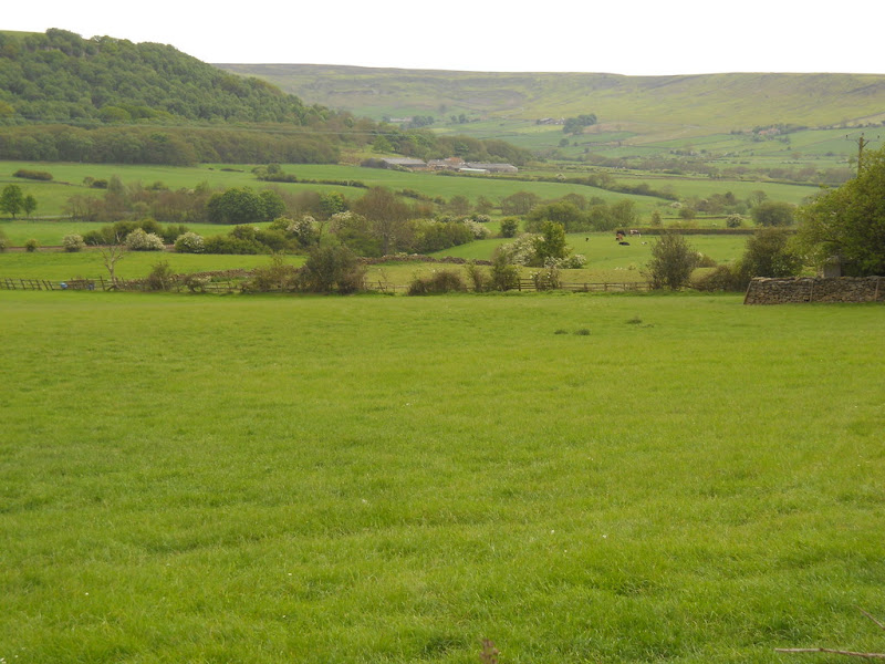 and past the River Noe, that runs through this part of the Moors.  We took a wrong turn out of Danby and got off the NCN route. Instead of backtracking, we kept on a parallel track that turned out to be very hilly. Just past Glaisdale, we crossed the Noe again. It was a pretty river.  Just outside of Glaisdale, we hit this short, impossible slope. It was a 33% grade.  John actually got up this. I stopped halfway to rest and couldn't get restarted and had to walk. We both agreed that getting back on the NCN route would be a good idea. We continued east through wildflowers, broad vistas  and the occasional tree-lined lane. 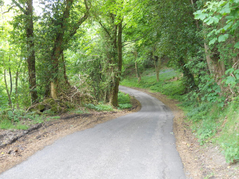 We stopped to make lunch sandwiches at Egton. I took lots of vista photos this day, like this one, 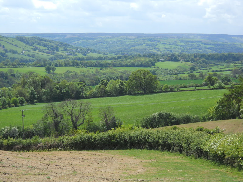 but none of them could capture the scene. We were riding above the River Esk and the way down, on the bike path, was on rocky dirt roads that required complete concentration on the patch of ground in front of my wheel. It was a bit like bike skiing than riding.  At the bottom, we rode along the placid Usk River for a while. We were both feeling all the climbing by the time we reached the outskirts of Whitby, on the coast. There was another 20% climb that I couldn't quite get up around a hairpin turn. Yet, 20% seemed like small potatoes when 33% has been encountered! After a sharp left turn, we were riding south instead of east and the coast was in sight. We were headed down to Robin Hood Bay, a tourist destination with nothing to do with Robin Hood. It was a beautiful spot.  Forgive the gravestones, but this was the best viewing spot I saw. I'd had a hankering for an ice cream since Egton and as we coasted into the village of Robin Hood Bay, we finally found a place to get one. We sat for about 30 minutes eating and planning the last 15 miles of the trip. Here is the view we had while eating our cones. 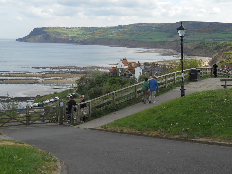 It was clear that the climbing for the day wasn't done. Scarborough is at the southern edge of the North York Moors National Park. We knew we had to ride all the way across to and then over the headland on the other side. It was clear from the map that our route across the bay called for lots of dirt, that neither John nor I were looking forward to. We climbed out of Robin Hood Bay and found the dirt track less than a mile from the village.  The path steadily climbed. At first, we were in trees and too low to see anything. But, eventually, we got up high enough where the vistas were stunning.  The path was clearly used by cars and contained rock and had big, rim bending potholes. We pushed along weaving back and forth trying to find a smooth line. I was not always successful. We rode all the way across the land side of the bay to the headland on the other side using this track. The views from the headland were fabulous.  I was glad to get to the end of the dirt. Instead of continuing on the bike path, we detoured onto the road. We continued up the headland for about a mile through farm fields  before turning and coasting down for several miles through the low point between two headlands and then up and over the other side. 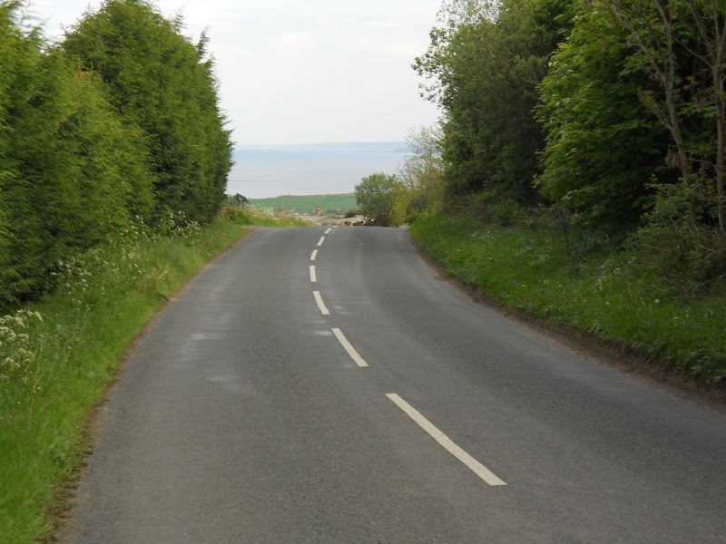 Eventually, we got to the flat bit heading into Scarborough. It started off paved and then went to dirt.  We took this track all the way to Scarborough. This track was sometimes smooth, mostly rocky, and often full of walkers. We followed the trail all the way into Scarborough and rode to the train station and picked up our tickets. We didn't have a reservation here and rode around the city for about an hour looking for a place to stay. The hotels around the train station were too pricey and the ones around the touristy beach area too funky. On our way back into the town from the tourist trap, I got this photo of Scarborough's pretty harbor.  We found a place up the hill from the beach, checked in, and walked to an Indian place where I had some "spicy" Madras Vegetables, which was a bit too hot for me to eat easily. I also had a dry Cauliflower side dish, which was very good. We walked back to the hotel and went to bed. |
||||
|
|
||||