|
|
||||
| Date | Starting Place | Ending Place | Author | Last Update |
|
|
||||
| 08-22-11 |
Bellingham, Washington, United States |
Oak Harbor, Washington, United States |
ray | 09-30-11 19:10:01 |
|
|
||||
|
My plan was to be out by 9:30am. I got up before anyone and had some breakfast. After eating, I started getting everything packed and in order. It took a while for me to get the things I was going to wear out of the bags and the rest arranged in them. I was ready to leave close to 9:30. But, there were more things to do. I had to find and ziptie my mirror to my helmet and set up Track My Tour on my iPhone, which required downloading a new version. After much trouble and waiting, I was finally off after some heartfelt good byes. The rain started just as I left. I made it down the road and stopped at the Subway and then a market for dinner fixings--broccoli, mushroom soup, cheese, and pasta. My stop for the night was a couchsurfing host in Oak Harbor and I had agreed to provide dinner. By the time I left the store, it was raining steadily and I decided to put on my rain gear, including my newly designed and constructed rain shoe covers. I rode through downtown Bellingham  and turned left onto the ACA Pacific Coast route, which also goes through downtown Bellingham. In addition to rain, it was muggy and I swearing profusely. I could feel that my clothes were soaked under the rain gear after about 20 minutes of riding. Bellingham is right on the water and the urban riding through Bellingham and it's outskirts provided views into Bellingham Bay. 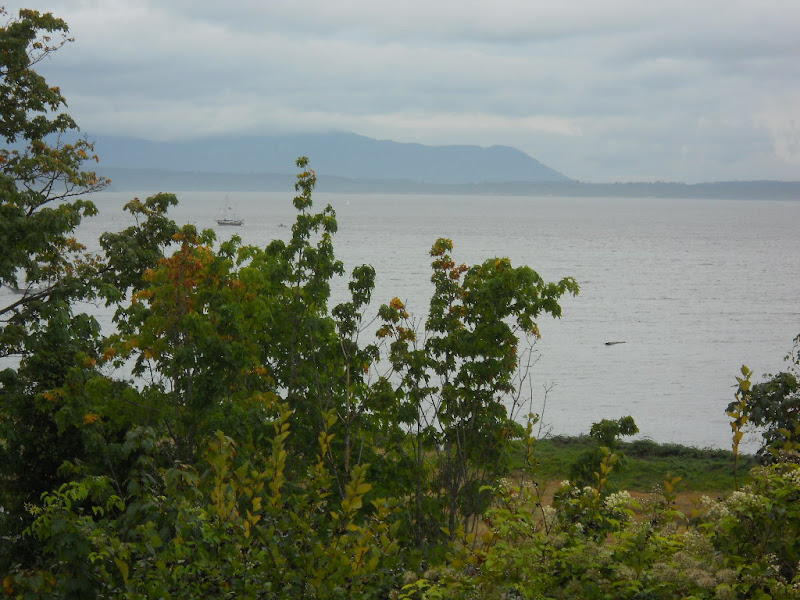 The road through Bellingham was wet but had a bike path.  In Fairhaven, a happening district of Bellingham, I turned onto Chuckanut Dr. This pretty house was at the intersection.  The town ended there and the road slowly climbed into the trees along a narrow, but lightly trafficked road. Even though I only saw a car ever couple minutes, the road had a narrow shoulder that disappeared at times.  As the road climbed into the trees, views of the water became visible, though shrouded in low clouds and rain.  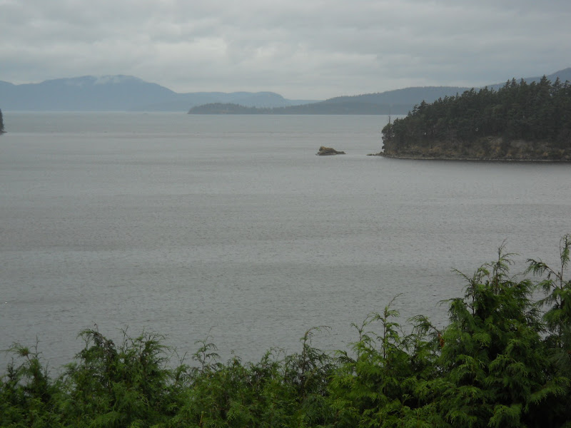 It was a very nice ride through forest with occasional lovely water views. Eventually, the road goes though Larrabie State Park which has cliffs on one side  and views into Puget Sound on the other.  The riding here was up and down in lower gears. Once past Larrabie State Park and out of the hills, the road became flat and went along farm fields.  Here, the headwind and the rain intensified and became unpleasant. I plugged along. But, even in the gloom, I could make out distant hills. Note the angle of the roadside grass showing the headwind.  At Bow, little more than a stop sign and a few houses, I stopped and ate a sandwich. I stood on the walkway that went behind the post office to get out of the wind and rain. There I turned toward Edison and out of the wind a bit, which was a short lived respite. Just past Bow, I passed this field of flowering plants with a ghostly hill in the background.  Edison is surrounded by flat fields and sloughs and near the mouth of the Samish River.  Edison was a tiny town with an attractive looking bakery and a "slough" food store. I didn't stop in but it would be a good food stop for bike tourists. After Edison, the road turned south, back into the wind. Every time I angled my head up to look in my rearview mirror, rain hit me in the face. The miles were wet and into a headwind. I saw some interesting views, but they were so shrouded in clouds and mist that photos weren't any good. I wondered how pretty they might be in the sunshine. The terrain remained flat with lots of meandering waterways emptying into the bay.  I rode along Padilla Bay but took no photos as I was trying to keep my head down and chew up miles against the wind. By now, I was soaked from both rain and sweat. The shoe covers kept the part of my socks out of my shoes dry. My shoes were wet, though not soaked, from sweat. While I was unclear about how well they worked, I was glad to be wearing them. Eventually, I got to Hwy 20, a fast four lane road with a wide shoulder that leads over a bridge to Fidalgo Island. It reminded me of Hwy 101, north of Santa Barbara.  There was a separate bike lane that made crossing the bridge no problem.  I stopped on the other side, just past a casino, to rest, check the map, and to try and get out of the rain for a short while. I was able to stay off a very busy Hwy 20 for a few miles by taking side roads through uninteresting, sometimes industrial, terrain. But, just before rejoining Hwy 20, I got this fabulous photo of Fidalgo Bay.  I really like the bands of color in this photo. Eventually, I had to merge back onto Hwy 20 for the short, well-shouldered run to the junction where Hwy 20 splits to Anacortes and Whidbey Island. The ACA route requires a left turn toward Whidbey Island and Oak Harbor. I managed to cross the two lanes during a brief lull in the fast traffic. Even then it was a bit nerve racking. It was still raining. I stopped at the clump of businesses just past the Hwy 20 junction to again get out of the rain and, while there, decided to take down the other Subway sandwich. After about 20 minutes, I continued on Hwy 20, which heads to Deception Pass. There is steady climbing on a two-lane road where slow trucks drive in the shoulder. Here is the view back toward the Hwy 20 junction with a truck driving in the shoulder. 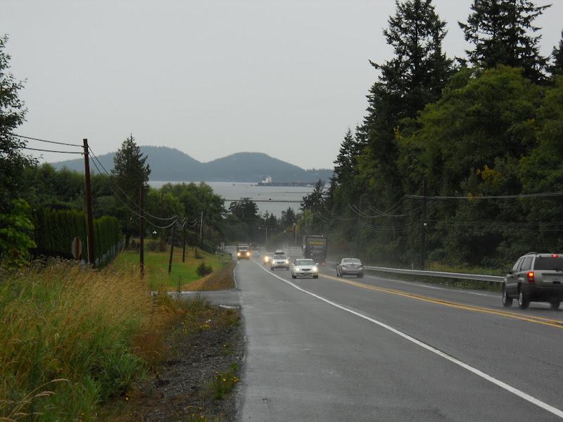 Needless to say, I kept my eye on that truck until it merged back into traffic! At the top of this incline, Hwy 20 makes a left turn, flattens out, loses its shoulder, and goes by picturesque Lake Campbell. 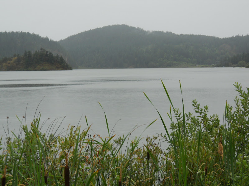 I carefully rode on a tiny shoulder with a stream of cars and trucks passing me by. 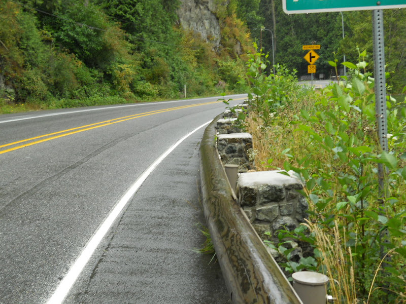 Luckily, the road's curves forces a speed limit decrease, which helped. A mile or so later was Pass Lake.   After Pass Lake, there was more serious climbing up toward Deception Pass. The shoulder was wide but cars and trucks came fast and in long clumps. I got to Deception Pass State Park, only to discover it isn't the top of the incline. The forest was thick and lush.  After a bit more climbing I came out to a view of an arched metal bridge and the end of Fidalgo Island.  The bridge had narrow walkways beside narrow single lanes full of fast traffic. As I came up to the bridge, I only saw a walkway on the opposite side and, at a break in the traffic, I went to the east side. The path was so narrow that I could just walk beside my bike on it. The bridge vibrated every time a car or truck would pass and the bridge was high off the ground. This would not be a good place for someone afraid of heights. There are actually two bridges and they span the narrow channels between Fidalgo and Whidbey Islands.  This is looking at the mountains of the Olympic Peninsula. To see them, you have to look above the trees but below the clouds.  I was a bit scary but the views were stunning. 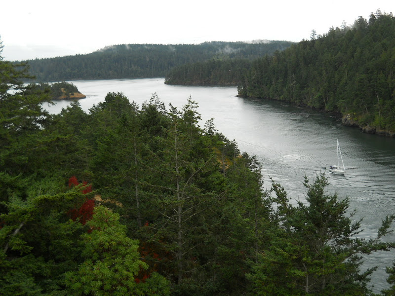 Here is what the traffic on the bridge looked like and the walkway I was on.  I'm sure the view from the other side of the bridge, which did have a walkway, as well, was just as stunning. This was the best I could get.  The rain had finally stopped. The views remained unbelievable. 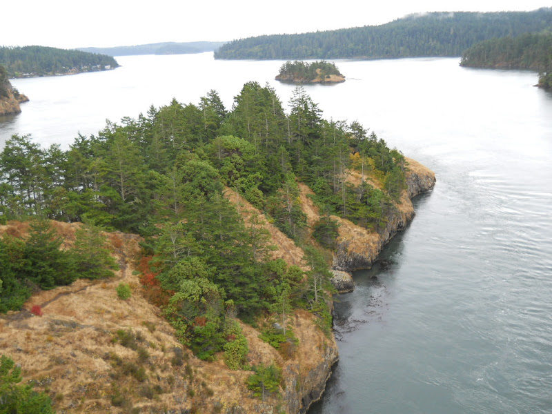 The only way to cross the road at the end of the bridge was on a steep staircase under it and to the other side. This wasn't doable with wet stairs and a loaded touring bike. Instead, I lifted the bike over the railing and checked out the view from the parking lot. 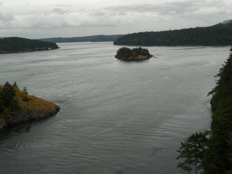 I was quickly out of the park on a quick downhill run, missing my turn-off in the process. I continued on Hwy 20 in a wide shoulder going up and down next to speeding cars.  By this time, I was getting tired. While the rain had stopped, the wind kept blowing. The ride down 20 was uninspiring, noisy, and undulating. The noise was both from vehicles and jets flying out of the Naval Air Station on Whidbey Island. Out front were the obligatory mounted planes. 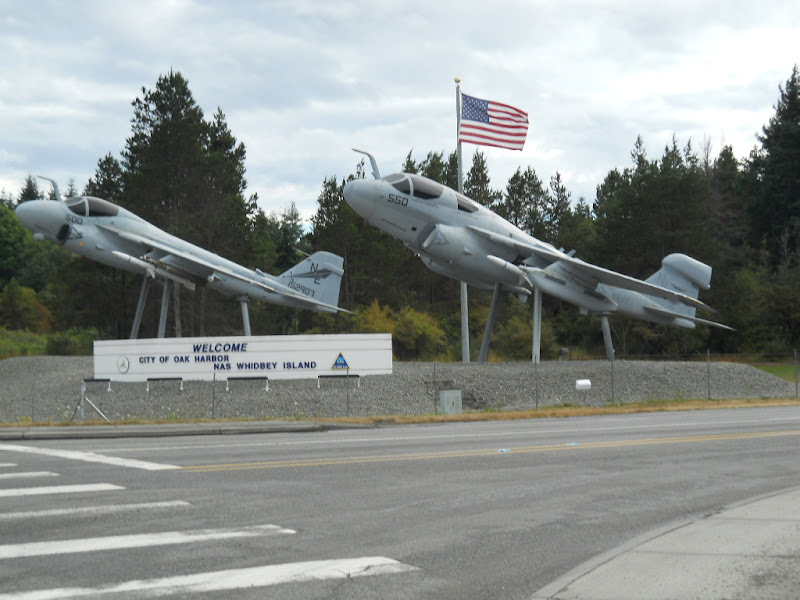 I wondered if these were real planes and, if so, what it costs to mount a war plane on a cement stand just for effect. Eventually, I found Regatta Dr and then ended up at the house next to my hosts' place. After a few minutes of waiting and knocking on the door, I called and discovered they lived next door. My hosts for the night were Sally and Jerry. In our pre-meeting emails, I had agreed to make dinner and had carried all the way from Bellingham. After showering, I made a tasty macaroni and cheese with broccoli that everyone had seconds of. Susan told me about an upcoming ocean cruise that went to Hawaii and Tahiti, along with many other places. It sounded like a fabulous trip. After eating, Susan and I talked about tomorrow's route across the island. Then, I went to bed with lots of drying clothes hanging around my room. |
||||
|
|
||||