|
|
||||
| Date | Starting Place | Ending Place | Author | Last Update |
|
|
||||
| 05-29-08 |
St Geniez-d'Olt, Midi Pyrenees, France |
Le Rozier, Languedoc Roussillion, France |
ray | 02-19-09 19:51:24 |
|
|
||||
|
I got up, showered, and went to the market across the street when it opened. As I was coming back in, the hotel woman came out and started telling me that I had to be out by 8:30. I didn't understand why (but remembered her mentioning 8:30 the night before). I was not packed at all so I went back to the room and did a speed pack and got out. I sat on the square and ate the breakfast foods I bought at the store. It wasn't raining, exactly, but it was foggy and misty. Here is a view of the weather and the hill I would ride toward out of town. 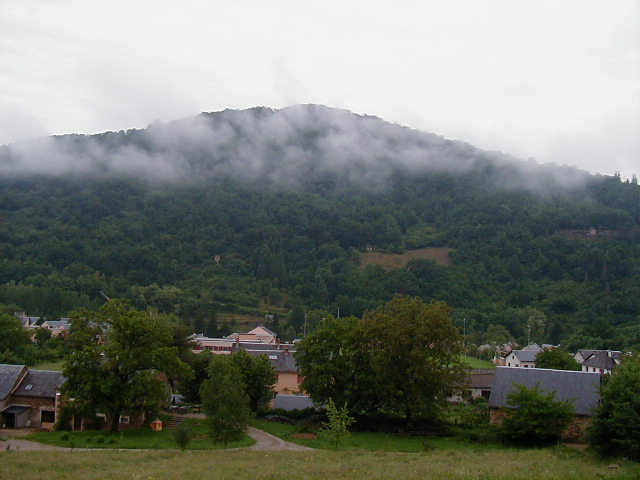 St. Geniez d'Olt is another town in a bowl and it was clear from simply looking around that my route would be up for a while once I left. The road snaked up among trees and pasture land cleared out of the forest. 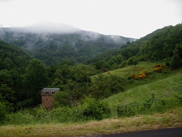 There were also old, mossy stone bridges over rivulets cascading down the sides of the valley. 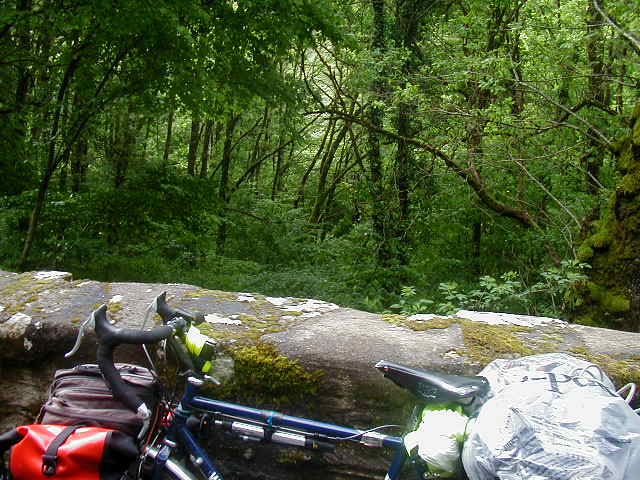 The buildings were few and far between (though there were several recycling areas). This old, sagging house caught my eye. 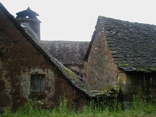 The weather was cool and the uphill not so steep to be a grind. Once I crested the top, I had a leisurely downhill and flat ride across little valleys with beautiful views. 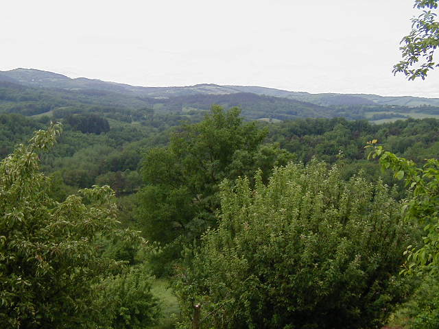 Much of the ride was under leafy trees. When there was a clearing, I saw this bridge in the distance. It stood out much more in person than it does in the photo. I saw it from different angles for several miles. It is a fond memory. 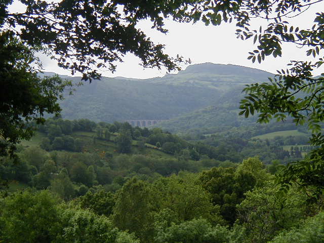 Eventually, I came back to the Lot River. 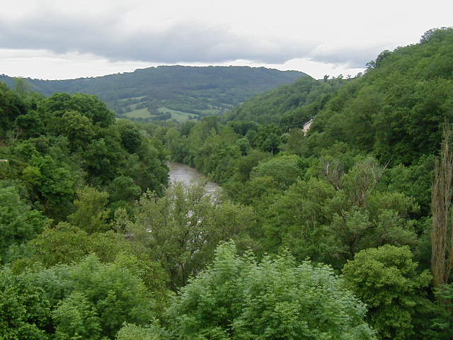 I rode along the Lot until it turned north just outside of Banassac. 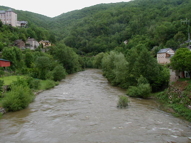 Banassac and La Canourgue are two towns that have grown into one. I stopped at the second one, walked up a street off the main road, sat in a tiny square and had lunch. 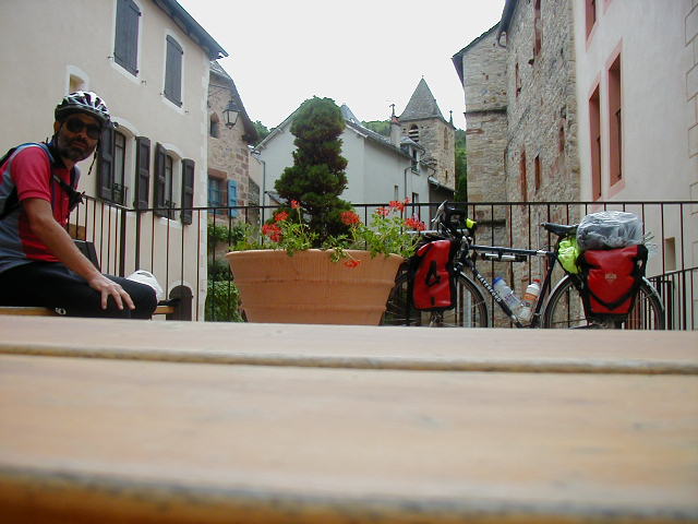 I knew that the next 15 miles would be a climb up to the top of the Tarn river gorge. It was flat, at first, as I was riding in the bottom of a valley. 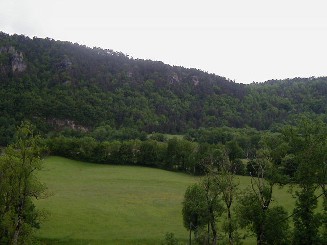 The valley walls were covered in trees with rock outcroppings. 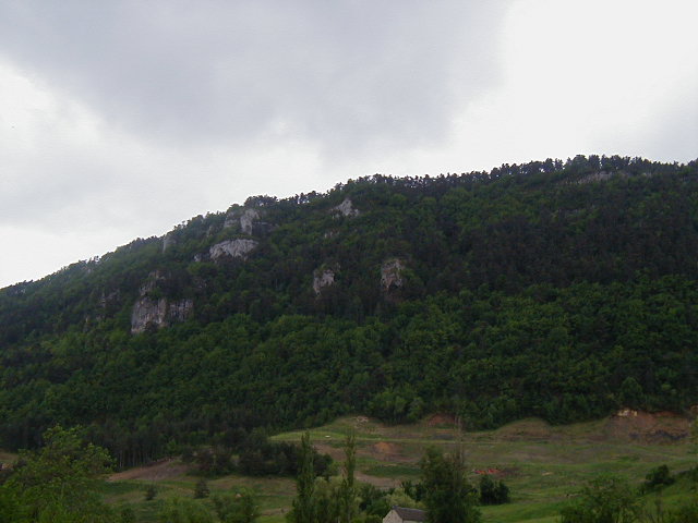 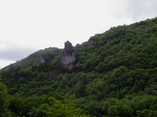 A couple of miles out of town and on the floor of the valley was a golf course. I stopped in to get some water and thought that it would be a pretty place to play 18 holes. 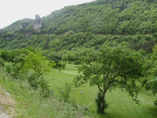 I could see that the road ahead was up. 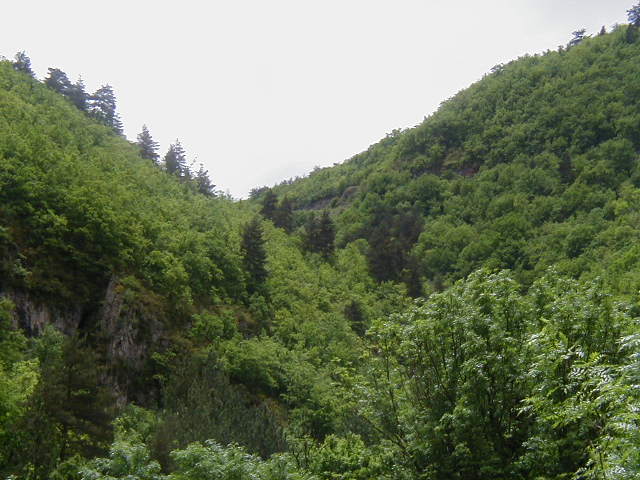 And, it kept going up. 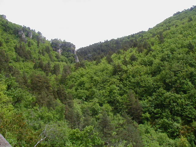 Here is a view down the road I was riding up. There was no shoulder, but there wasn't any traffic, either. 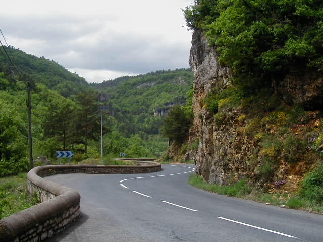 The newly paved road levelled out a bit and I saw these purple flowers and couldn't resist yet another wildflower photo. 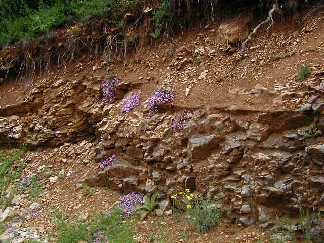 I went around a couple of curves and entered this long valley. 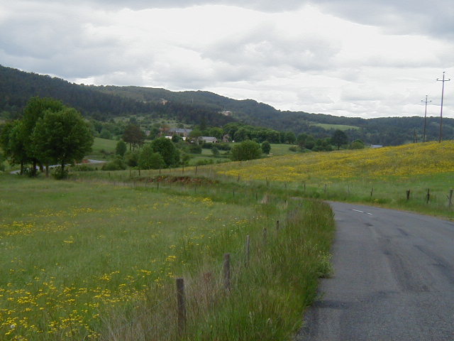 The rolling hills that lined the valley were every several shades of green. This picture only hints at the mosaic. 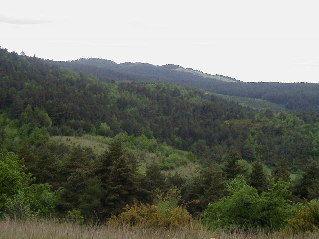 I was still going up but the slope was much less. The views were stunning. 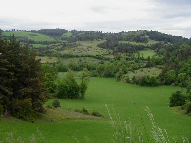 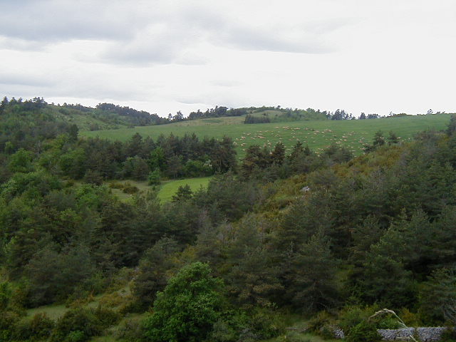 The top of the ride is near the village of Laval-du-Tarn. This is looking toward what would turn out to be the start of the Gorges du Tarn. 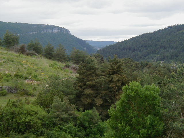 Just over a rise and I was looking almost straight down to the Tarn river. 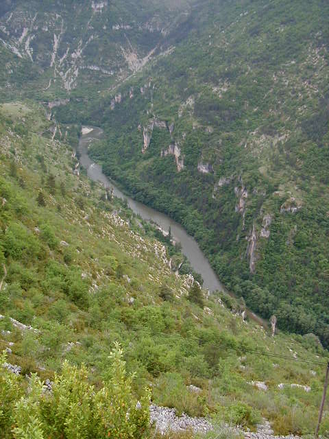 The views from this deserted perch were absolutely stunning. 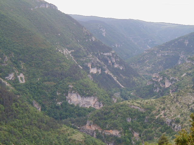  My mood was ecstatic as I stood on the road and looked down at the river and across at the cliffs. The three weeks of effort, the pain and discomfort, the rain, the joy of biking all somehow came together as I stood taking in this scene. The cliff was steep and there only a short stone wall at the end of the road. It felt a bit eerie to be riding along knowing that one lapse in concentration and it would be all over. Here is the view straight down. This is looking over the stone wall and I am standing on the road. 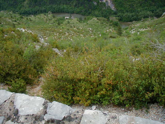 This is the view of the way down to Ste-Enimie, the town at the start of the Gorges du Tarn. You can see a lower section of the road to the middle right of the picture. 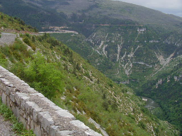 It was hard to keep my eyes on the road with so much wonderful scenery everywhere. 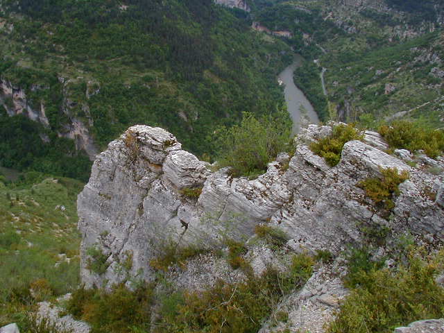 Originally, I thought this was Ste-Enimie. But, it turned out to be another village right on the Tarn, la Malene. 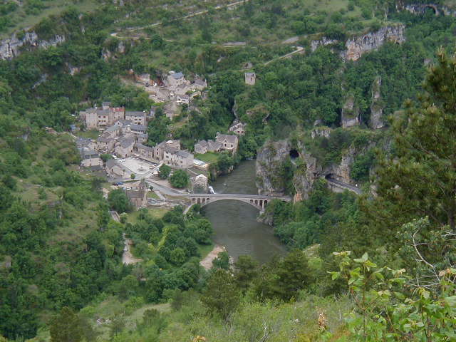 Ste-Enimie is tucked around the corner in a curve of the Tarn. Here it is peeking out. 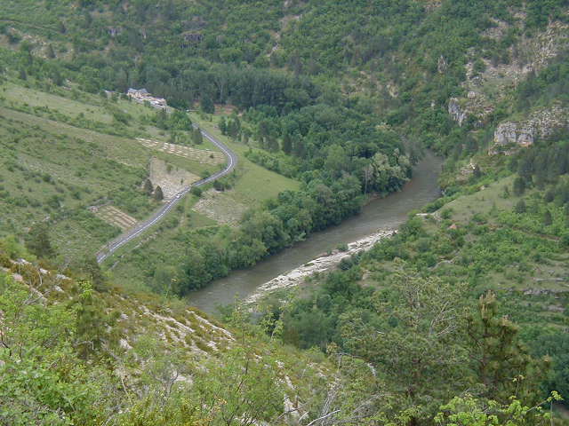 The view looking north. 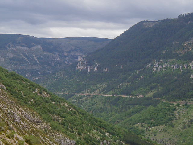 The road down to the river required concentration. 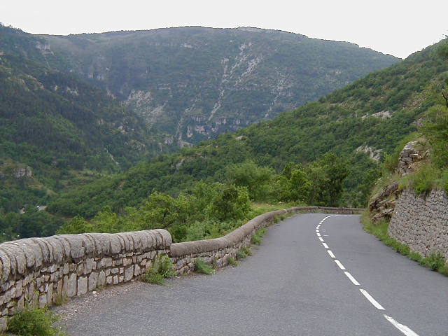 As I snaked down along the cliff, I kept seeing the town of Ste-Enimie from different elevations and angles. 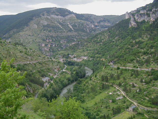 There was another road on the other side of gorge that also went to Ste-Enimie that had some nice outcroppings. 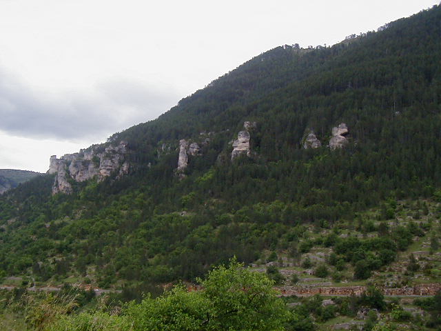 I took these two pictures as I got closer and closer. 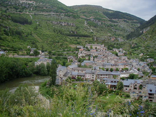 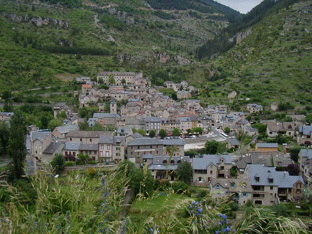 This is a close-up of the main road next to the river and the river, itself. 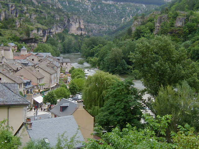 I stopped at the TI and spent about 20 minutes talking with the people there. I was mostly interested in the route I would have to ride the next day which would take me out of this area and over the kinds of elevations I could see all around me. It was now about 3pm. If I had had more time (that extra day I spent in Angouleme, for example), I would have called it a day at Ste-Enimie and enjoyed the pretty village like many other tourists were doing. But, there was plenty of light left and the TI people had assured me that I could find a place to stay at le Rozier, 20 miles away. Also, it was clear that bus loads of tourists plied the road through the gorge and that they were more likely to do this earlier in the day. As a result, after a food break, I decided to ride on through the gorge. It was clear that the Tarn, like all the other rivers I'd seen, was at high water. 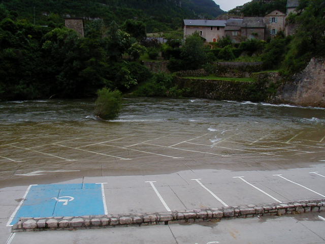 The Tarn makes a 90 degree turn at Ste-Enimie. The road down the gorge stays on this side of the river. But, this is one of the few places where the river can be crossed. 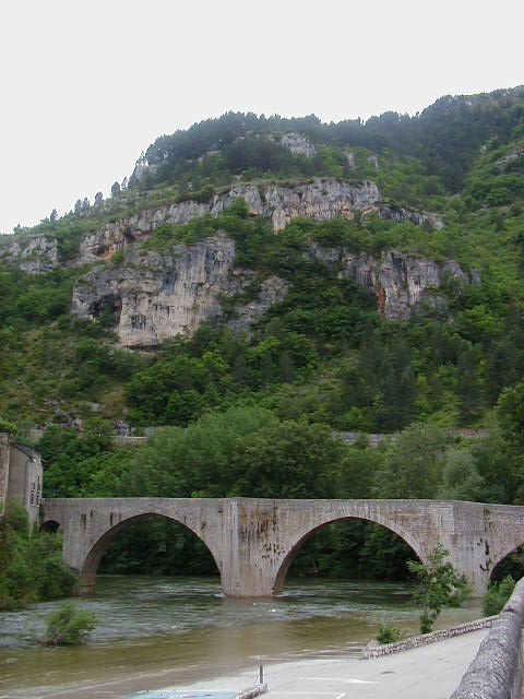 The town continued on the other side and expanded along the cliffs overlooking the river. 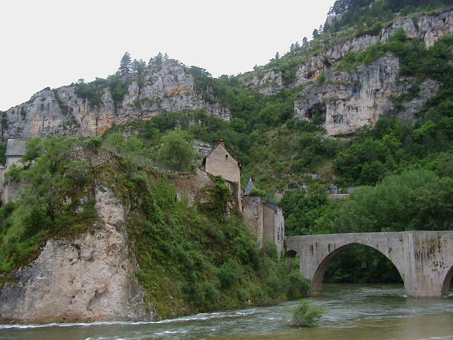 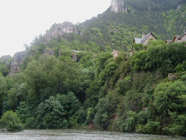 The view up was as amazing as the one I saw from the top.  This is a final look back at the river and Ste-Enimie. 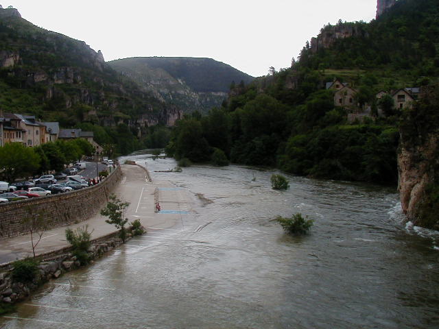 At first, the river meandered along just below the road. I took this picture because of the white flowers in the these trees which had a sweet scent that followed the road for quite a ways. 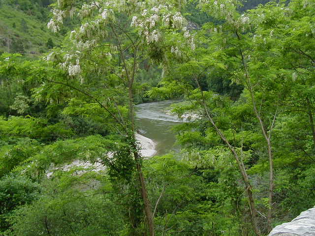 Views along the river. 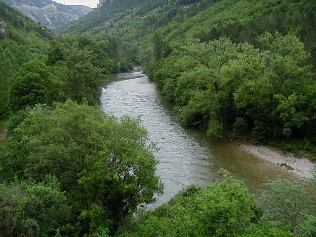 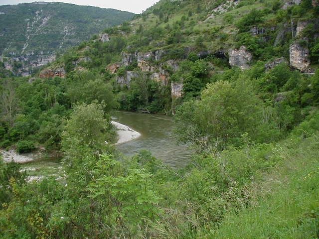 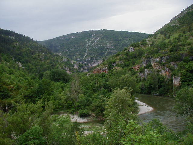 In addition to all this natural beauty, there were my favorite red poppies, too. 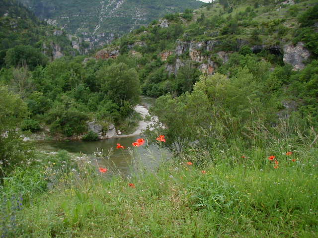 The road weaved through huge exposed rocks and oddly formed outcrops. 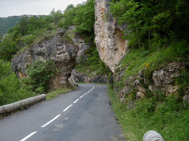 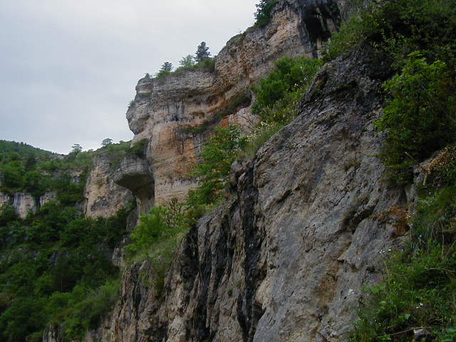 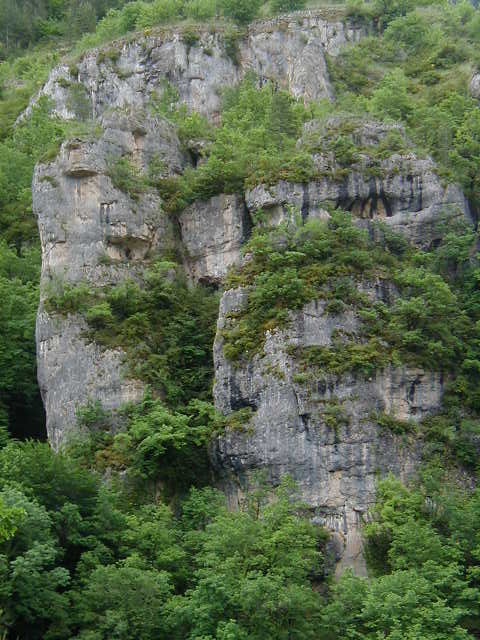 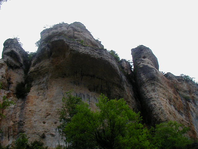 I have taken to describing the Gorges du Tarn as the Grand Canyon combined with Disneyland. It was views like this, of the village of la Malene, that gave me that idea. 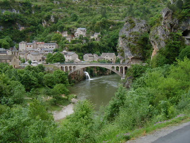 There was no way for the road to skirt some of the rock formations. Instead, it went through them. 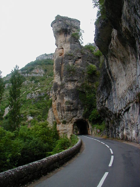 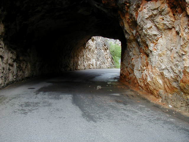 Not all of the villages on the other side of the river had bridges. This one had a cable and a box to get things over the river. 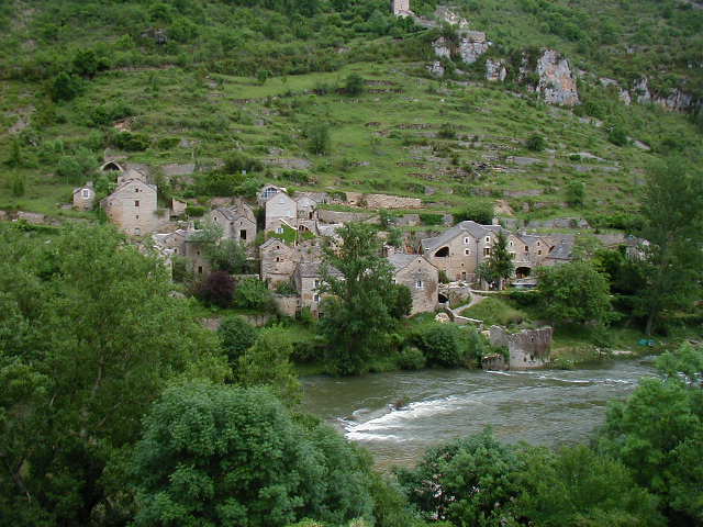 It was hard no to stop and take pictures around every turn in the road. Eventually, I began having an internal conversation asking if I had already taken a photo of a view like this one. If I thought so, I kept riding. One amazing sight was all the trees and vegetation growing on top of the sheer cliffs next to the river. 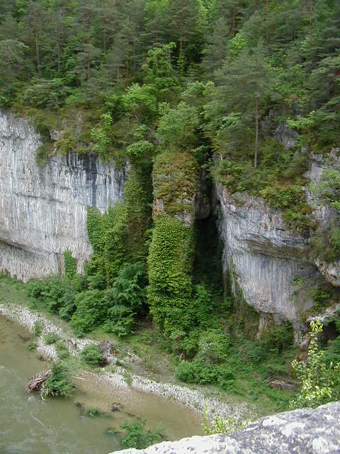 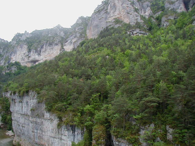 Then, above the trees were more exposed rocks. This was unbelievably pretty. What made it all the more stunning was that I was on the road all by myself. In the 20 miles, I saw about 10 cars. It was just me, my bike, and the Gorges du Tarn. 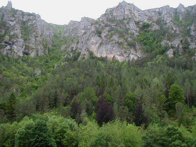 It was the red in the rock that allowed me to take another tunnel picture. 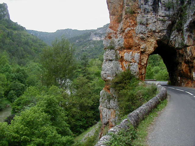 In an area with overhanging rocks, I saw a stopped car and asked them to take a picture of me. 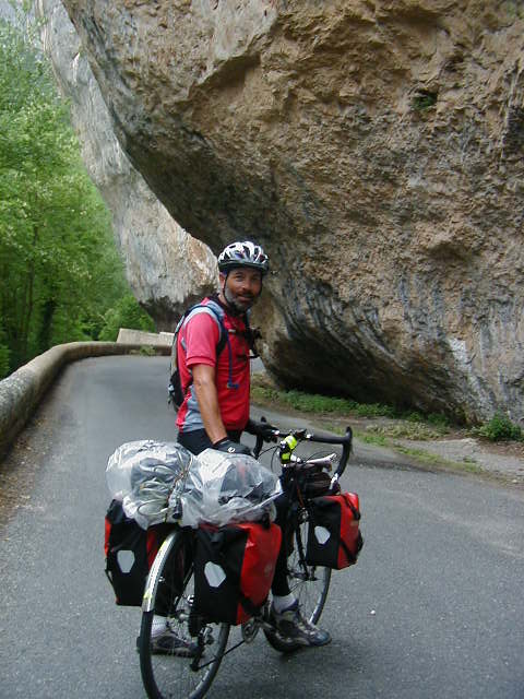 I started noticing more color in the rocks. 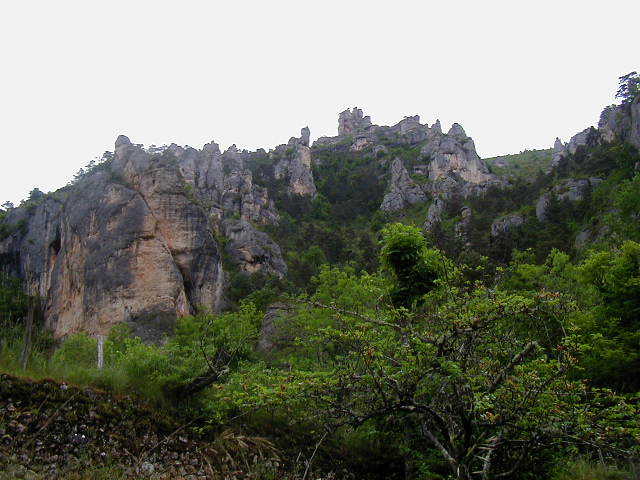 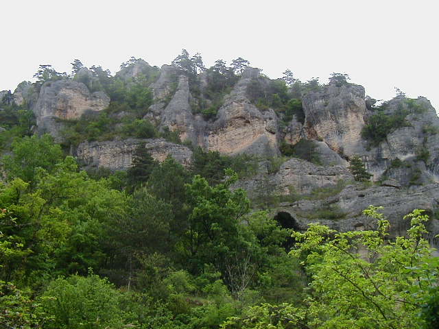 I believe this is called Roc des Hourtous. 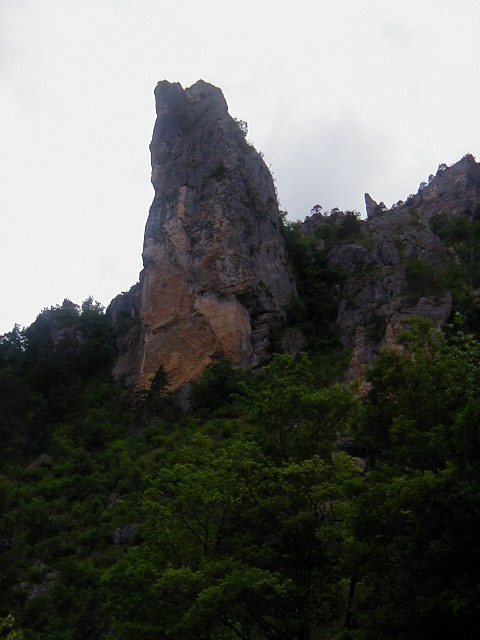 At a place called les Detroits (the Gates), the river narrowed and showed much whitewater. This view is greatly enhanced, in my opinion, by the nice bunch of white flowers in the foreground. 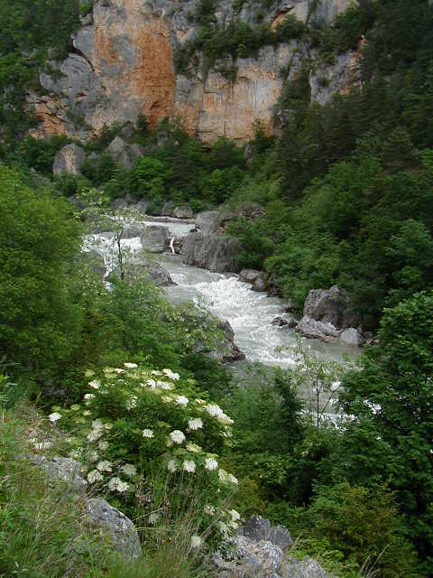 More whitewater. 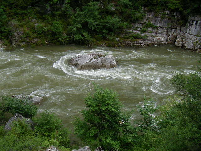 Shortly after this (15 minutes in bike distance), the gorge began to level out and road descended to be closer to it. 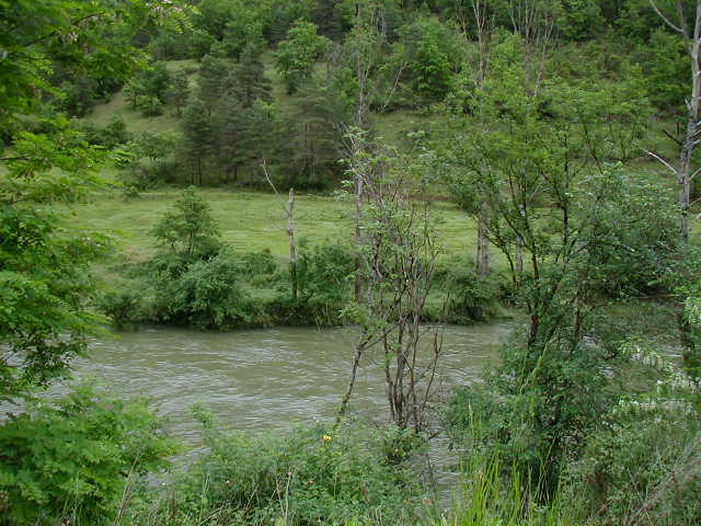 Now, the view up to the top was even more spectacular. 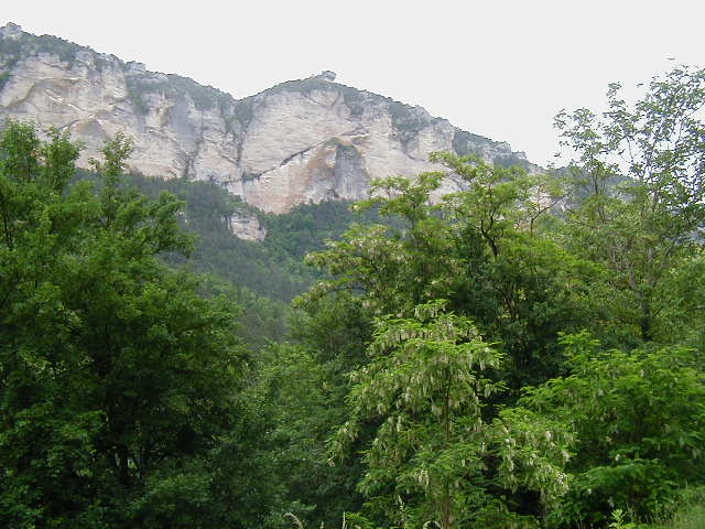 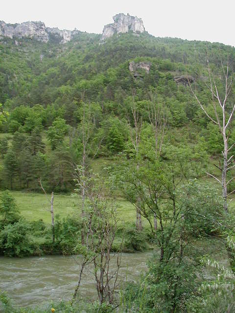 This view was simply unbelievable. There were very large trees growing on tiny ledges on steep cliffs. Not only that, but look at all the shades of green splashed across the hillside. 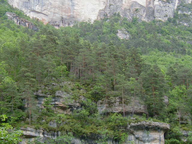 The water was so high in the river that trees growing on the edge were completely inundated. 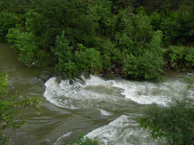 This overgrown enclave was near the end of the day's ride and just too picture perfect to resist. 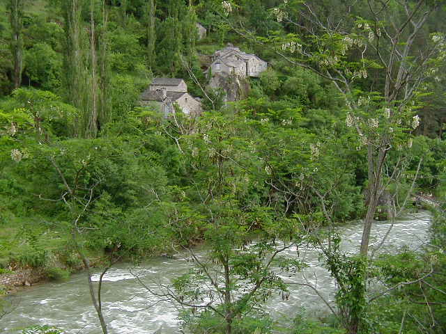 One last outcropping. 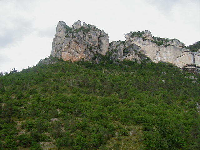 As I crossed the bridge over the Tarn that took me into Le Rozier, I took one final picture of it and said my good-byes. 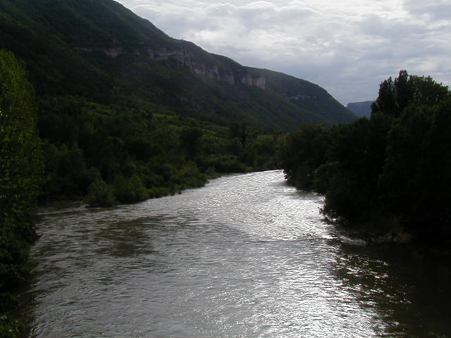 The le Rozier section of the Tarn is not as spectacular as the Ste-Enimie part. As a result, the town of le Rozier was not as well-off or attractive as Ste-Enimie; not even close. First, it was much smaller. Second, several of the town's buildings were shuttered, either permanently or because is was still pre-season. Also, its mix of businesses was geared more to tourists than residents, mostly hotels and bars. I found a room for the night and walked around. The town is split by the Jonte river, whose gorge I would ride the next day. Most of the town's commerce appeared to be on this side of the river and I checked them out as I walked along the town's main street. Here is a view up the Jonte from the main bridge in town. 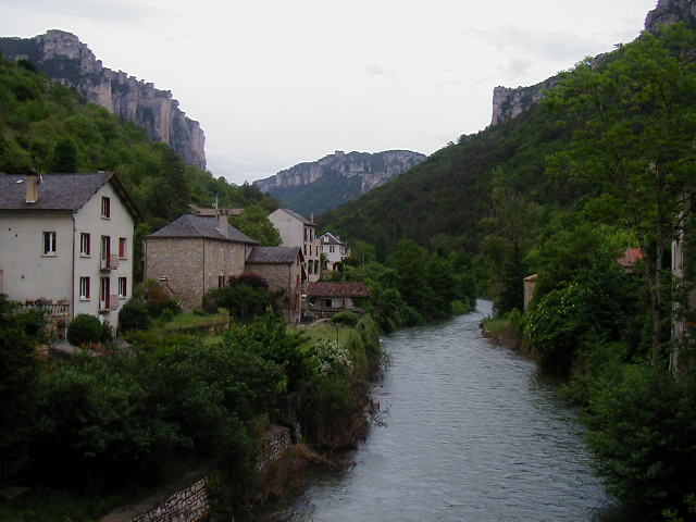 The town had no boulangerie. Instead, a very small store also sold bread that was delivered each morning. I looked through the offerings of this store and decided on a can of string beans, a carton of Leek and Potato soup, and the last bagette the guy had. I walked back to my hotel, showered, and ate dinner. Here is the view out my hotel room window with my cycling clothes drying on the window grille. 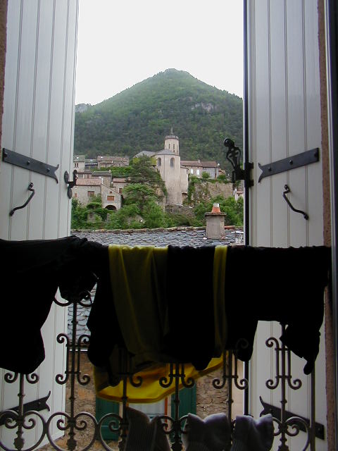 Le Rozier had a municipal campground that was right along the Jonte. I checked it out but decided not to camp as rain had been forecast and the skies looked it. Yet again, it would rain overnight. |
||||
|
|
||||