|
|
||||
| Date | Starting Place | Ending Place | Author | Last Update |
|
|
||||
| 04-23-09 |
Long Beach, California, United States |
Laguna Niguel, California, United States |
ray | 05-04-09 21:18:39 |
|
|
||||
|
Becky left before I woke up and John needed to be out early, so I joined them and was out on the road by 9:30am. I rode the short distance to Highway 1 (PCH). As I waited for the light to change, a motorcycling Policeman pulled up. I asked him how he kept his hands from getting sunburned. He told me that he applied high-SPF lotion ever couple of hours. He added that he also wanted to keep an even tan so he hit the tanning booths every couple of days, as well. I thanked him for this information, as the light changed. I stopped at the original Hof's Hut just before Seal Beach for breakfast. Here's my bike taking a rest while I ate. Note that there aren't any front panniers. I have no camping or cooking equipment and the load is much lighter.  After eating, my next stop was Rick's office in Newport Beach, about 20 miles down the coast. The route stays on PCH/Highway 1 until Huntington Beach, about 9 miles of condos, restaurants, and surf shops. At Huntington Beach, there is another bike path on the beach the runs the length of Huntington Beach's shoreline. Here is the start of the bike path. 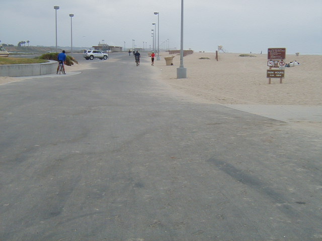 It was cool and overcast on the beach; quite a change from the previous day's heat. At the end of the path, there was a fenced off area reserved for snowy plovers, who next on the beach. It gave me the idea of what the beach might have been like before it was "humanized."  I got to Rick's office for lunch. We went with Fred and two of their clients to the same place we always go to: a 50s-themed burger place that limits my meal options. I went for the Veggie Burger. When lunch was over, I left Rick's office to ride down to his house in Laguna Niguel. The ride from Fashion Island in Newport Beach to Laguna Niguel follows PCH/Highway 1 through the toney beach town of Newport Beach. It is mostly expensive beach condos, luxury boat and car dealers, and other evidence of the well-off. There is a brief respite from the development (mostly high-end McMansions) is at Crystal Cove.  The picture is the start of the bike path that goes through the State park. It meanders for about 2 miles on the cliffs above the ocean. This was the best deal the environmentalists could cut. Everything else was developed. This photo is from a vista point looking at the beach. It gives some idea of what the "natural" coast might have looked like.  This view is from the path and down an arroyo to the beach.  The ride through Laguna Beach is horrific. There are parked cars, a small space, and cars doing 55 MPH. There isn't much room for a bike tourist.  I have learned to ride up one street to miss the northern part of this death zone. But, in south Laguna Beach you just have to have faith and keep pushing hard. Just before I turned up Crown Valley Parkway, I stopped to have a snack. This parking area is part of the beach public access between the housing developments on the cliffs. While it isn't Big Sur, it is a view of the California Coast that people pay lots of money for!  After a few miles going uphill, I got to Rich's neighborhood, found his house, and took some time to rest. |
||||
|
|
||||