|
|
||||
| Date | Starting Place | Ending Place | Author | Last Update |
|
|
||||
| 09-13-10 |
North Woodstock, New Hampshire, United States |
Conway, New Hampshire, United States |
ray | 11-06-10 18:56:01 |
|
|
||||
|
The weather report for today was rain. I thought about spending the day in North Woodstock but it looked like it would rain tomorrow, as well. I decided to walk out for breakfast, check out the weather, and then decide what to do. The town was still closed up at 8am. There was only one restaurant open and that was the ritzy Woodstock Inn that includes breakfast with its rooms. The food wasn't cheap, but it was very well done. I got a complimentary sticky bun while I checked the menu. I ended up getting an omelet and drinking a bit too much coffee. It wasn't actually raining, so much, as the town was in the clouds. It was foggy, misty, and everything was wet.  It didn't seem all that bad and hanging around an empty tourist town all day didn't appeal to me so I decided to head out. I packed up and was on the road about 9:30am. While packing up my gear, I couldn't find my pack towel. I immediately had an image of putting it outside at Dan and Andy's place and then forgetting to pick it up before I left. Since there were several outdoor stores in Lincoln, I decided to replace it on my way out of town as I might be camping soon and didn't know when I'd find another opportunity. Lincoln is a much bigger town than North Woodstock and contains all the real commerce of the two.  I was directed to a large store where I bought the only camping towel they had. It was the biggest one and I was pleased with it, as the one I had was a bit too small. I also hit a Subway in the same strip mall for a couple sandwiches. With that behind me, I left. There was a bit of traffic, but just outside of town was this bike path.  Frankly, it seemed like the bike path wasn't all that necessary. As you can see in the photo, there is plenty of shoulder on the road. Also, the path was quite short, no more than a mile or so in length. Nonetheless, it was a nice ride.  The bike path ends at the Loon Mountain Resort, a ski and mountain bike park a short distance out of Lincoln. There wasn't much to do at the resort on a cold, rainy day and the parking lot was empty. I don't know the name of this river, but it was beside me most of the way up to the pass. This shot is right in front of the Loon Mountain Resort. 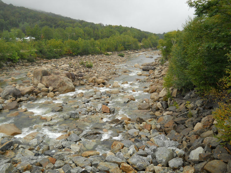 Even though the ski slopes were directly across from me, the clouds were so thick that this was all I could see of them. 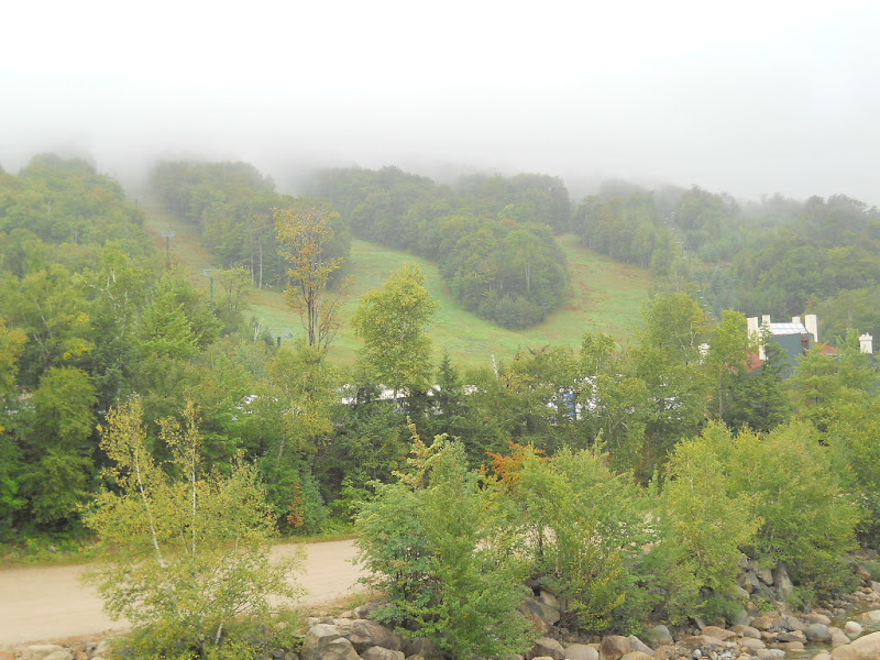 Once I was past the ski resort, it was just me, drizzle and the road moving steadily up. 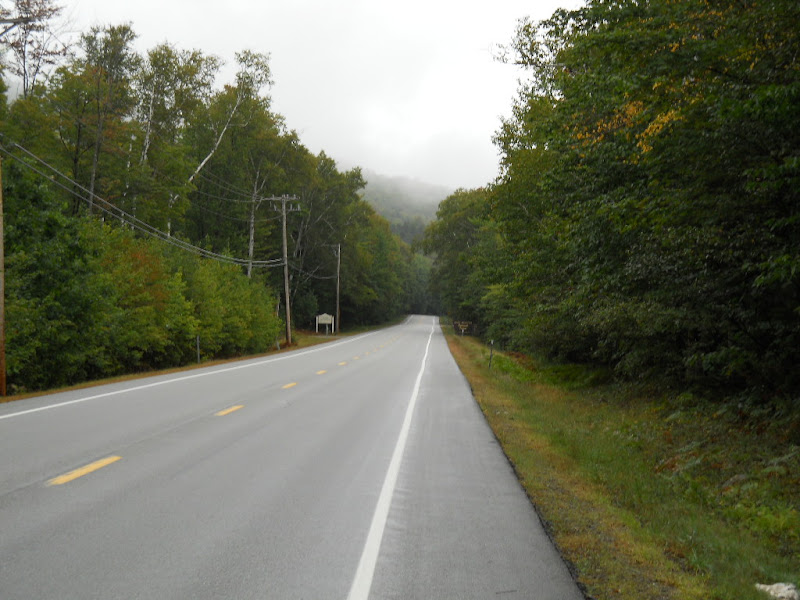 I liked this sign, though can't say that it made much difference. 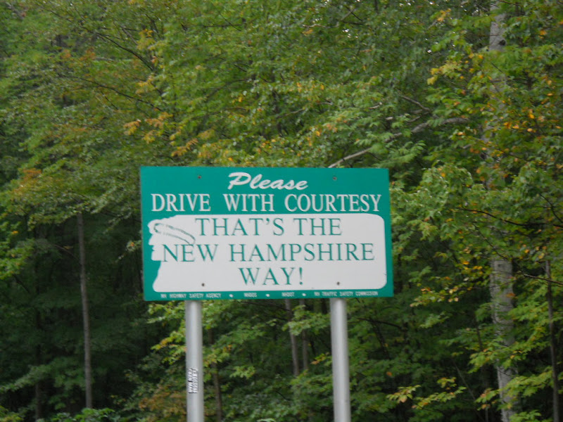 I was now officially on the Kancamagus Highway, or the "Kanc" as the locals call it.  Given the extra cups of coffee I'd had at breakfast, I was feeling pretty good. The grade was steady but not steep and the drizzle was more thick mist then rain drops. What's more, the river kept me company.  I took lots of river photos. Here is another one I liked.  It was the hints of color that drew my eye to this view. 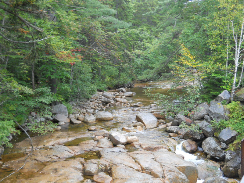 Eventually, the drizzle turned into light rain, the distinction I made at the time involved drops versus mist. About the same time, the road began getting a bit steeper. The combination of wet road, no traffic, mist-shrouded mountains, colorful trees (and coffee) made for joyful bike riding.  I had been told that the last few miles would be tough. I must have reached that point as the road kinked up seriously. In addition, the rain got more intense. This is looking the road I'd just climbed. 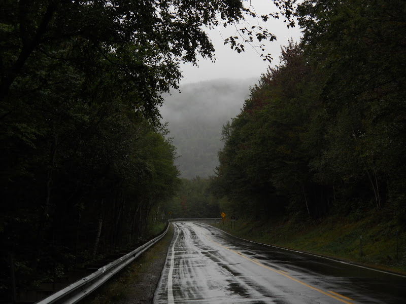 The road turned and I could see a long straightaway up ahead. I hoped that it was the last push to the top. There was a viewpoint here, as well, and I turned in to rest and get out of the rain for a while. The viewpoint had covered picnic tables and I rested there while eating a sandwich. I couldn't see much beyond a few hundred feet but could see from the information panels that it was a nice view.  Shortly after I arrived, a couple drove up and set-up a picnic on the table. I asked if I was near the top and they said no. When I mentioned the view, the man said that his camera still had pictures from the last time they were there and showed them too me. It seemed a bit ludicrous to be looking at photos of a view that I couldn't see! He also too a photo of me that accurately shows my reaction to learning I wasn't near the top, yet. 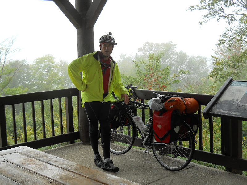 The rain was steady and the road steep as I ground up the road past the viewpoint. While I was lamenting the lack of clear view, I was appreciating the sense of mystery added by the thick mist.  There were lots of changing trees, due to the altitude I assumed. On occasion, the mist would clear and I would get a bit of a view. 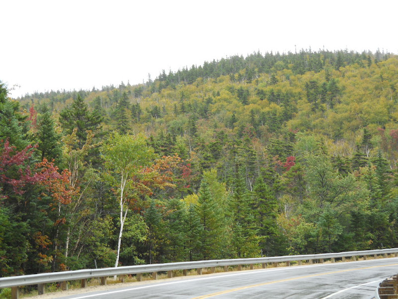 At the top of the incline, I could sorta see across the valley I'd just climbed out of. 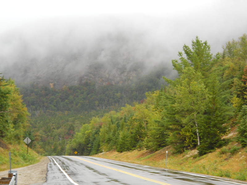 Even in this weather, the views from this vantage point were stunning. 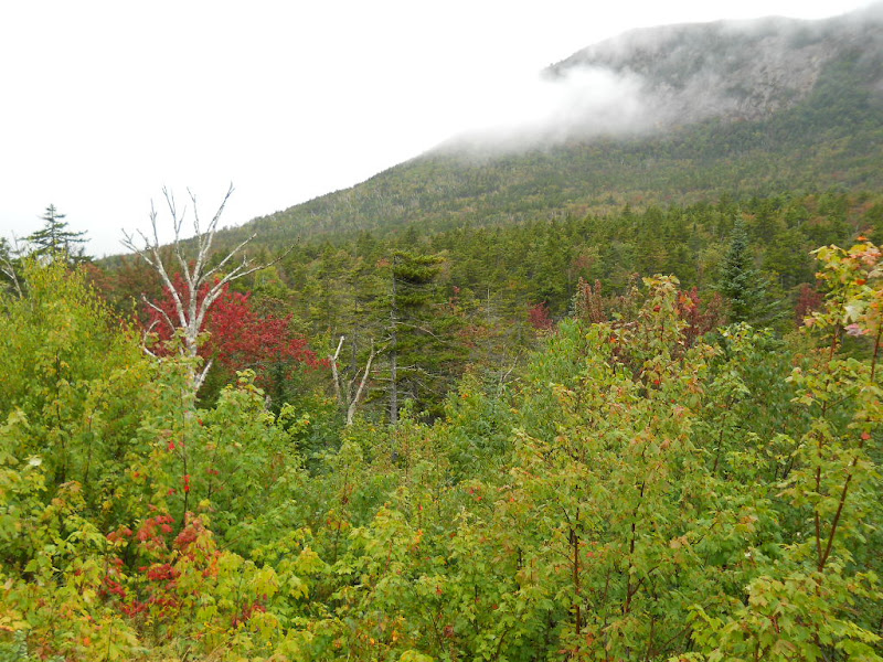  I still wasn't done climbing. It took another 15 minutes of hard grinding to get to the top. 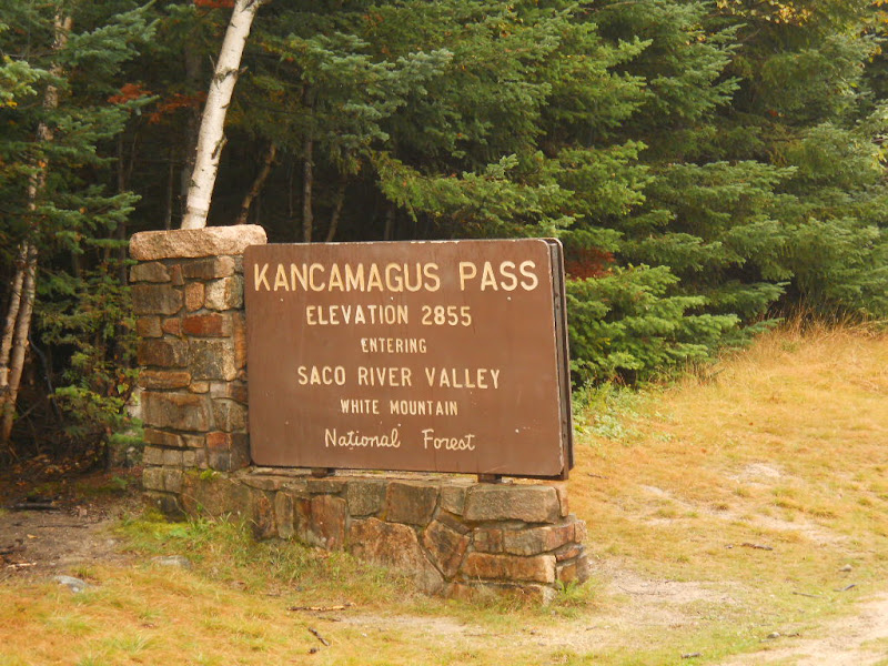 It felt good to have all the climbing behind me. Even the rain had stopped! Here was the view.  The road was as steep going down as it had been coming up. The road was wet, making my rim brakes less effective, and it was hard to stay below 30 MPH. I stopped frequently to take photos and cool my brakes. Even with all the clouds, the views were stunning.  The colors in the tree-lined mountains were the most intense I'd seen so far. Some of the views were both beautiful and expansive. 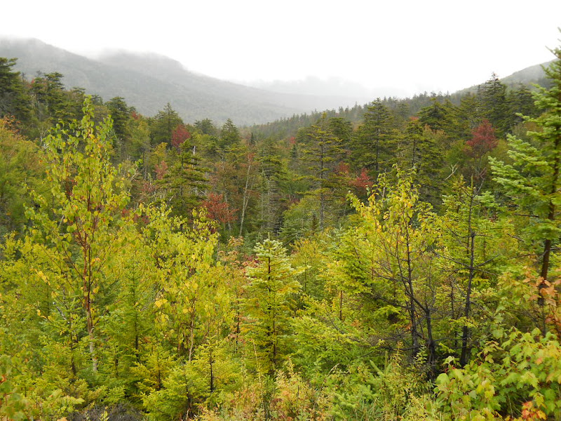 In fact, the above picture, as nice as it is, doesn't come close to conveying how pretty this vista was. Maybe it was the direction I was riding, but the views on the way down seemed to be "larger" then the ones I'd seen on the way up.  I had thought that I was done with the rain after reaching the top. But, about a mile down, the skies opened up and I got absolutely soaked. It was one of those bike touring moments where there was nothing I could do but keep riding, as stopping simply meant that I'd be standing in the rain. I was headed down a steep slope in pouring rain that felt like hail when it hit my face. It was everything I could do to keep my speed under control and my bike upright. I was so cold that, for the first time on a bike, I was shivering. The rain continued for about 10 minutes and there wasn't any part of me that was dry. I stopped at a viewpoint to rest after this soaking and changed into some dry clothes. Even with the dry clothes, I was still shivering. I stopped by the side of the road, put on my non-breathable rain pants, and shifted up a couple of gears to generate some heat. This warmed me up a bit and I wondered why I hadn't put the rain pants on at the top of the pass. After struggling with the rain pants, I took a photo of a small, but noisy, water cascade nearby.  It took me about 30 minutes to navigate the rain and the steep downhill. The road was still descending but at a more even grade. The vistas were still grand, though. 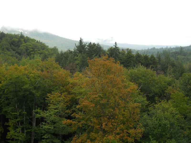  Eventually, the road went back into the trees and I started seeing streams.  I was still in the White Mountain National Forest. The road had leveled out and I was now curving though the woodlands. 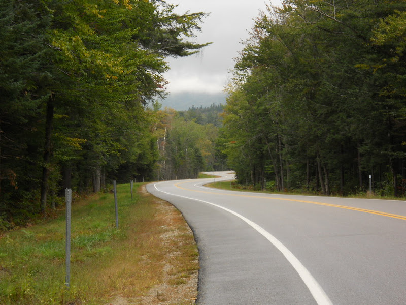 The road, still called the Kancamagus Highway, again found a river to follow. This one was called the Passaconaway River, I think. 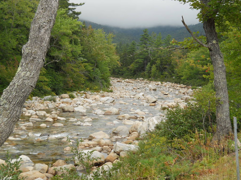 The river valley provided some elevations to see. 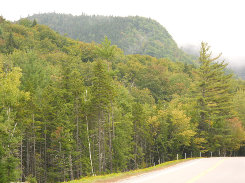 After all the color and vistas I'd seen this day, I was still amazed by every new one I saw.  I was particularly struck by the treeless cliffs on the mountains.  As I exited the White Mountain National Forest, I saw this sign explaining who Kancamagus was. 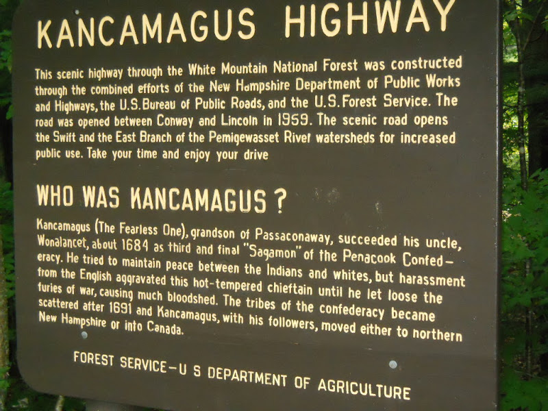 I continued following the river  and began seeing the outskirts of Conway. I rode though the small commercial section of Conway and, after riding over a wooden bridge, 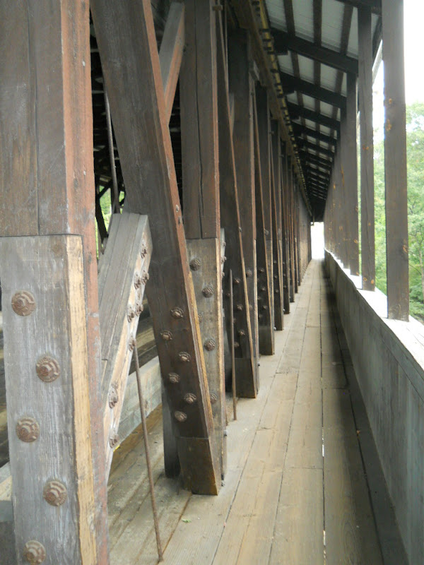 eventually found my host's house. Becky worked at home and I didn't want to disturb her, so I sat in her large backyard, took down my last Subway, walked across the street and checked out the dollar store and minimal market, and came back to wait to be invited into the house. When it started to rain, I took everything into a covered passageway between the house and the garage and while doing so, Becky appeared and invited me in. She lives in an old house that doubles as her medical office. Becky is a Naturopathic Doctor. My room was upstairs and the first thing we did was to take a mattress from the basement, up 2 flights of stairs, into my tiny bedroom. But, it was warm and dry, which was all I really needed. Becky was done for the day and we sat and talked when I came down after my shower. It turns out that her son is one of the founders of Couchsurfing, which was the topic of conversation for much of our initial discussions. After while, she made some dinner, we got some wood for her first fire of the season, and we talked further. I wasn't completely sure of my route from Conway through Maine to Bar Harbor and I spent some time with Becky's collection of local and state atlases checking out various roads. I went to bed shortly thereafter. |
||||
|
|
||||