|
|
||||
| Date | Starting Place | Ending Place | Author | Last Update |
|
|
||||
| 09-21-10 |
Bar Harbor, Maine, United States |
Blackwoods Campground, Maine, United States |
ray | 08-04-20 21:05:45 |
|
|
||||
|
My plan for today was to ride the Loop Road along the Mount Desert Island coast, maybe ride some of the carriage trails and end up at Blackwood's Campground for the night. The ride to the campground would be less than 15 miles so I was in no hurry to start. If you are interested, here is the National Park map of Acadia National Park. I walked out and had breakfast at a diner/mini-mart across the street from my motel. The place had a few tables and a cooking area in the front of the store with the usual mini-mart inventory in the back. The food was plentiful and the service casual, which is all I needed. After breakfast, I took my time packing up and left the motel about 10am. I rode through town to the Hannaford's, bought food for dinner and tomorrow's breakfast and hit Subway for a couple sandwiches and ice water. Then, I rode back toward the motel and kept going out of town on Main Street (SR 3). It was a sunny, cool, breezy day and the road had light traffic. 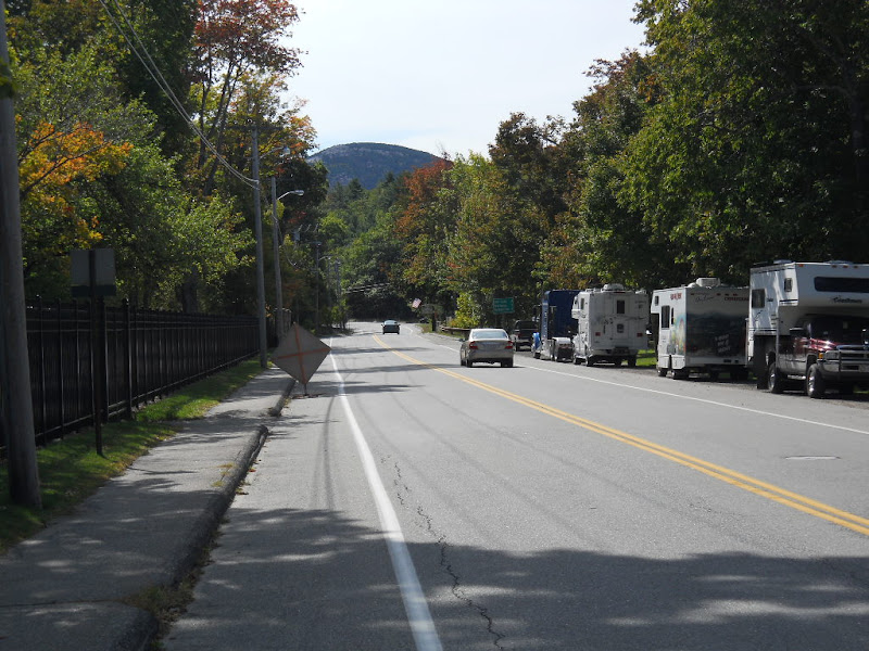 Just south of Bar Harbor is the Jackson Laboratory. I rode around the college-like campus and turned onto the deserted Schooner Head Road, which runs right along the coast. I pedaled through woodlands and then a wetland that provided a view of the hills paralleling the road. 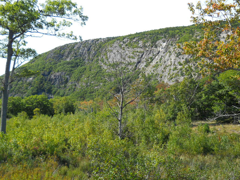 Here is view across the wetland. 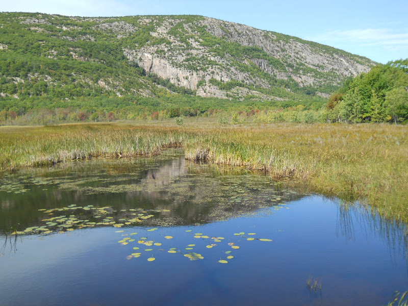 Not surprisingly, Schooner Head Road goes to Schooner Head Overlook where a short walk goes down to the water. There is no beach, only rocks diving into the ocean.  Schooner Head, like much of Mount Desert Island, is private and the location of a huge house. 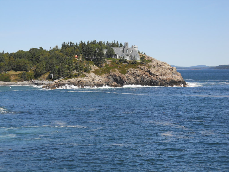 As this longer view show, it seems a bit inaccessible, but I doubt the owners care. 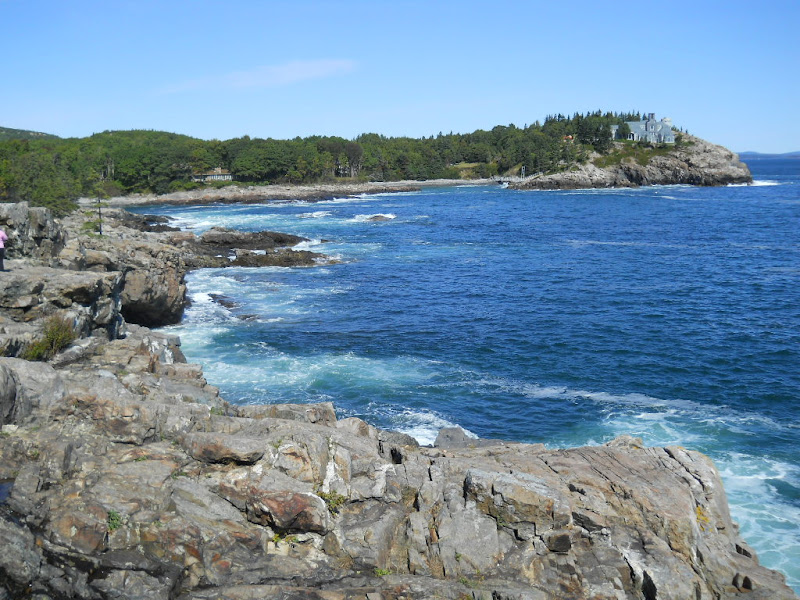 After Schooner Head, I had to ride on the main Park Loop road. It is a two-lane, one-way, shoulder-less road with slow moving traffic. 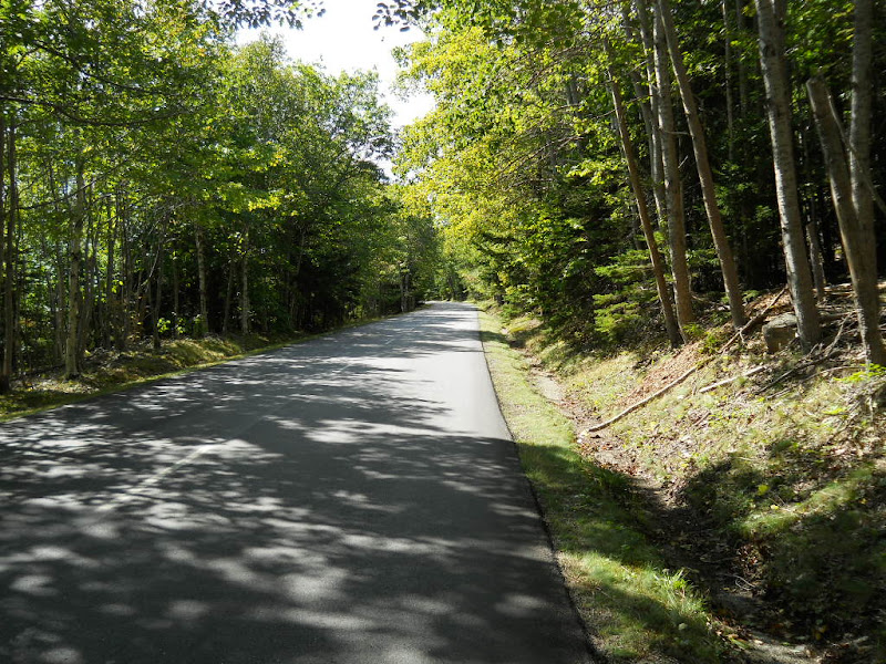 My next stop was Sand Beach. I locked my bike and took the short walk to a wide sandy beach. 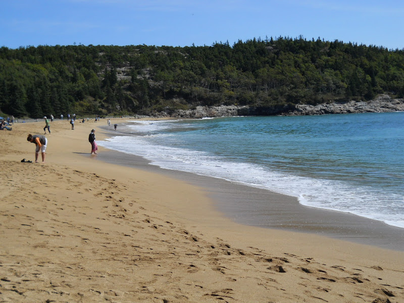 I sat on the beach and ate one of the Subway's while enjoying the sun and sound of the surf. The beach is at the end of a long, rock-sided channel. 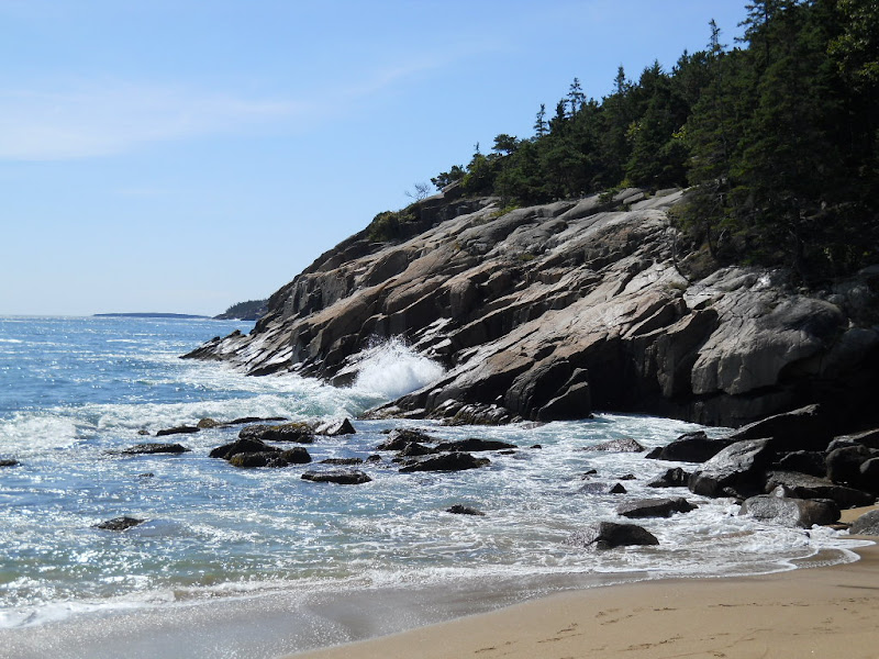 Just behind Sand Beach were dramatic rock outcroppings. 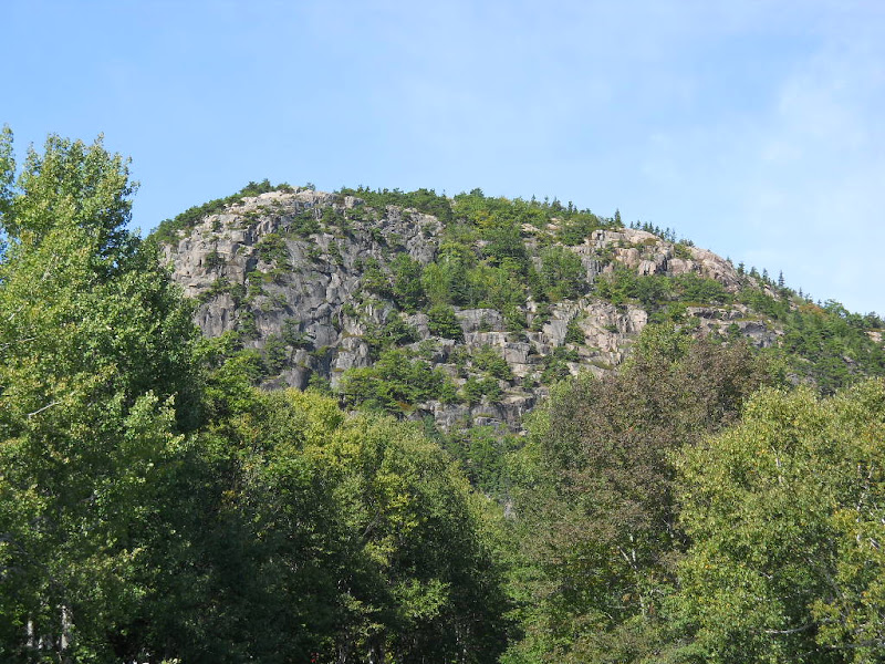 I rode along the rocky coastline enjoying some stunning views (after walking past all the parked cars). 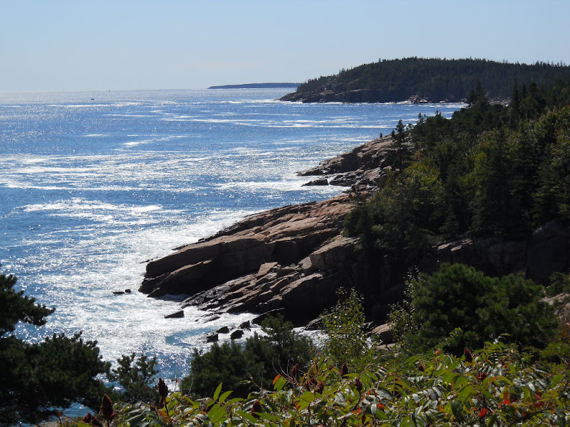 The views were pretty all around and I took lots of photos. This one shows that trees were along the coast, as well. 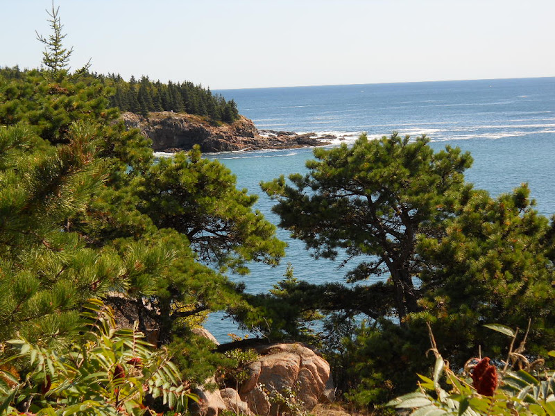 This is the view along the cliffs back toward Sand Beach. 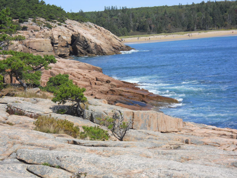 The ocean and the cliffs interacted in a white water dance that occasionally resulted in huge plumes of spray that I couldn't quite capture no matter how many ocean/rock shots I took.  I wasn't alone on the cliffs and often had to wait several minutes for people to exit the scene I wanted to photograph. Here is what it looked like at the bottom of the stairway from the road. 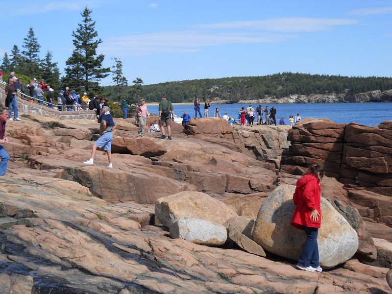 I had driven along this road in the shuttle bus yesterday and it was pretty. But, the views were so much more immediate on a bicycle. Here is yet another coastal vista. 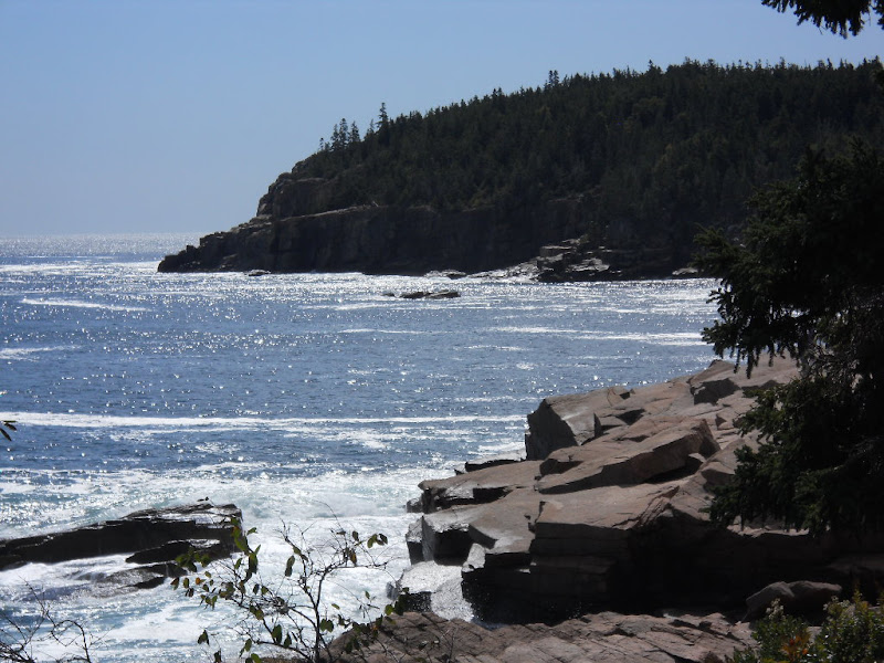 The Park Look Road continues down the coast and climbs a bit so the views were now looking down at trees growing almost to the tide line. 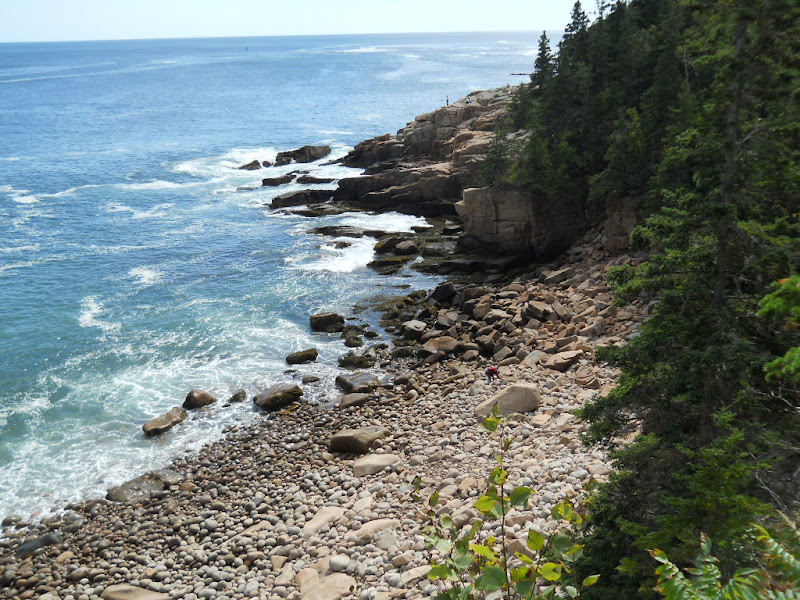 On the other side of the road was trees seemingly growing directly on rocks. 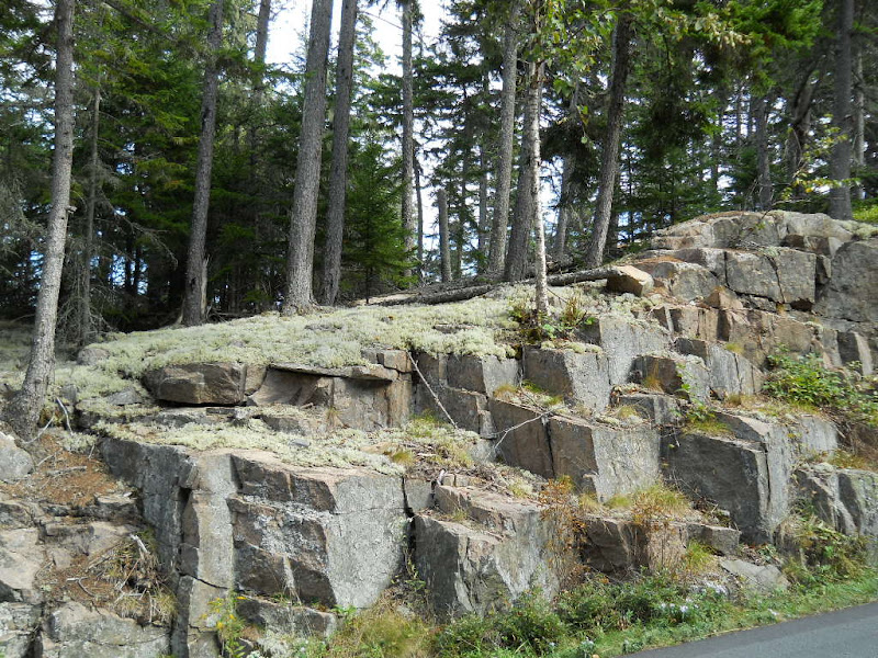 I took this shot standing on a low rock wall at the edge of the road looking straight down. 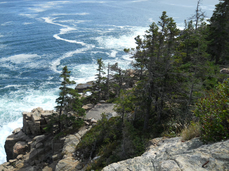 This view is looking back all the way to Sand Beach. 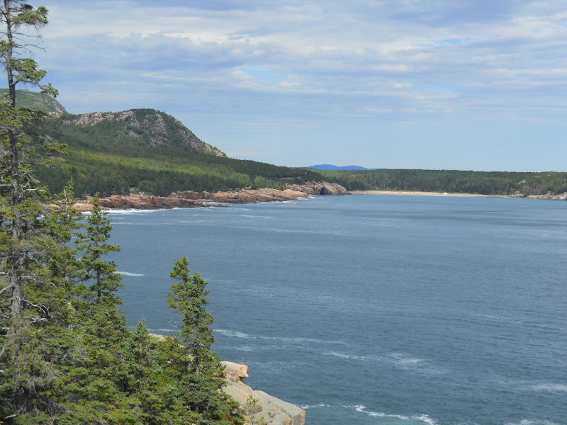 This is the view looking the other way, toward the end of Otter Cliffs. 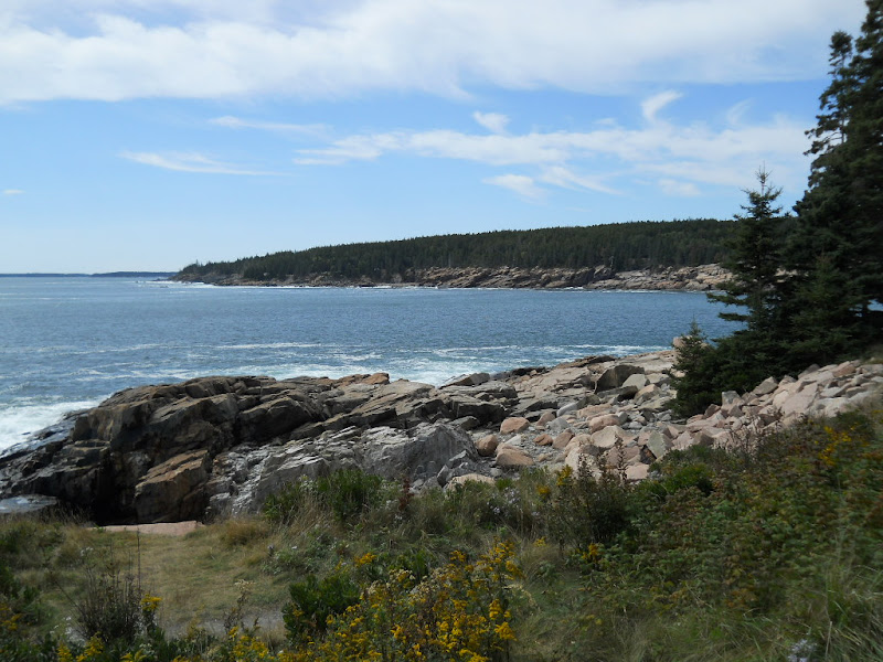 I rode down to an area identified as Thunder Rocks and got this bit of "thunder." 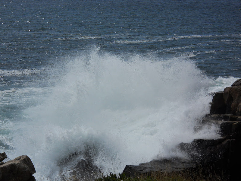 I had to turn off the Park Loop Road in order to get to Blackwoods Campground. This road is away from the coast where the view is trees and the occasional wildflower-filled meadow. 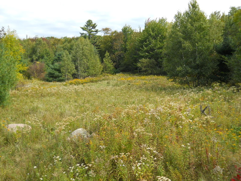 I went through the deserted hamlet of Otter Creek where, outside the campground, is a coin-operated shower room. I didn't feel like a shower, so I rode on into the campground, arriving around 2pm. I stopped at the Ranger Station, paid my $20 camping fee, and rode off to find my site. The campground has 2 areas and only one of them was even open and most of the sites in the open section were empty. Here is my site. 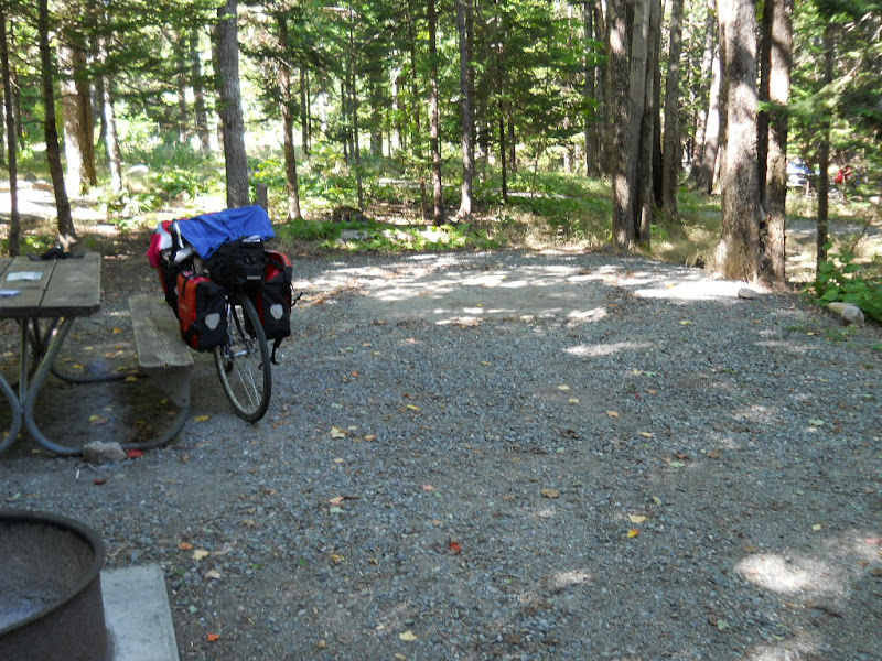 The view up through the trees was very pleasant. 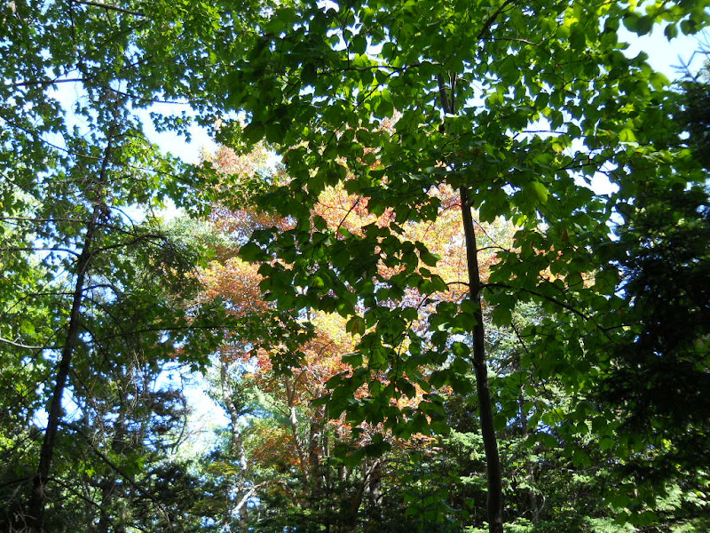 After setting up my tent and putting all my food and other scented items in a raccoon box, I took a walk down the short trail to the ocean. The Park Loop Road crossing is unmarked and the views from the rocks on the other side were fabulous. Here is a photo looking into Otter Cove. 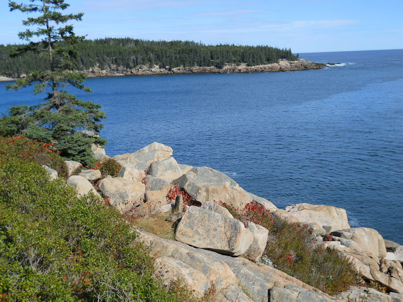 The view the other way, southwest, shows a water spout and the Cranberry Isles in the distance. 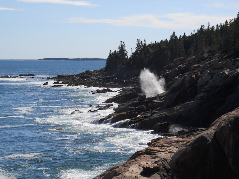 I spent quite a while here enjoying the view and the sun. While the rocks weren't particularly comfortable, I even managed to take a nap and get this photo using the camera's timer. 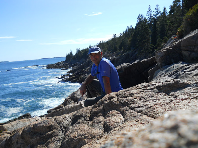 Acadia National Park contains a spider's web of "carriage" roads. These hard packed paths are car-free and designed for horses and bicycles. I'd been told that they are a main(e) attraction and planned to ride on them. However, I was not motivated to get back on my bike once I walked back to my campsite. Instead, I relaxed, read a bit, and got to know the people who had recently driven into the camp site next to mine. They were a couple from Texas, currently living in Virginia, on a last road trip before their son goes into the military. They were very nice and even gave me a bundle of wood to burn that evening. Once it got dark, I tried to make a fire but only succeeded in creating lots of smoke. It eventually caught fire, but not before imbuing everything I had with campfire smell that would stay with me for the rest of the trip. I made a dinner of veggies and ramen and stared into the fire for quite a while before crawling into my tent for the night. |
||||
|
|
||||