|
|
||||
| Date | Starting Place | Ending Place | Author | Last Update |
|
|
||||
| 06-08-12 |
Mendocino, California, United States |
Gualala, California, United States |
ray | 07-08-12 11:48:58 |
|
|
||||
|
After spending the night in Fort Bragg at a very nice motel of individual cottages (Shoreline Cottages), my wife and I were up and out by 8am to eat breakfast. We chose Egghead's Breakfast, a cafe that is an homage to The Wizard of Oz, including naming every entree for some character or scene. I had an omelet and ordered the "Good Witch" avocado sandwich to take for lunch. After breakfast, we drove the 8 miles south to Mendocino, where I would leave and my wife would spend some time before driving over the hills to her hot springs weekend. I have an S&S coupled bike that I'd taken apart and stuffed into the car's trunk. 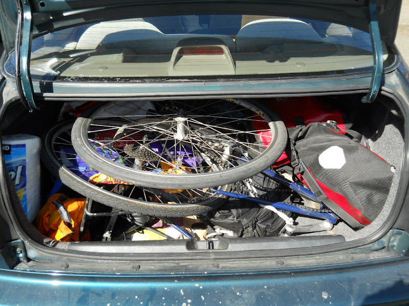 It took me about 30 minutes to reassemble the bike, gather my gear, and prepare to leave.  Mendocino is an odd combination of tourist mecca and hippy town. It appears that economic conditions haven't been kind to Mendocino as there were many closed shops and vacant stores. In fact, the reason we had breakfast in Ft. Bragg was that the day before, on our way to Ft. Bragg, we couldn't find a suitable place for breakfast in Mendocino! Here is the view down Main St.  I started pedaling about 10:15am. Mendocino is a small town in a pretty place, that I was stopping to take my first photos within 5 minutes. The town is on a headland that forms the northern part of a bay (Mendocino Bay) that is also the outlet for Big River. Note that this is a common geographic feature of the California Coast. This photo is looking across the bay from north to south.  This view looks southwest. In the foreground is the river forking as it enters the ocean.  The picture looks northeast along the river and back toward Mendocino's headland.  It would be hard not to complete the set with the view of Mendocino's white church poking above the spar-spotted beach.  Big River was a translucent green as it rounded its last tree-lined bend.  A strong tailwind was predicted for the day and by 10am it was already blowing consistently. It was enough force that while stopped and taking photos, I had to make sure my bike was secure or the wind would push it around. I probably had one of the better days as while I was riding the wind noise dropped to zero and I could hear birds chirping and waves down on the beach. One odd result of the wind was that I would feel "rain drops" whenever I rode next to a cliff with particularly strong waves at the bottom. It took me a few times to realize this! Around every bend there was another breathtaking view (this was taken 6 minutes after the previous one!). I found the shades of blue in the ocean stunning.  Tree-covered headlands plunging into the ocean are a common sight.  Another common sight are ugly electrical wires strung between the road and the ocean, spoiling the view.  Riding on Highway 1 down the coast means spending the day on a narrow, curving road surrounded by tantalizing views.  It is easy to choose camera angles that show pristine coastline. But, in reality, there are homes everywhere.  The views on the inland side of the road are full of trees, brush, ferns and wildflowers.  Another common view, on the ocean side, is seeing the blue ocean through twisted coastal trees. 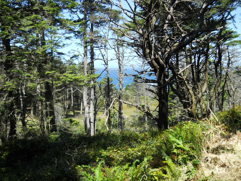 One of the highlights of bike touring is seeing something from the side of the road that no one else notices. This is one such view, taken with my bike just a foot off the side of the road and looking down.  This view of the same cove is looking north up the coast.  The next large river below Mendocino's Big River is the Albion River, 7 miles south. On Highway 1, the many rivers and creeks are crossed by bridges. Some of these are high above the river; others are down closer to the water. The higher bridges don't involve the fast downhill and slow uphill that the ones closer to the water require. The bridge over the Albion River is one of the high-up ones.  The view down was of the port facilities of Albion.  Less than a mile south was another bridge over some unnamed river.  This house is actually on the beach.  For this part of the ride, I was on the tops of the headlands. While looking down was always alluring, the view across the top was nice, too.  The road often had no shoulder at all. But, it was curvy enough that cars didn't go too fast and were respectful. This view shows that, in addition to trees, there are grassy stretches, as well.  Incidentally, the 42.11 you see on the post next to the road is the mileage to the end of Highway 1 in Mendocino County, which is just after Gualala. These mileage markers make it easy to follow your progress as you ride along. The first bridge I can to that was down by the water was the one over the Navarro River (about 10 miles south of Mendocino), where I suspect the span was too great to go directly across.  The bridge is back away from the ocean about a mile and right over the water. This is the view of the road going down along the northern side of river.  Looking out toward the ocean from the road.  The bridge from the same spot.  I crossed the bridge and ground up toward the top of the headlands on the other side. On effect of a strong tailwind is that it turns into a headwind going up cliffs. This view of the river meeting the sea through the trees was as much a short rest as a great photo.  Once I was up at the top, the stunning coastal views returned.  The view north from the same spot.  I couldn't get over all the different shades of blue I would see in the water.  About 17 miles south of Mendocino is the tiny town of Elk.  There isn't much there but it does have a store/deli if you need food or drink. It was such a pretty day and the views so outstanding that it was hard for me not to take a photo every couple of minutes. The 17 miles from Mendocino to Elk took about 2 hours. In that time I took 56 photos: an average of one photo every 2 minutes! I stopped briefly in Elk and ate some food at a ocean overlook down a short path in the middle of town. If not for the arch, I would have skipped this photo as it was too much like many of the others I'd already taken!  There was construction on the bridge over the (unnamed) river just south of Elk. The one way controlled traffic was nice enough to wait for me to clear the bridge before starting. This photo was taken just past the construction site looking back at Elk over the river's mouth.  South of Elk, Highway 1 moved away from the cliff edge and fields of grass started appearing. This photo shows both the grass and the waves caused by the strong winds.  The views on the inland side of the road were their own "sea of green."  From here down to Gualala, the road would meander toward the ocean and then away from it. In a few short miles, I had river mouth ocean vistas,  expansive coastal views,  and roadside bouquets of wild flowers.  Cow pastures began appearing  and the views became more farm-like.  As Highway 1 moves away from the coast, I came to Irish Beach, a service-less collection of homes and then to Manchester State Park, which houses a campground. It is a bit of a ride to get to the park which is on the coast. I wanted to eat my "Good Witch" sandwich so I turned down the road and went by a well equipped KOA campground and turned in when I saw a sign for a walk-in campground that was part of Manchester State Park. After a short ride on a dirt road, I camp to field where bike riding was prohibited. There was no place to sit so I rode the short distance back to the KOA and sat there and ate. After eating, I checked the fee schedule and didn't see anything about bicycles and asked the manager who said that they offer a $10 hiker/biker site, though it isn't listed. Since it is "only" 30 beautiful miles from Mendocino to the KOA at Manchester State Beach and 20 miles from there to Gualala, I started thinking about the arrangements for doing a short tour with other people who are not seasoned bike tourists, like my wife. This kept my mind busy for several miles! Just past the State Park is the village of Manchester. While I didn't stop and go in, it looked like its single store offered some food for a hungry bicyclist.  Some roadside topiary that caught my eye in Manchester.  I discovered that the reason for the route's diversion was Point Arena, a triangle of land that juts into the ocean and is marked by a lighthouse.  The northern bit of this triangle is the home of Manchester State Park. A couple miles past the turn off to the Park is the small town of Point Arena which has shops and restaurants.  South of Point Arena, the road climbs a bit through a narrow gorge on a twisty road. Amazingly, the wind gusts were so strong that at one point I was accelerating up a slope without pedaling! After a mile or two, Highway 1 is back on the coast. 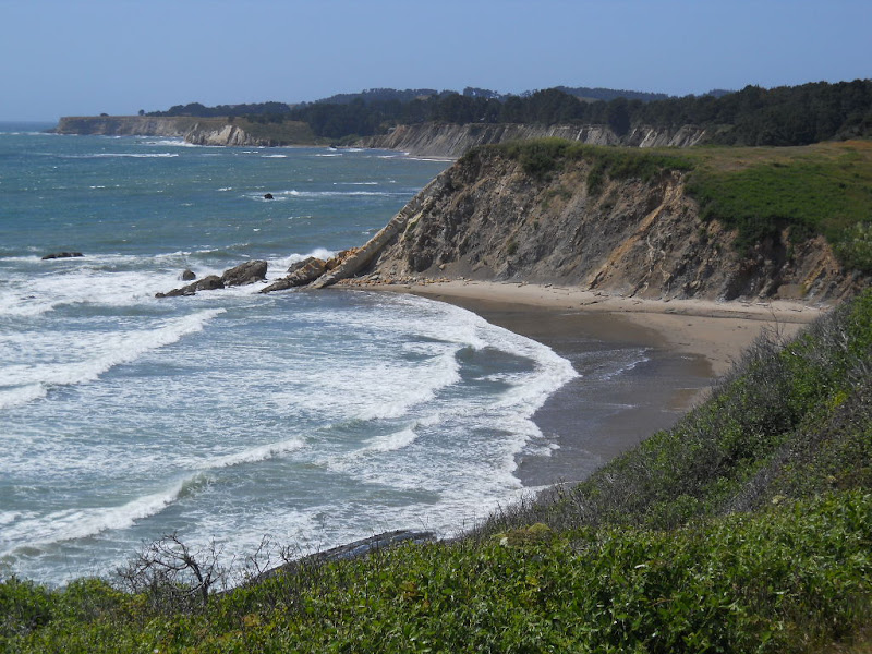 South of Point Arena, the highway goes right along the coast. There were fabulous ocean views  some unusual tree, creek, and ocean sights,  and even some sunny forest.  About 10 miles past Point Arena is Anchor Bay, a tiny hamlet with a couple of restaurants, bars, and shops. Yet another supply stop north of Gualala.  Even though I'd taken dozens of ocean shots this day, there are some that call out for a photo.  As I approached Gualala, the largest town on the coast south of Mendocino (and possibly even bigger), I started seeing more buildings. This inn speaks to this area's Russian history.  I wasn't sure if there were any dinosaurs in the coast's deep past, but I took a photo, anyway.  Gualala is big enough to have 2 grocery stores! I stopped at one to eat a bit of food, buy some fruit for tomorrow's ride, and get some chocolate as a gift for my hosts. It is a place I normally would lock my bike but someone manning a grill in front of the store told me he'd watch it for me. I didn't use my lock once on this tour! Here is Gualala's main street (Highway 1) looking north coming into town.  Directly south is the mouth of the Gualala River which meanders a bit before it hits the ocean.  The Mendocino-Sonoma county line is the middle of the bridge over the River (and where all the roadside mileage markers reset). The huge development known as Sea Ranch starts just south of the river. Sea Ranch is an 8 mile long strip of private land with a golf course, many wooden houses, and lots of "Private" signs but absolutely no services. But, that isn't to say there aren't some pretty parts. Here is a view over the golf course.  A more typical Sea Ranch vista.  The Sea Ranch chapel, I think.  The highway through Sea Ranch land has no shoulder and a bit more high-speed traffic.  I never felt in danger but kept an eye on my mirror and occasionally pulled off the road when I saw a large truck coming. Sophia and Bob, my couchsurfing hosts for the night, were 8 miles south of Gualala. As I turned into their street, I saw some young deer grazing by the side of the road.  They were clearly accustomed to people as they didn't even move as I rode right by them. Sophia and Bob are a 40-something couple who both have work-at-home jobs. She is an urban planner with clients in San Diego (where they used to live) and he writes computer games. They were very experienced couchsurfing hosts and vegetarians! I wasn't particularly tired from my wind-aided ride and the three of us immediately fell into easy conversation about ourselves. They had recently been to Alcatraz and we spent a good deal of time on that topic, as well. Specifically, we(I) discussed the upcoming 50th anniversary of the famous escape in 1962 and the "new" information I'd gotten from the US Marshall investigating the case that had recently spoken at Alcatraz. Sophia made a pasta and veggie sausage dinner that tastily filled up my gas tank. The topics turned to programming and gaming after dinner. Bob gave me some ideas for my bike touring game, which was an unexpected bonus. We all went to bed about 11pm. |
||||
|
|
||||