|
|
||||
| Date | Starting Place | Ending Place | Author | Last Update |
|
|
||||
| 09-13-06 |
Placerville, California, United States |
Kirkwood, California, United States |
ray | 03-15-09 00:44:11 |
|
|
||||
|
This was a hard day of bike riding. I knew it would be tough as I had mapped it out using a program that calculated the amount of climbing as 11,000 feet. The route map shows Placerville at about 2,000 feet and Kirkwood at 8,000. I had not idea if I could do this amount of climbing or if I'd have to turn back. This was all the more important because I wasn't carrying camping gear and couldn't simply plop down when I ran out of energy or night fell. As it turned out, I ended up sleeping on the ground, anyway! Given the difficulty of the day's ride, I wanted to get an early start. I was up and out at the Waffle House by 7:30 and back at my room by 8:15. I needed some toiletries, so I took a quick trip to the nearby Rite-Aid and then started to get everything back into the panniers and started stretching. Just as I was getting ready to roll out the door, I noticed that I had a flat rear tire. It took me about 40 minutes to unload the bike, change the tube, find the thorn (the guy I rode on the American River Bike Trail had warned me about thorns on the trail due to lack of maintenance by the U.S. Forest Service!), and get the bike repacked. Instead of getting out at 9am, I left about 9:45am. While an extra 45 minutes would have been handy at the end of the day, I'm not sure I had the energy to use it effectively. On my way out of town, I bought a sandwich for use on the road. The Western Express route follows Highway 50 out of Placerville up to Pollack Pines. This way meant about 2200 feet of climbing followed by 600 feet of downhill in about 19 miles. The day seemed hard enough without doing any extra up and down. Instead, I chose to take Newtown Road out of the Placerville, which moves away from 50 and is a more direct route to Jenkinson Lake, where the Morman Emigrant Trail starts. Instead of doing 2 sides of the triangle, I only would do the hypotenuse and cut 3 miles and an extra 600 climbing feet off my day. I was quickly out of Placerville and onto a road going along forested foothills. The grade was steady uphill with some steep sections. This view is looking back from whence I had just come. Again, the road was narrow but the traffic was light. 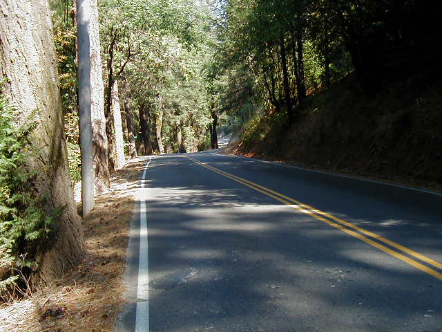 In the quiet, I could hear a stream running below the road. 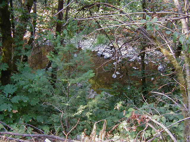 The terrain had switched from oak woodlands with forest. It was a nice change, cooler, and with a natural scent that I found refreshing. 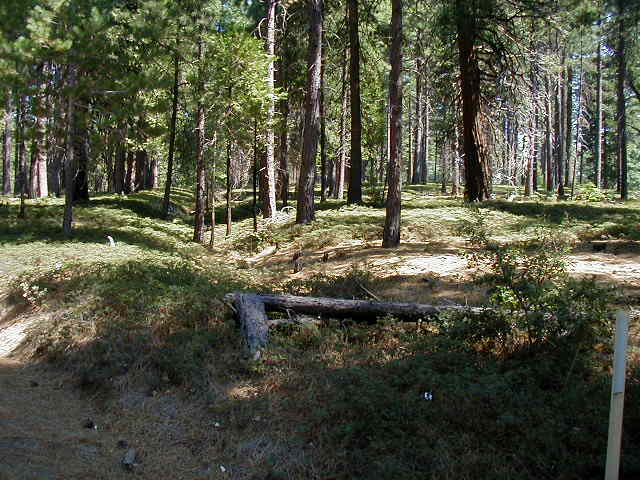 Newtown road dead-ends into (the second) Pleasant Valley road. After about a mile, I came to the town of Pleasant Valley, where I stopped to have some food. There is a full grocery store there with a deli for sandwiches. I sat on a bench, ate, and called my wife. It was quite warm in the sun by this time. Past Pleasant Valley, the road remained flat for a short while but then started the steady climb to Jenkinson Lake. The scenery was still very pretty, though. 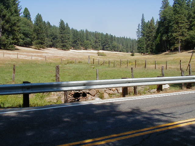 The road to Jenkinson Lake introduced me to what climbing 11,000 feet felt like. It was a low-gear crawl with an average speed in the mid-single digits. Finally, I got to the lake. 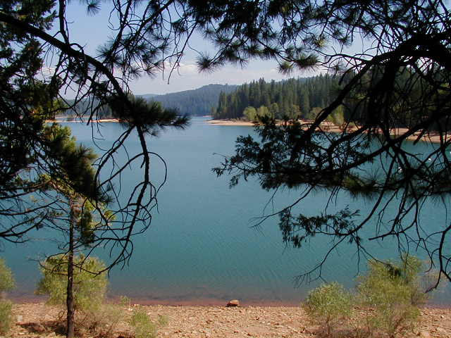 Here is the view looking away from the lake. It was a pretty spot. 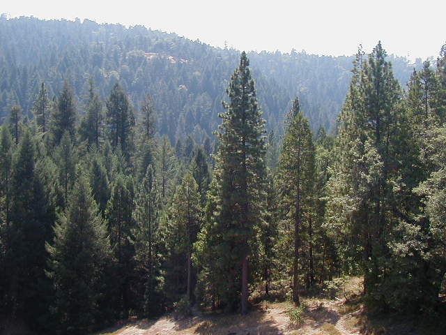 It was now about 1pm and I had about 37 miles to go. The sun set around 7pm so I had 6 hours and needed to average 6 miles an hour to get to Kirkwood before dark. It seemed like it should be easy. However, the road was merciless. I was in my lowest gears all day. I would be crawling up an incline only to look ahead and see a stiff kink in the road just ahead. On the really steep parts, I had a choice: I could ride or walk. As it turned out, it didn't matter which one I did as the speed was about the same -- 3.5 MPH. I figured 3pm was my decision point. If I couldn't make it to Kirkwood, I would have to turn around. When 3pm came, I knew I was in trouble. I was going too slow and didn't have the energy to go much faster. But, I decided to stick with it, figuring that eventually the road would level out. As I continued climbing, I started to get broad vistas. 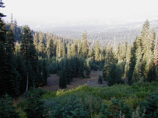 The Mormon Emigrant Trail was a two-lane road with a nice shoulder that rarely had any cars. It was a bright sunny day with just a hint of cloud in the distance. It was still quite warm, but a great day for biking nonetheless. 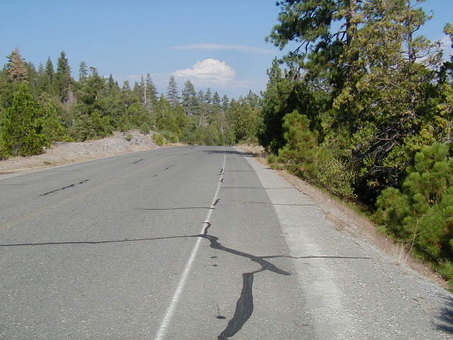 Here is yet another side-of-road vista. 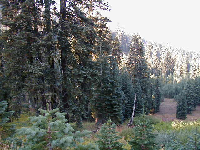 Twenty-five miles after Jenkinson lake, the Mormon Emigrant trail empties into Highway 88. It was getting late by the time I hit this intersection and the sun was getting low in the sky. The road climbs a few more hundred feet from that junction and the road gets busier and a bit narrower, though still with a shoulder. A few miles later, I passed a sign showing the elevation as 8,000 feet. Just around that corner, I took this picture looking down at Silver Lake. 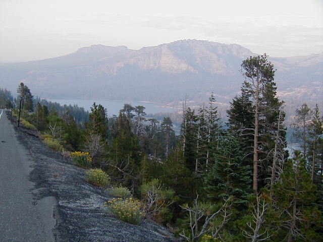 This view is looking a bit further toward the south. Note the long shadows in the valley. There wasn't much daylight left. 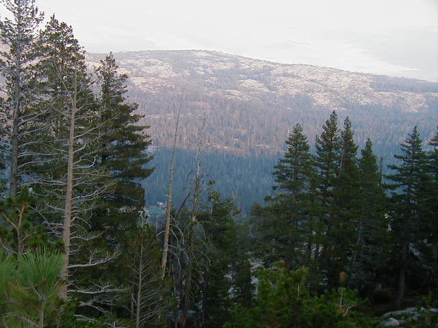 This picture was just a reminder to me that even the steepest roads have to go downhill sometimes. Just past the 8,000 foot elevation sign, the road dips down to Silver Lake. A high speed rush 600 feet down that is immediately regained on the other side. Nonetheless, it was great not to be weaving along at 5 MPH! 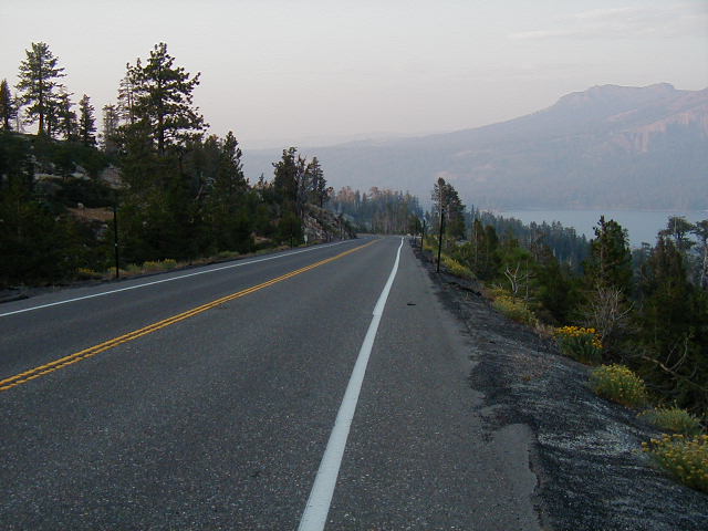 I guess there is something about the quality of the light at dusk in the mountains that makes for particularly stunning vistas. This image was deeply gratifying as I was seeing it from the saddle of bike I had ridden there. 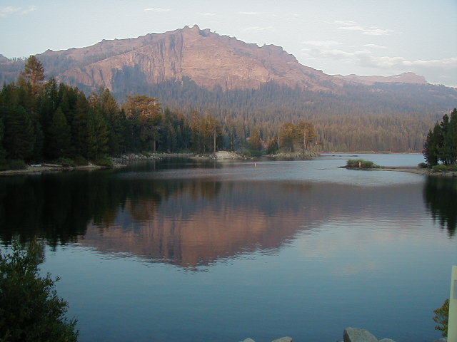 A short distance from this viewpoint, there is a sign for Kay's Resort, which offers cabins and a restaurant. I had called here before I left and was told that they were booked solid for the night. But, I was getting low on water, day light, and energy and figured I'd stop in and see if, for some reason, they had a vacancy. The resort is about half a mile off Highway 88. The woman at reception offered no place to sleep, but she did fill up my Camelback. In the lobby was a man who was arranging some very nice watercolors. As I sat waiting for my water, we got to talking. When he learned about my predicament, he offered to drive me the 5 miles to Kirkwood, saying it was too dangerous to do it at night. I didn't offer any resistance nor ethical concern about taking a ride in car. Once he had finished, we loaded my bike and bags into his camper shell and in 15 minutes I at Kirkwood. It turned out that Dale, who was teaching a watercoloring class at Kay's Resort, had done some bike touring as a younger man. He once had to sleep in a bathroom at the Mariposa Airport so he was sensitive to my plight. It was angelic of him to drive me over to Kirkwood. He even gave me fifty cents to pay for the phone call I had to make to Kirkwood night clerk. By the time I got to the small vestibule in front of the Kirkwood Lodge lobby, it was 7:30pm. The place was deserted and the reception desk was closed. The sign on the door said that I should call a local phone number to get the night clerk to come and check me in. I had called before I left and verified that it was OK to arrive this late and still get a room. They said that it happened all the time and that there would be someone on call to take care of me. I called as instructed and got a computer generated voice saying that I should leave a message. I did. I waited for about 15 minutes without a call back. I called again. Only, this time I left my cellphone number, which was very low on power but actually got a signal up there. I then walked over to the only place that looked open, the bar. It closed at 8pm and the guy closing up said that he didn't have any food left that he could offer me. I ended up raiding my panniers for something to consume that I could call dinner. I decided to walk back to the vestibule to wait. The room I was in was about 15 by 15 and contained a pay phone and a box for returning room keys. The floor was made of large, flat paving stones. There was nothing to sit on and no electrical outlets. I managed to prop-up an pannier as a back rest as I sat on the floor. After about an hour, I called my wife in San Francisco and asked her to call and go on-line and see if there was some other way to get a hold of these people. There wasn't. I realized I would likely have to spend the night on the stone floor. I had no access to a bathroom but I had changed my clothes. It was beginning to look like a horrible end to a very tough day. Suddenly, someone walked into with a ray of hope. This guy was working at Kirkwood and had locked his keys into his room. He called the emergency number on the door (the one I had called). I told him of my situation and asked if he had a couch I could crash on. He said that if he got back into his room, he would come back and let me stay there. My spirits were buoyed for a short while. But, he never returned. About 11pm (three and a half hours after I arrived!), I realized it was going to be a night on the stone floor for me. I had nothing to lay on except biking shorts and jerseys and a thin wind breaker. The floor was hard and I was exhausted. It didn't matter how I laid on the floor, some part me ached. I have no idea how much I slept, but it wasn't much. In order to document the ordeal for a later letter to Kirkwood, I took this picture. I was there all night. 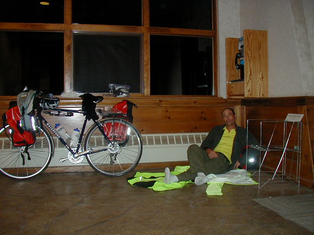 |
||||
|
|
||||