From July 7 to August 3, 2013, I rode from Missoula, MT to Jasper, AB, mostly using the ACA's Great Parks North route. I spent time in Many Glacier, went over Going to the Sun Road, made my way north via Invermere, over Sinclair Pass and into Kootenay National Park, and finally from Lake Louise to Jasper via the Icefields Parkway. I never got accustomed to the stunning views of mountains, rivers, lakes, waterfalls, forests, and their seemingly infinite combination. I took over 2,300 photos in 28 days riding about 835 miles. An average of over 80 pictures a day. Or, stopping every 2000 feet to take a photo for 835 miles. I often stopped far more often than that as there were awesome vistas around just about every turn. I've culled the lot down to 82 photos. Here they are in chronological order: The Clark Fork River runs right through Missoula. 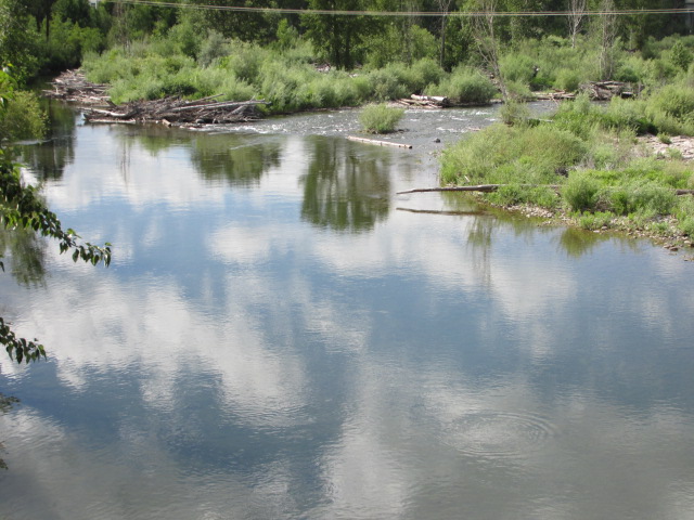 Brian, my warmshowers host in Missoula, had many talents. One of them was painting. 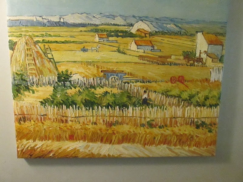 I rode east out of Missoula, along the Blackfoot River.  Some miles east of Missoula, I went through the Potomac Valley.  Osprey nests were common near the river. 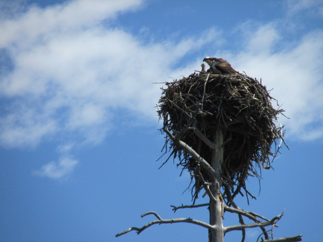 Evening view from first night's campsite.  View toward Rogers Pass and the Continental Divide. 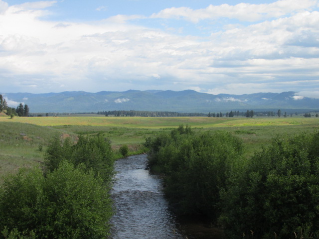 The Blackfoot River was a constant companion the first couple days.  Wildflowers, trees, and mountains were a common vista.  Once I crossed the divide and began heading north, the Front Range came into view.  The view of mountains in Glacier National Park from the Blackfoot Reservation from which it was carved.  A couchsurfing host drove me into southeastern Glacier National Park to show me some sights I would have missed otherwise. This is Lower Two Medicine Lake. 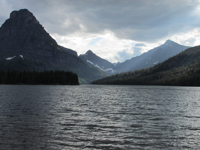 The way to Glacier National Park was through river valleys and up seemingly endless grades.  As I approached Glacier National Park, the real mountains loomed.  Chief Mountain towers over the road to Canada.  Wildflowers decorated the roadside the entire trip.  Glacier's stark vertical walls were a common sight on the way to Many Glacier campground.  There's a reason it is called Glacier National Park. 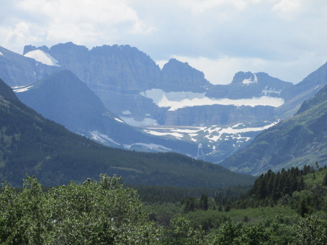 A resting day hike revealed more natural beauty,  stark granite walls, 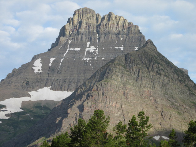 cataracts between lakes, 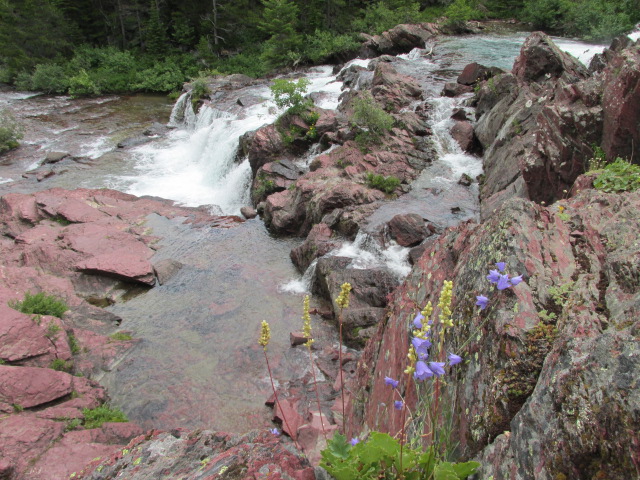 and grand mountain views.  Sometimes, I got all of them at once! 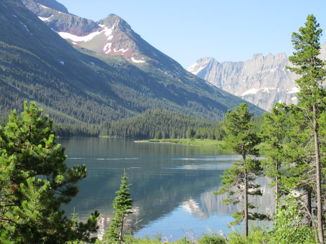 An early morning view on the way out of Many Glacier. 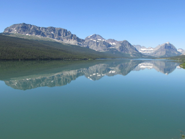 Swiftcurrent Creek is a constant companion along the Many Glacier road.  I rode east to west on Going to the Sun Road, which starts by going along the length of St. Mary Lake.  While the glaciers are melting, there are still some large ones left.  As I climbed higher, the scale of the landscape became huge. 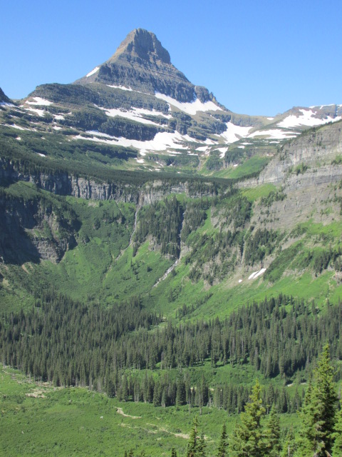 Near the top, I not only got stark mountains, but waterfalls, too.  This combination of river, forest, mountain and snowfield is simply stunning.  Bicycle travel restrictions meant a long hike at the top. The views into Glacier's western side are indescribable.  This waterfall is one of the bends in the road on the way down. 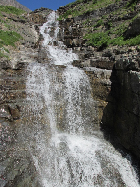 MacDonald Creek runs next to Going to the Sun Road once it becomes relatively flat on the western side.  I rode out of Glacier National Park to the west through small Montana towns, such as Columbia Falls. There isn't much of interest there, except a few murals. 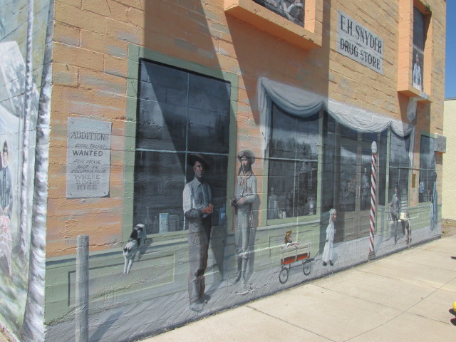 I spent a rest day in the arty town of Whitefish where this attractive window caught my eye. 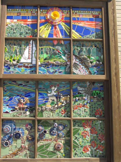 The ride north from Whitefish toward the Canadian Border went by lakes,  beside tree-covered mountains,  past forest streams,  and even along some still ponds.  The mountains were constant companions whether behind meadows,  reflective lakes, 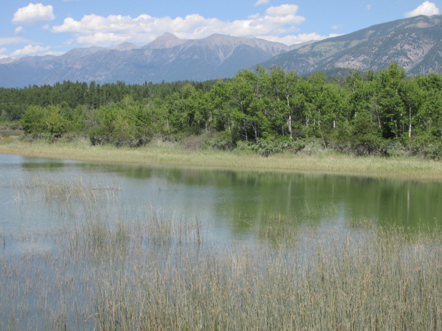 or at the end of the road.  I took a rest day in the pretty town of Invermere on the northern shore of Windermere Lake.  I'm sure the locals consider deer in the park a nuisance. But, I found them worth a photo.  The valley views just before the turn up to Sinclair Pass were superb.  The climb up Sinclair Pass in Kootenay National Park has river, forest, and mountain views, along with some red rock cliffs.  Just past Sinclair Pass is Olive Lake.  The Kootenay National Park has the Ball Range to the east  and the Vermillion Range to the west.  As this vista shows, a massive forest fire in 2003 left lasting damage in the Kootenay Forest.  The Vermillion River runs at the base of the Vermillion Mountains.  Once over Vermillion Pass, the Castle Cliffs hold court. 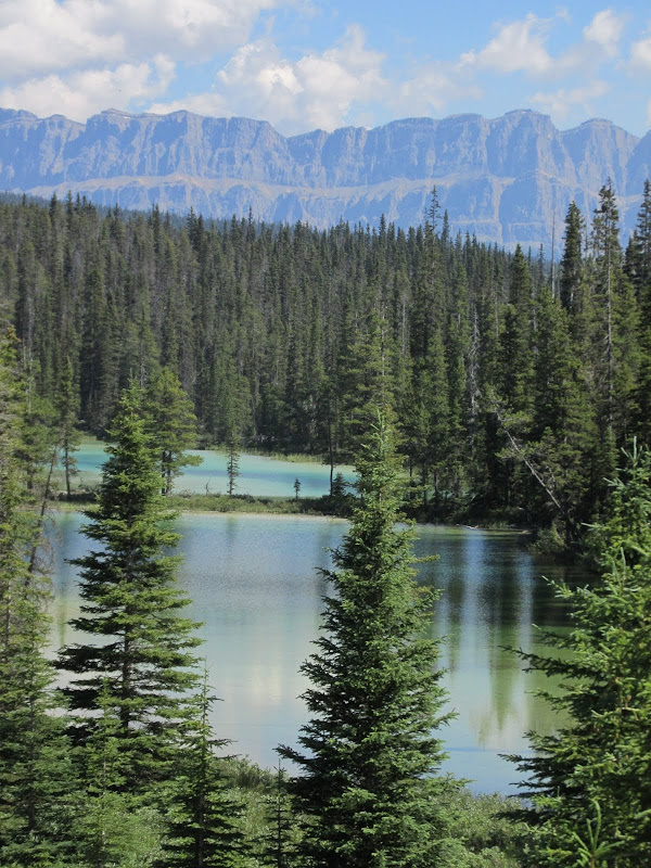 The mountain peaks are simply stunning.  The views along the Bow Valley Parkway can be outrageous. 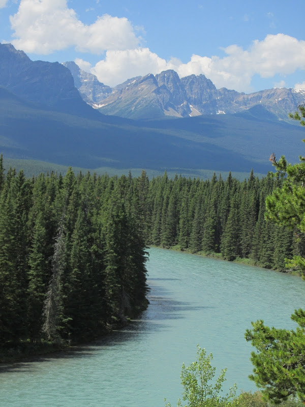 Lake Louise. 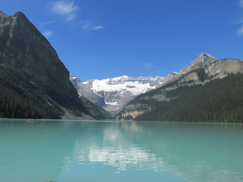 This lake is just past the entrance to Banff National Park.  The mountain peaks that line the Icefields Parkway are hard to believe.  As if mountain grandeur wasn't enough, the wildflowers were in bloom.  Milky blue lakes, glaciers, peaks and forest are common sights.   It seemed the mountains went on forever.  It is hard to pick a favorite sight along the Parkway, but mountains over lakes might be mine.  What's not to like? 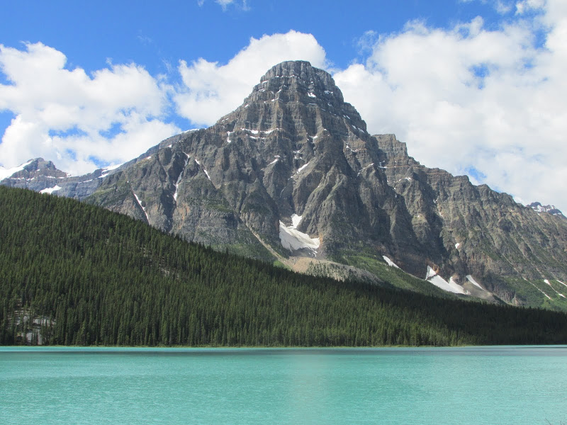 But, mountains behind a river isn't bad, either.  Some mountains were devoid of snow with trees for epaulets. 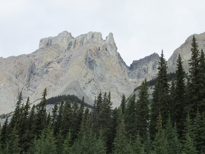 There were even mountains behind meadows for a bit of variety. 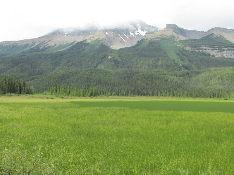 Some things have to live here. 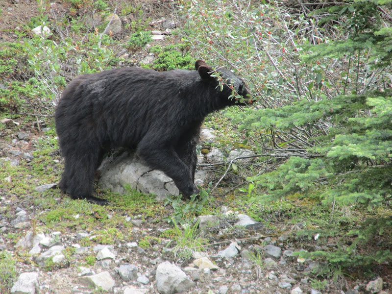 The Weeping Wall is a favorite with ice climbers in the winter.  The ride up Sunwapta Pass was the hardest of the entire trip.  But, waterfalls gave me an excuse to stop, take a photo, and catch my breath.  There is a glacial bowl at the top of the pass. 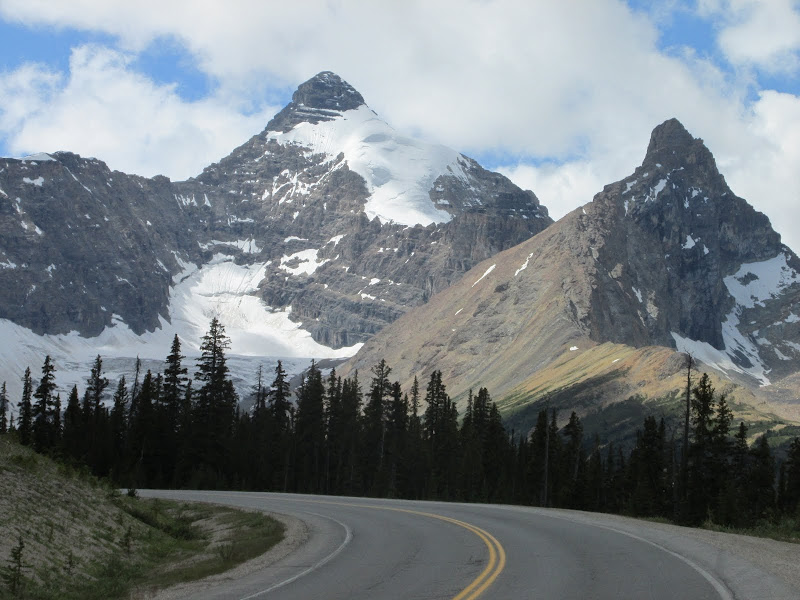 The Columbia Icefields is an enormous glacier at the top of the mountains. One of its fingers is Sunwapta Glacier a couple miles past the pass. The two tiny dots on the glacier are full-sized buses.  The views back toward the pass kept drawing my attention to my rearview mirror!  Simply stunning vistas became common sights. 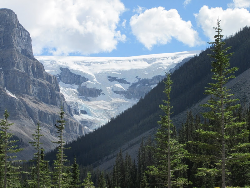 The Sunwapta River drains the melting glaciers.  This early morning shot from the primitive Hilda Creek Hostel left my shoes wet and my mouth open.  The well-named Endless Chain Ridge delineates the eastern edge of the Parkway.  The western side is the much rockier Winston Churchill Range. 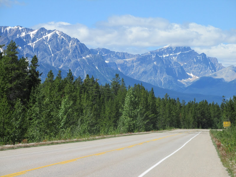 The long downhill into Jasper was crowded with stunning mountain vistas. 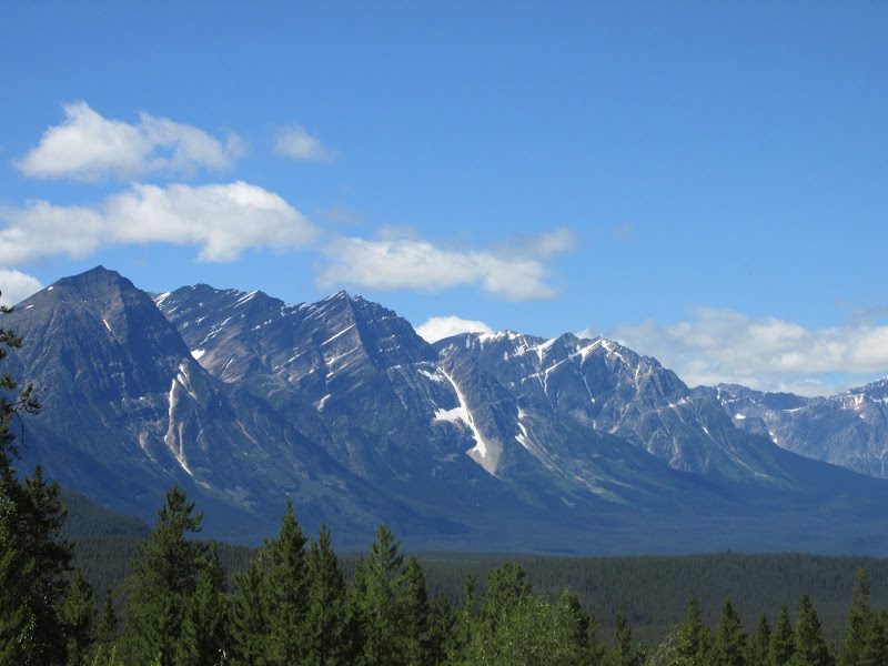 Then, out of nowhere, a bit of Zion National Park shows up!  Views like this kept my mind off the fact that my tour was coming to an end.  Wide shoulders, an empty road, and this. What more could a bicycle tourist ask for on his last day?  |